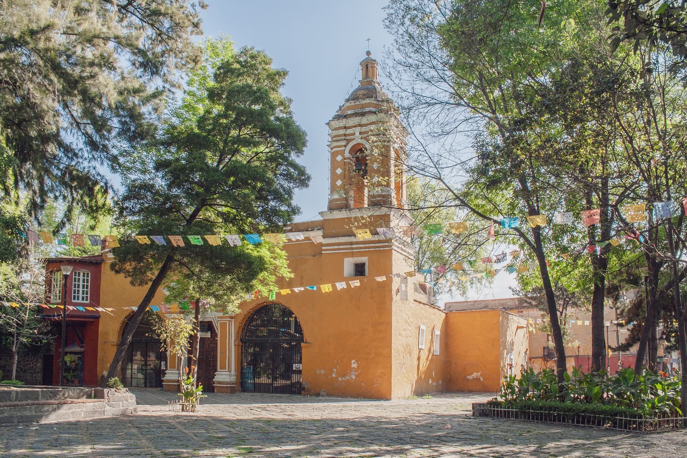
Walk Coyoacán's colonial road from the Viveros tree nursery past convent gardens, the coyote fountain, La Conchita and the town hall to Frida Kahlo's Casa Azul and Trotsky's walled house.
Start · Viveros de Coyoacán: One Park for the Trees and the Village
DirectionsStops
- 1
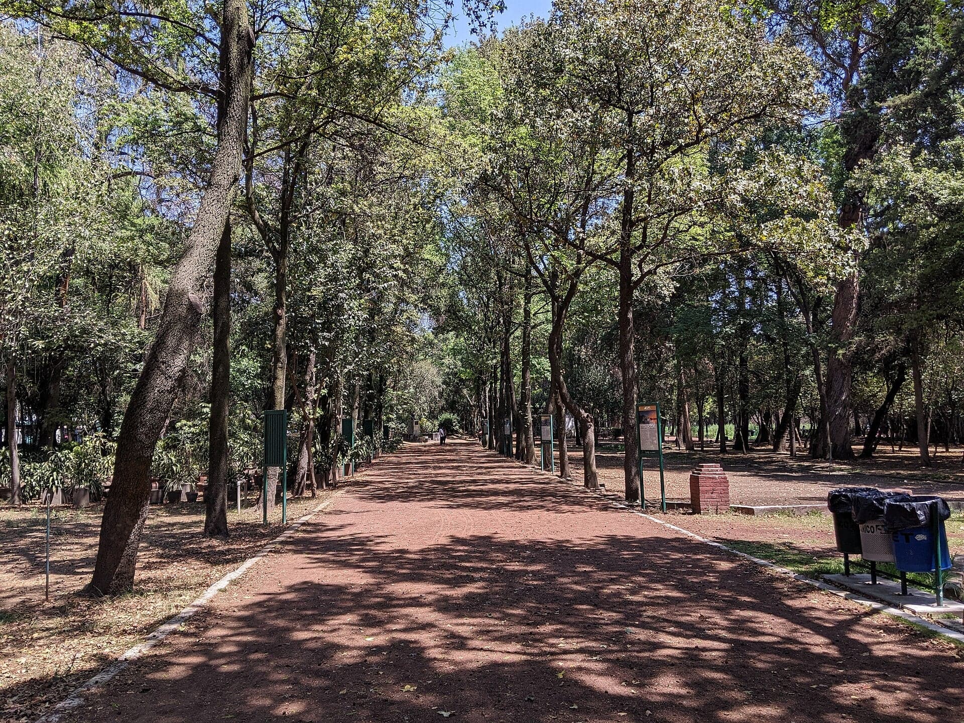
Viveros de Coyoacán: One Park for the Trees and the Village
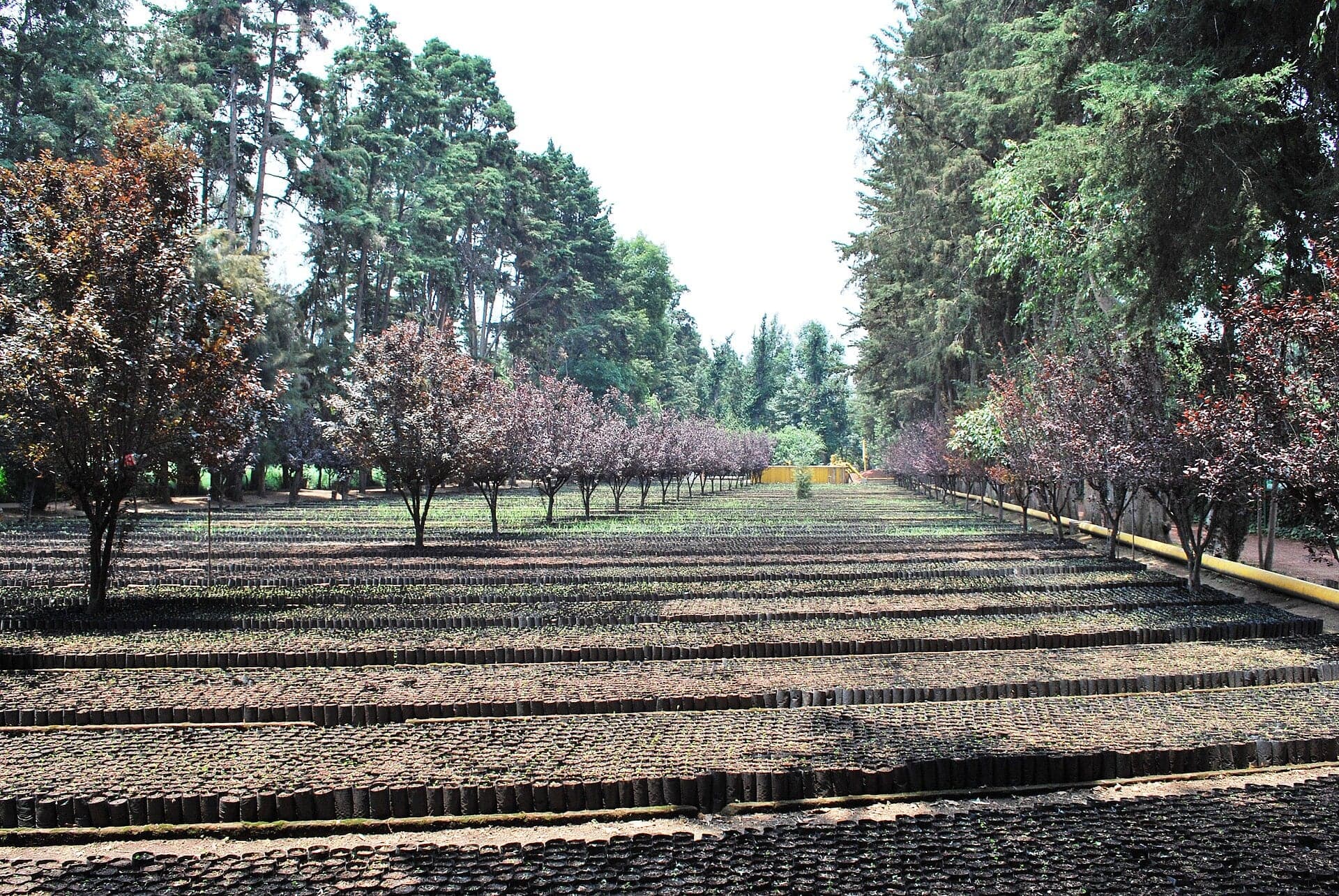
Mexico's first forestry nursery grew from an engineer's own ranch land. Founded in 1907, it shares a 1938 national park decree with old Coyoacán.
- 2
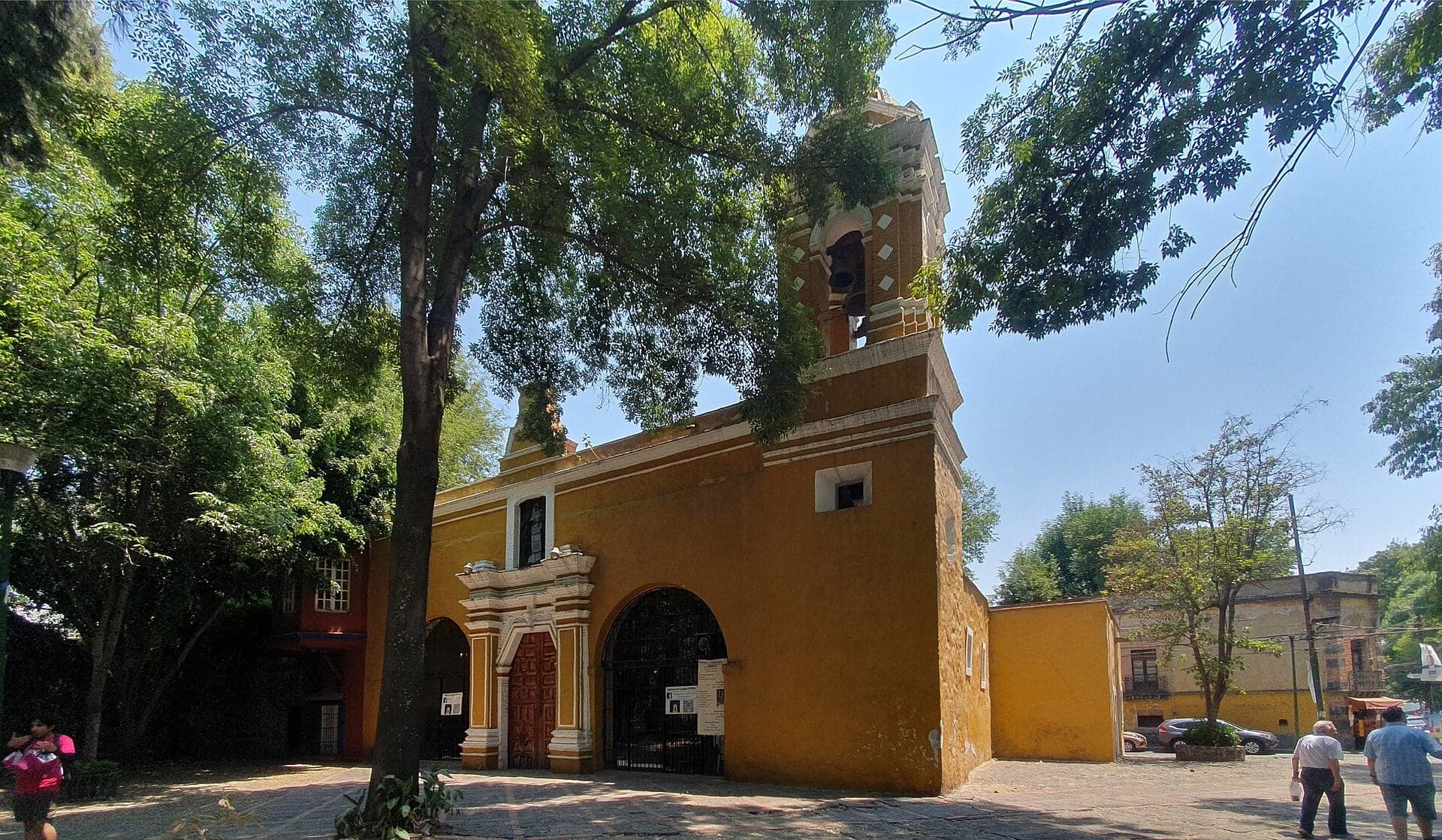
Plaza Santa Catarina: A Chapel Built Open to the Air
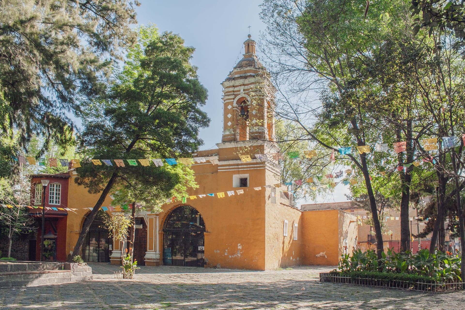
A village chapel that began open to the air, on a square. Its churchyard wall came down in 1933 to make a park.
- 3
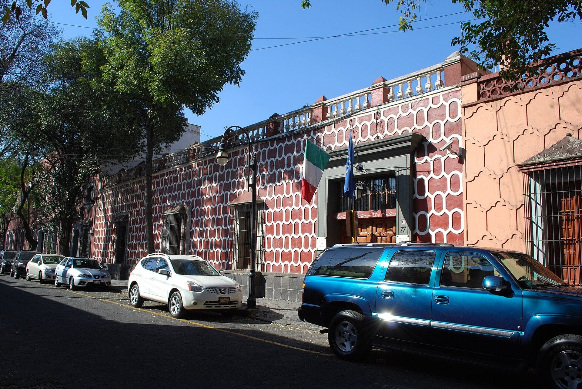
Francisco Sosa: The Royal Road to San Ángel
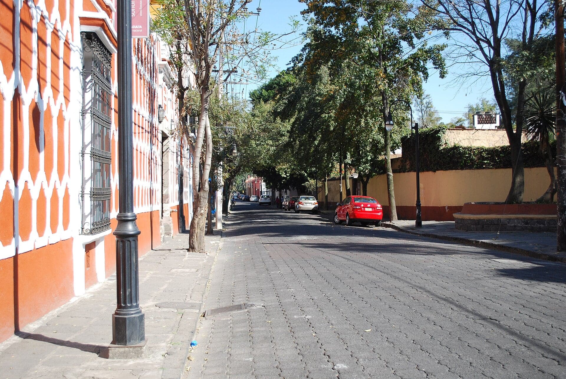
A sixteenth-century royal road renamed for a local poet and historian. Cobbled, lined with old house fronts and the gardens behind them.
- 4
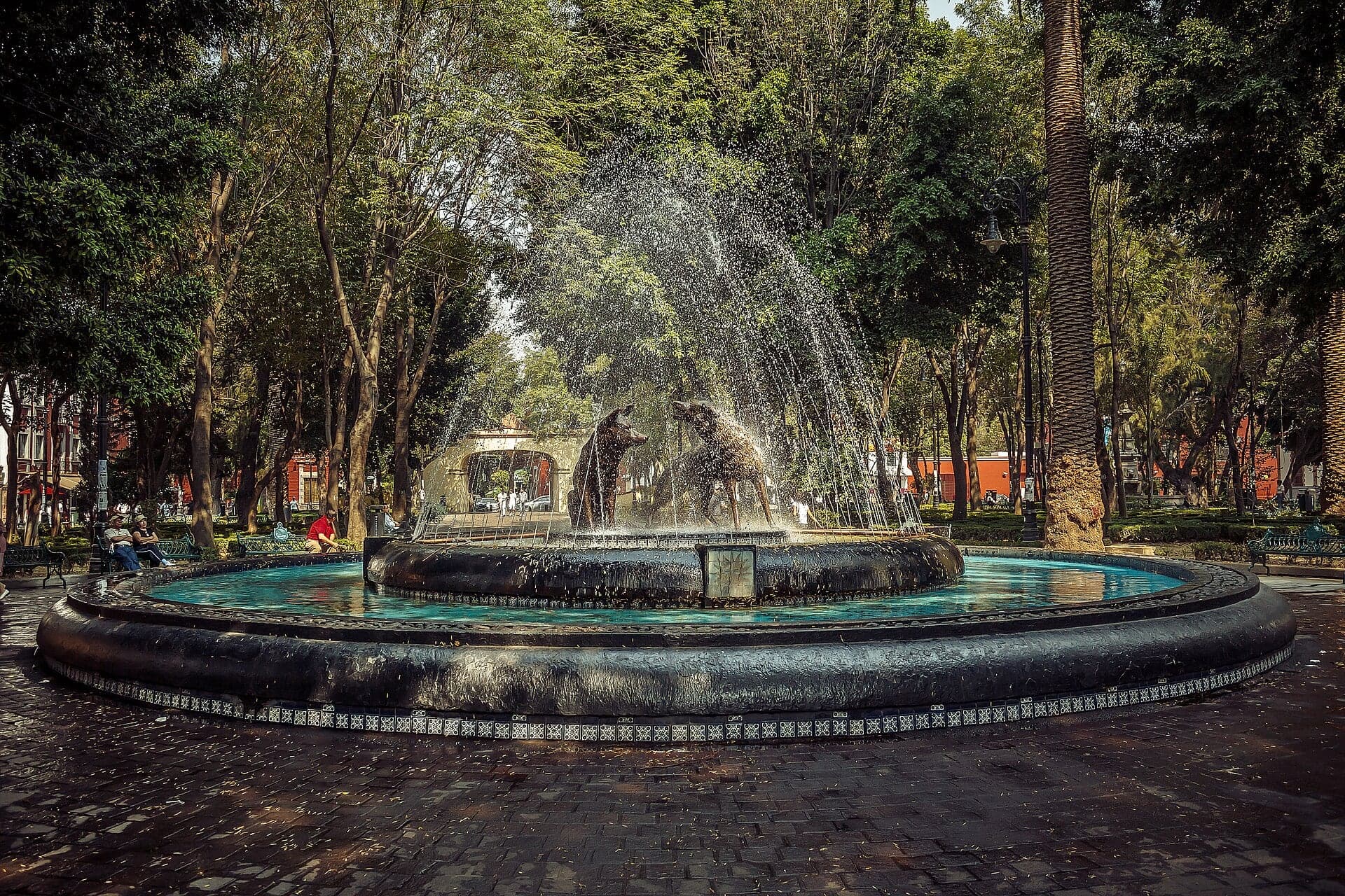
Jardín Centenario: The Churchyard a President Tore Open
A convent churchyard turned public garden in 1914, entered through its old stone arch. Two bronze coyotes in the fountain.
- 5
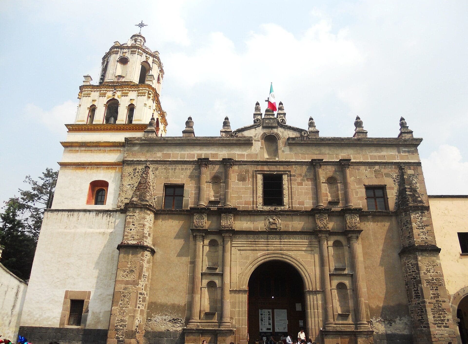
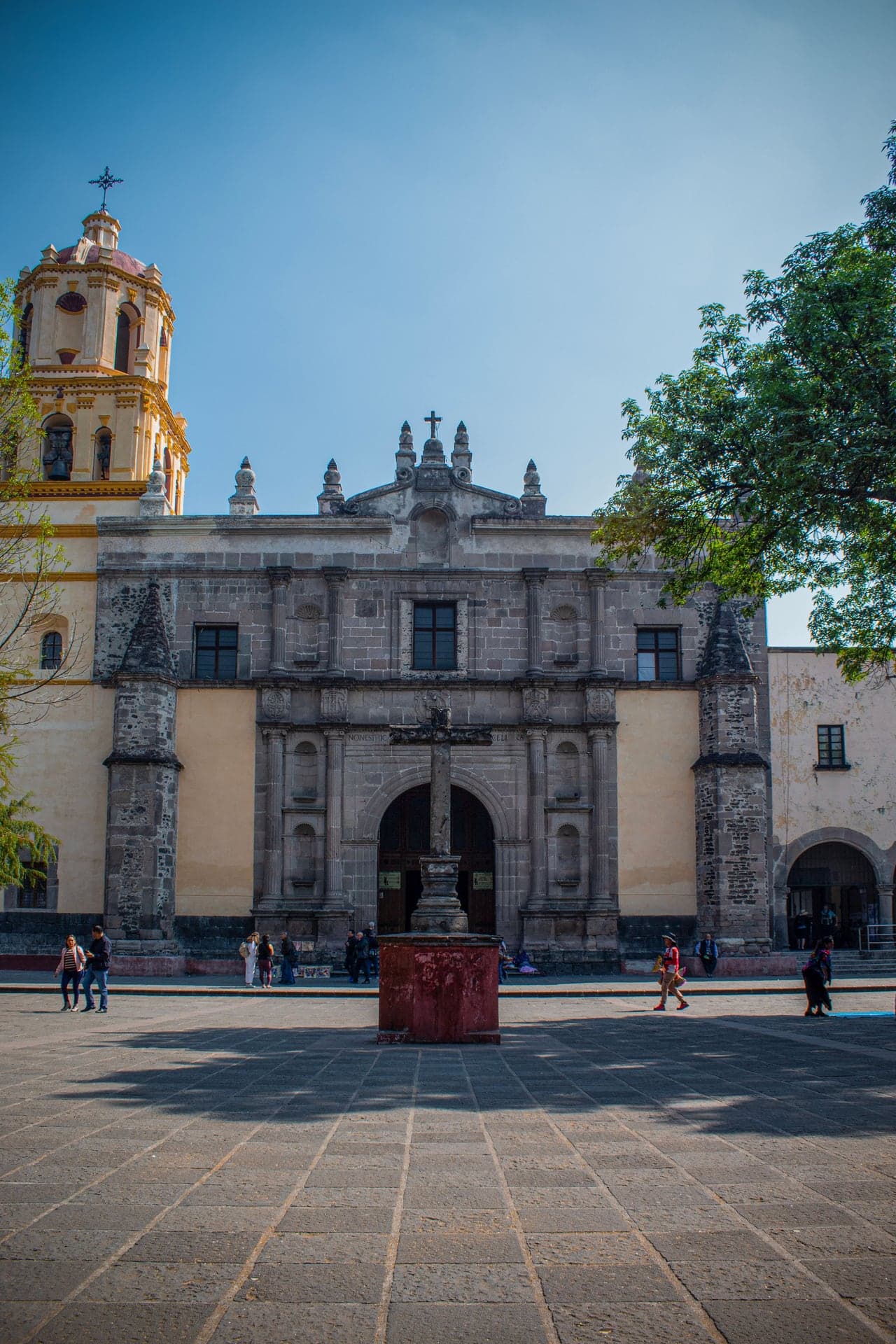
San Juan Bautista: One Church, Three Owners
Coyoacán's parish church was founded by Franciscan friars in the 1520s. Its gray stone front, from a church built in the late 1500s, faces the forecourt.
- 6
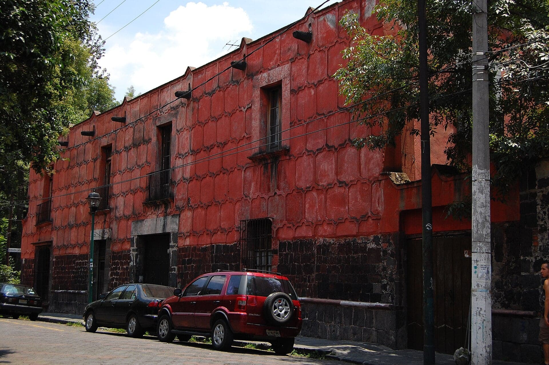
Casa de la Malinche: The Red House and Its Legend
A red house that local tradition ties to La Malinche, Cortés's interpreter. No document puts her here.
- 7
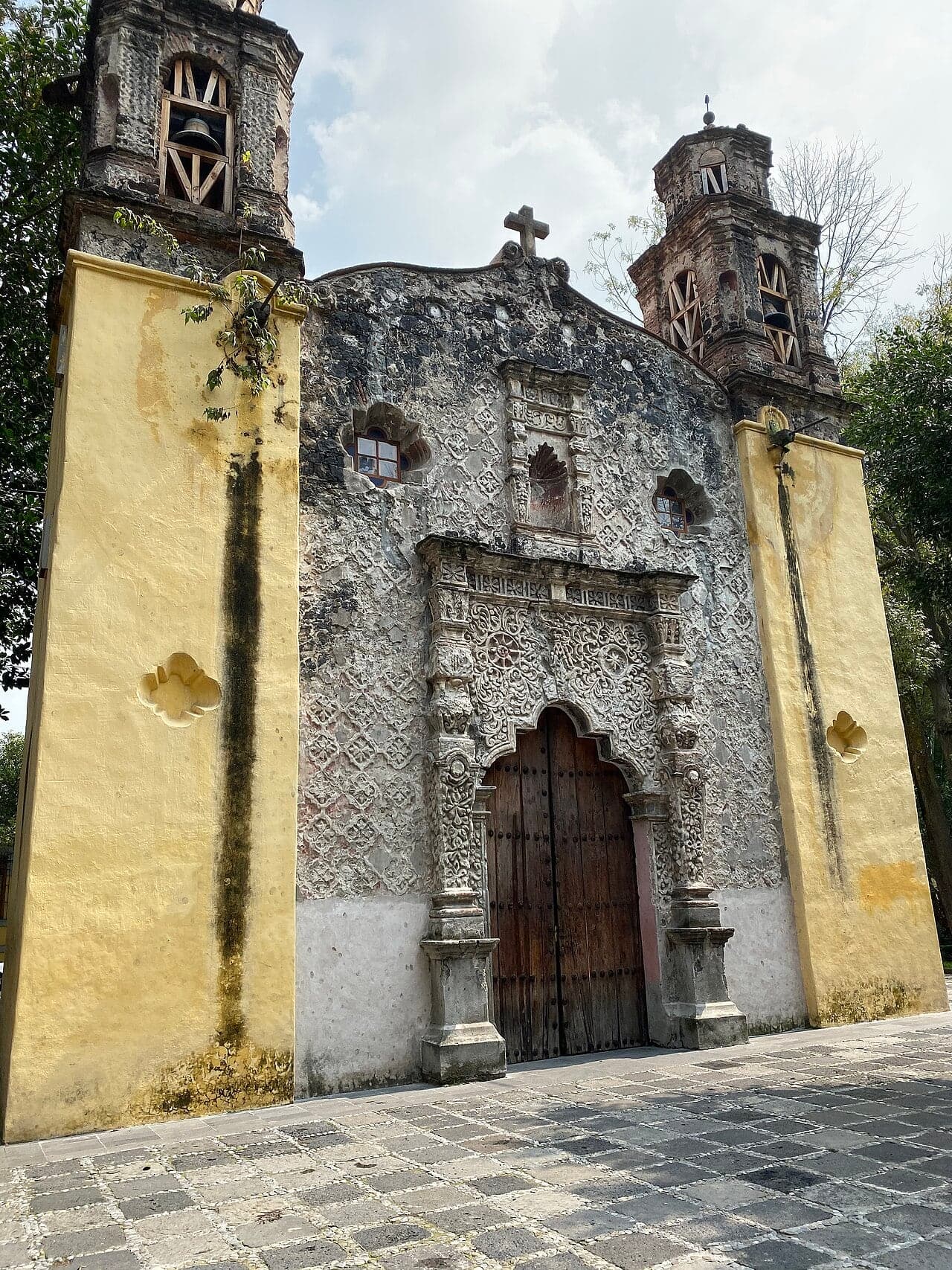
La Conchita: A Chapel on a Tepanec Mound
A 1750s chapel on the mound where Cortés ordered one in 1524. Its front is modeled in mortar by Indigenous craftsmen.
- 8
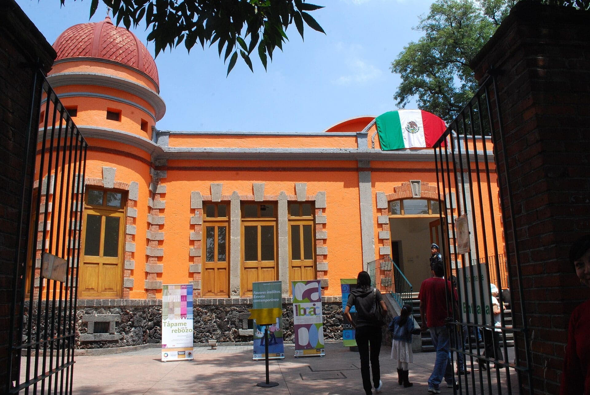
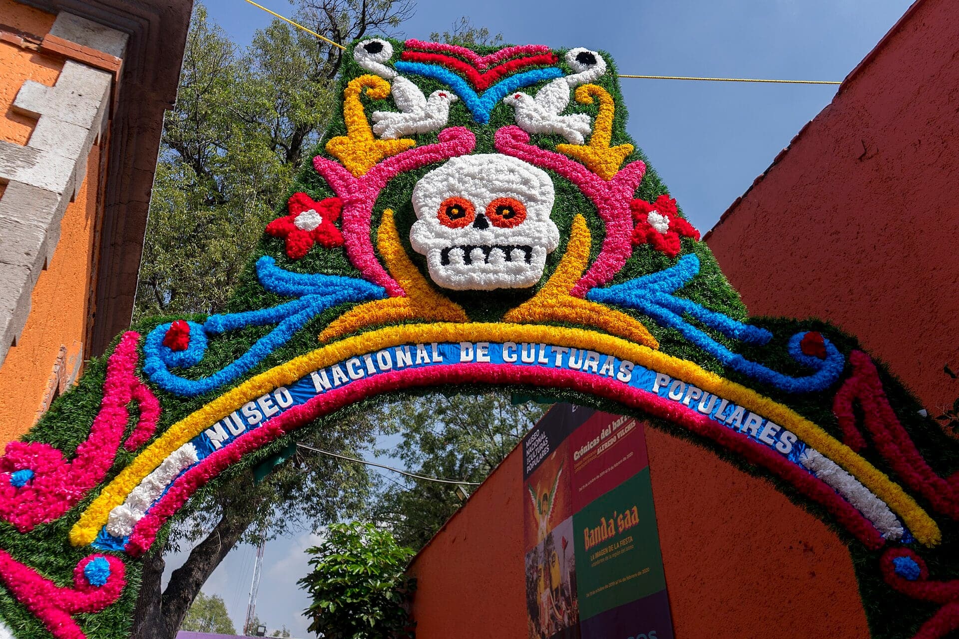
Culturas Populares: A Museum of Everyday Mexico
A national museum of popular culture, opened in 1982 in a house from around 1900. Its exhibitions change.
- 9
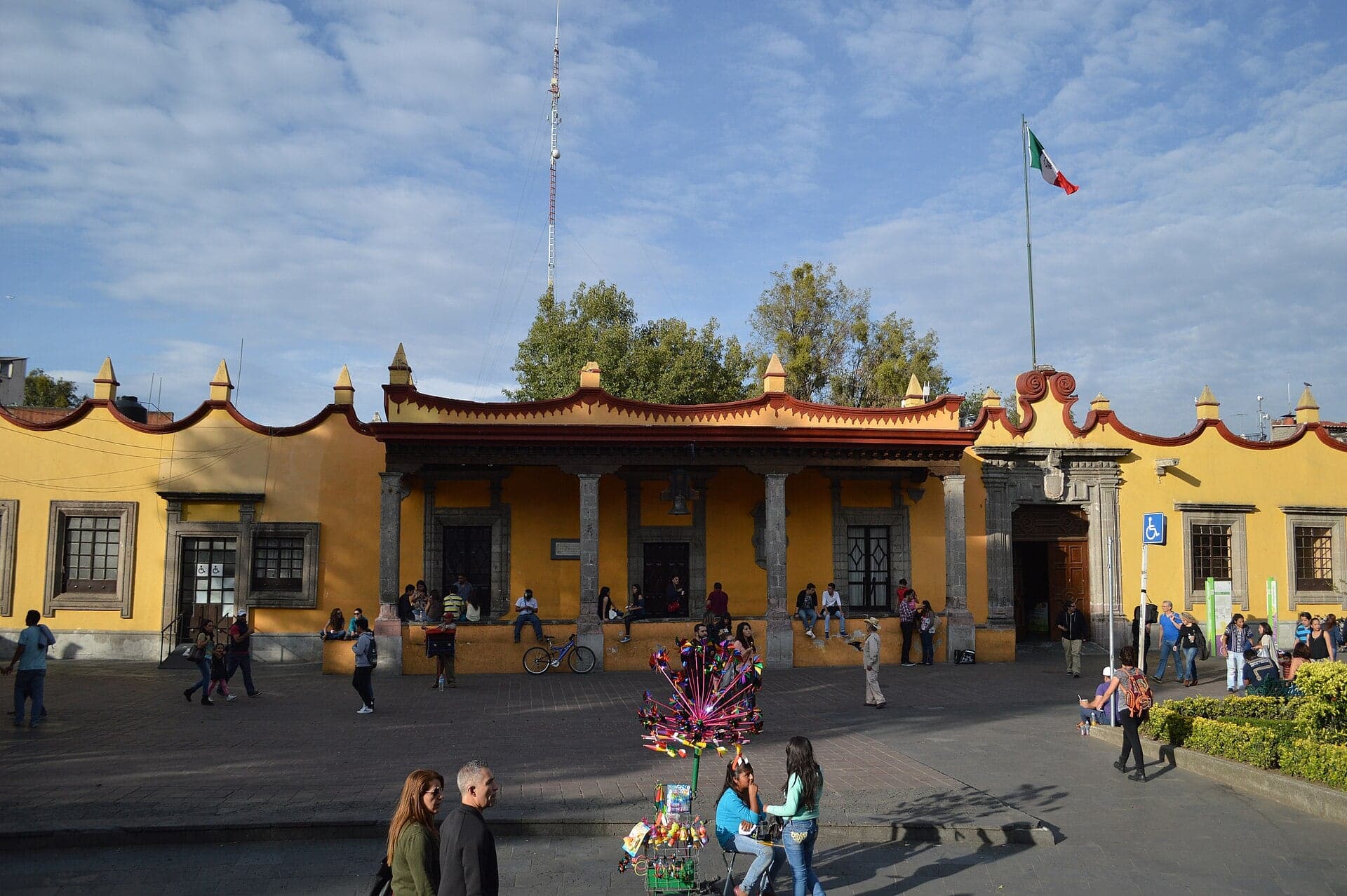
Plaza Hidalgo: Cortés's White Walls and Frida's Wedding
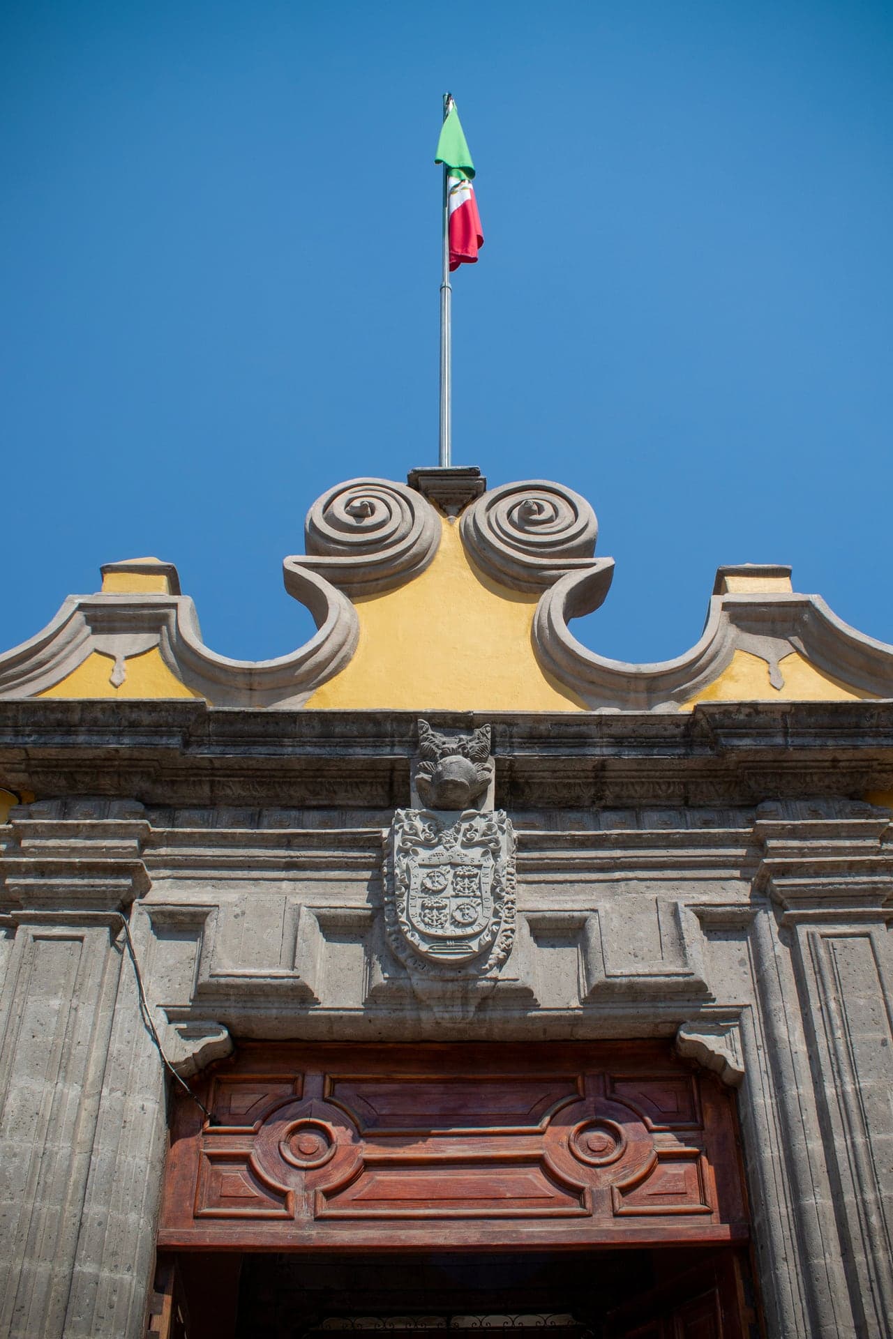
An eighteenth-century town hall called the Casa de Cortés, on the main square. Frida Kahlo married Diego Rivera here in 1929.
- 10
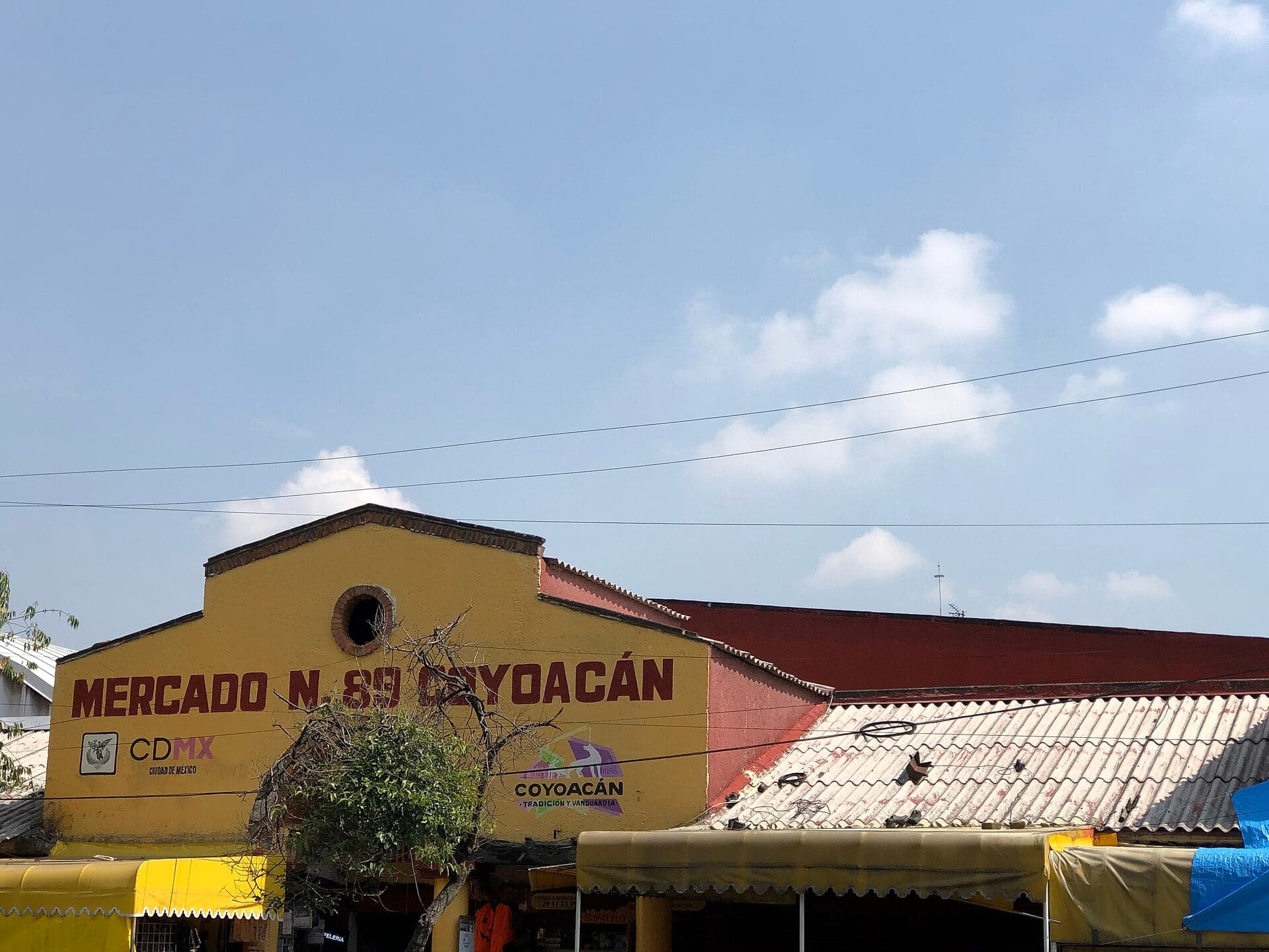
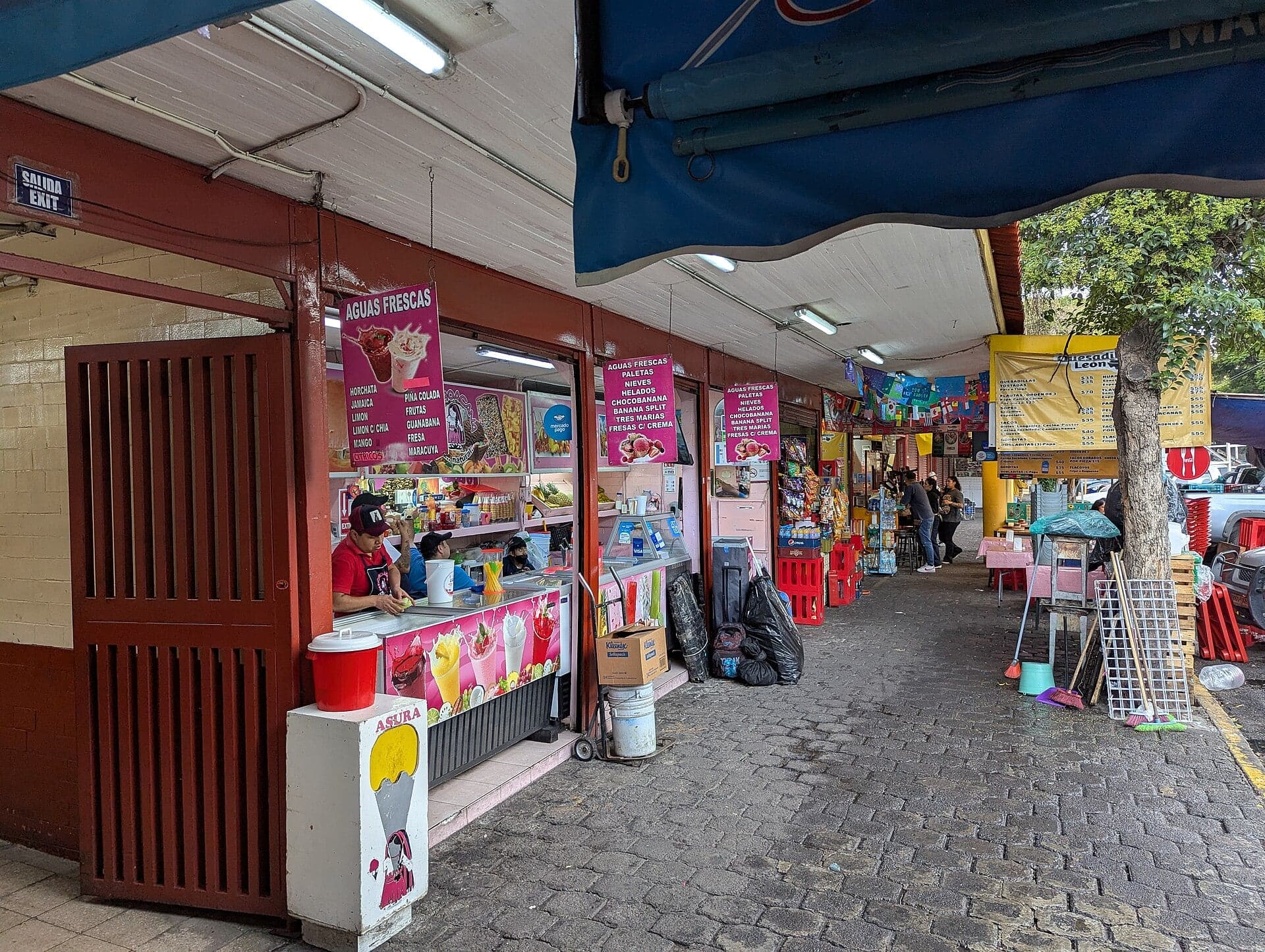
Mercado de Coyoacán: The Neighborhood Market
Coyoacán's covered market from the mid-1950s, a working neighborhood market and a good place to eat.
- 11
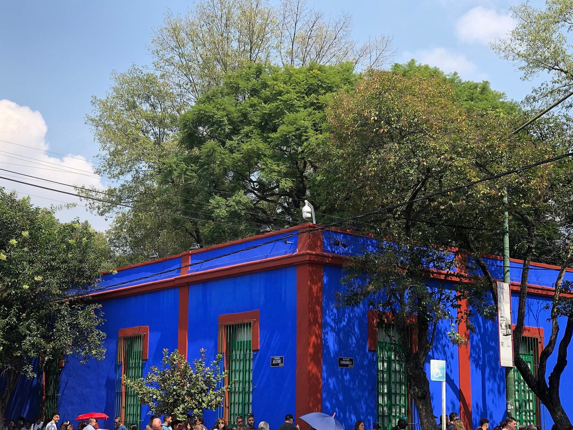
Casa Azul: Blue Walls Around a Garden and an Exile
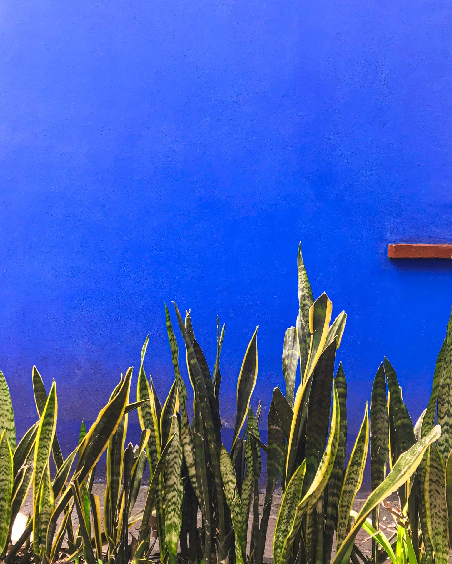
The house where Frida Kahlo was born and died, now her museum. Its blue outer walls went up in 1937 and 1938, while Trotsky lived there.
- 12
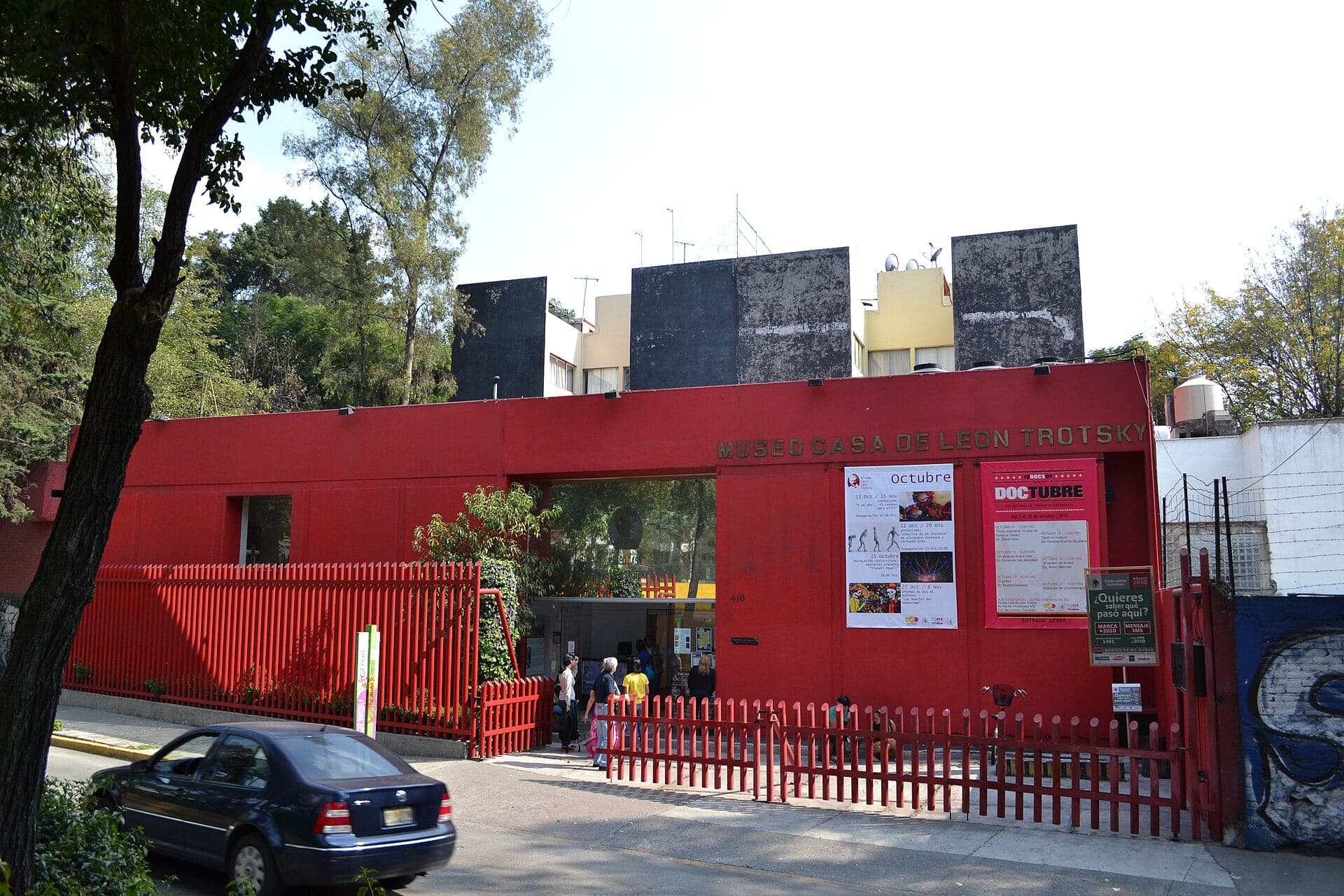
Trotsky's House: The Walls That Failed
The walled house where Leon Trotsky lived his last months in exile. He survived one attack in 1940 and died after a second. His ashes lie in its garden.
Details
Best Time to Visit
Tuesday to Sunday, starting between 9 and 10 am, so the Frida Kahlo Museum, the Trotsky house and the Museo Nacional de Culturas Populares are open (all three close on Mondays; checked 14 October 2026). Book a Casa Azul time slot for roughly an hour and a half after you start. Weekdays are calmer; on weekends the Jardín Centenario fills with vendors and performers and the Casa Azul queue runs along the pavement. The Viveros are open 06:00 to 18:00.
Pro Tips
- •Frida Kahlo Museum tickets are sold online only, for a set time, at boletos.museofridakahlo.org.mx (or a self-service machine at Londres 234), and daily capacity is limited. Open Tuesday 10:00 to 18:00, Wednesday 11:00 to 18:00, Thursday to Sunday 10:00 to 18:00; closed Monday. Checked 14 October 2026.
- •To reach stop 1, take Metro Line 3 to Viveros-Derechos Humanos and walk about 500 m through the Viveros (open 06:00 to 18:00) or along Avenida Progreso to the south gate on Avenida Guillermo Pérez Valenzuela.
- •The Trotsky house entrance is round the corner from the last stop, at Avenida Río Churubusco 410. Guides report Tuesday to Sunday, 10:00 to 17:00, about 60 pesos (2025 figures; no official page found, checked 14 October 2026).
- •The Museo Nacional de Culturas Populares is open Tuesday to Thursday 11:00 to 18:00 and Friday to Sunday 11:00 to 19:00 (Secretaría de Cultura, checked 14 October 2026).
- •From the end on Avenida Río Churubusco, a taxi or app car is the easiest way on; Metro Coyoacán (Line 3) is a longer walk.
- •The Fonoteca Nacional, in the eighteenth-century Casa de Alvarado at Francisco Sosa 383, is west of stop 3, off the route; check its hours before you go.
- •The market at stop 10 is the walk's food stop; it is a working neighborhood market, so ask before photographing stalls.
Safety & Precautions
- •Right after stop 1 the route crosses Avenida Guillermo Pérez Valenzuela (three one-way lanes) at Callejón Torresco with no traffic lights. Cross with care.
- •Footing is uneven: stone setts on Francisco Sosa and Felipe Carrillo Puerto, pebbles on Calle Jardín Santa Catarina, and rough cobbles in the Plaza de la Conchita, hard going for wheelchairs and strollers.
- •Callejón Torresco, Avenida Progreso and Calle Vallarta are very quiet residential lanes: walk the tour in daylight.
- •Keep phones and wallets secure in the weekend crowds of the Jardín Centenario and Plaza Hidalgo and in the Casa Azul queue.
- •The atrium gates of San Juan Bautista have no published hours. If they are shut, view the church from the gate on Calle Felipe Carrillo Puerto and continue along that street to Plaza Hidalgo.
- •San Juan Bautista and La Conchita are places of worship: do not visit during mass.
- •Mexico City is about 2,240 m above sea level. On your first day, walk slowly and drink water.
- •On Mondays the Casa Azul, the Trotsky house and the Museo Nacional de Culturas Populares are closed; the street stops all work.
Travel advisory: Exercise Increased Caution (Level 2).
Gallery
Related Reading
Go deeper on what you'll see, hear, and walk through.
Read the walk
The full story of Coyoacán: Open Gardens, Blue Walls and Trotsky's Fortress, in words. Prefer to listen? Play it narrated, from home or on location.
Introduction
Coyoacán, in the south of Mexico City, the capital of Mexico, was a town of its own for most of its history. After the Aztec capital, Tenochtitlan, fell in fifteen twenty-one, the Spanish conquerors settled here while the ruined city was rebuilt. Coyoacán stayed a separate town, with its own town hall from the eighteen fifties, until it was joined to Mexico City in nineteen twenty-eight.
This walk follows the old village from a tree nursery, along its colonial road, through two gardens and a square, to a market and two famous houses. Watch the walls as you go. Some were pulled down to give the town its public gardens. Others went up to keep someone safe.
Three people return along the way: Hernán Cortés, the Spanish conqueror, who made Coyoacán his; Frida Kahlo, the painter, born and married here; and Leon Trotsky, the Russian revolutionary, who came as a hunted exile.
There are twelve stops over about three point six kilometers, a little over two miles, taking about two hours, more if you go inside the Frida Kahlo Museum. Mexico City sits about two thousand two hundred and forty meters above sea level, so on your first day take it slowly and drink water. Between stops, the cobbles, painted house fronts and carved stone are part of the walk too.
Begin with stop one, at the south gate of the Viveros de Coyoacán, on Avenida Guillermo Pérez Valenzuela.
1. Viveros de Coyoacán: One Park for the Trees and the Village
Welcome to Coyoacán, and to the first stop on this walk, at the south gate of the Viveros de Coyoacán, the tree nursery. The park is free and open every day from six in the morning to six in the evening; the details are on this stop's card.
Look through the gate at the rows of trees. They are here because of one man. In nineteen oh one an engineer named Miguel Ángel de Quevedo, known as the apostle of the tree, gave a hectare of his own ranch to grow young trees. In nineteen oh seven, after visits from the finance minister and the president, it was founded as Mexico's first forestry nursery. Between nineteen eleven and nineteen thirty-four the government kept buying the land around it, until it reached the thirty-nine hectares it covers today.
Then, in nineteen thirty-eight, President Lázaro Cárdenas signed a decree that made two things into one national park: this nursery, and the old village of Coyoacán. The park was named El Histórico Coyoacán, historic Coyoacán. Hold on to that president's name. He comes back near the end of the walk, at the blue house.
So the streets you are about to walk were made part of the same national park as these trees.
Follow the route across Avenida Pérez Valenzuela, with care, and along quiet lanes to a small square with a chapel.
2. Plaza Santa Catarina: A Chapel Built Open to the Air
Walk on into Plaza Santa Catarina and stop at the edge of the square, with the little chapel across it.
This was once a neighborhood of its own, one of the village barrios that depended on the friars of San Juan Bautista, the big church you will reach a few stops from here. Each barrio had its own chapel, and the friars came out to it.
Look at the chapel's front and try to imagine it open. It began as an open chapel: a building that opened to the outside through large round arches, so that a crowd could stand in the open air and follow the mass. Later it was closed in and altered. An art historian from Mexico's national university suggested that chapels like this one were closed in from the sixteen hundreds, as the Indigenous population fell. Can you see where the openings might have been?
Now look at the square itself. A wall once closed in the chapel's churchyard. In nineteen thirty-three it was torn down, and the neighbors made a park here, separate from the church. The stone benches came with a remodel in the nineteen seventies. The paving is volcanic stone, and jacarandas shade it. Keep that wall in mind. A few stops from here you will walk into a much bigger churchyard that lost its wall in the same way.
Follow the route along Francisco Sosa, the old cobbled street.
3. Francisco Sosa: The Royal Road to San Ángel
Walk on along Francisco Sosa and stop outside number seventy-seven, the house of the Italian Cultural Institute.
This street is older than its name. It dates from the sixteenth century, when it was the Calle Real, the royal road from Coyoacán to the village of San Ángel. Later it was called Calle Santa Catarina, the name of the square you just left. Only in the twentieth century did it take its present name, from Francisco Sosa, a poet, historian and journalist who ran Mexico's national library from nineteen oh nine and died here in Coyoacán in nineteen twenty-five. A road built for the Crown ended up named for a man of books.
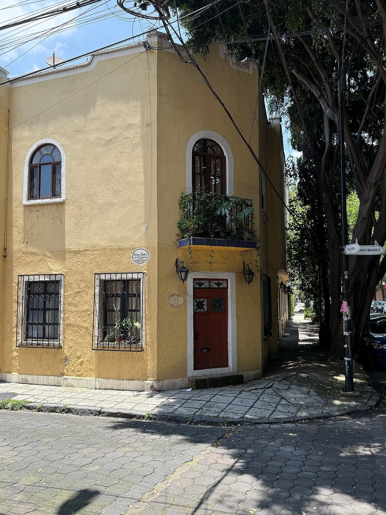
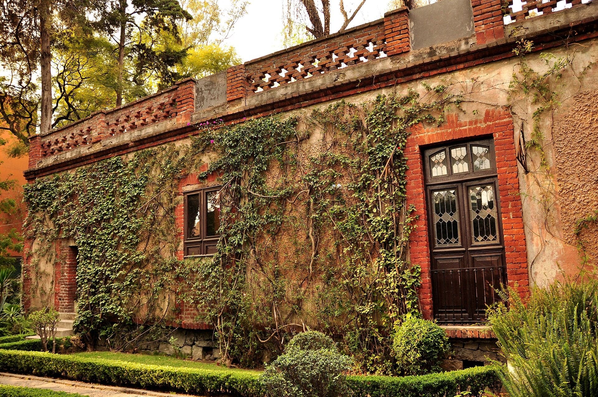
Look down at the stones. The cobbles were re-leveled along the whole street in twenty twenty-four, so the surface is new work laid on an old line. Then look along the street at the painted house fronts and the high garden walls, with doors that give nothing away.
Number seventy-seven is described by the city as one of the oldest buildings on the street. Before the Italian institute, it housed the embassies of Poland and of Belgium. Most of what makes this street is like that: a front on the pavement, and a life behind it you are not shown.
Follow the route along Francisco Sosa. The street ends at a double stone arch, and that is the next stop.
4. Jardín Centenario: The Churchyard a President Tore Open
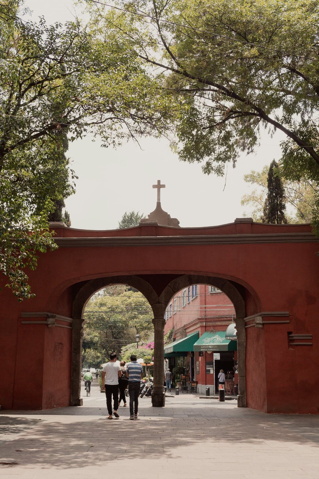
Ahead of you, Francisco Sosa ends at a double stone arch. Look at it as you come up to it, then walk on through it into the garden and stop just inside.
For centuries this garden was not a garden. It was the walled churchyard, the atrium, of the convent of San Juan Bautista, whose church front you can see at the far end. The arch was the atrium's main gateway. The city says the carving on its side columns, in an Indigenous style, goes back to when the church was built. Look at the dark carved stone set into the white wall, and the cross on top. In twenty twenty-four the borough restored it with lime mortar mixed with the sap of the nopal cactus, following national heritage rules.
Then, in nineteen fourteen, the walls came down. That April a law had been passed to protect the country's monuments. Even so, the order to destroy the atrium came, as the inspectors' file records, from the president of the Republic himself, on the grounds that the town needed a municipal garden. The inspectors of monuments found out while it was happening. The gateway survived; the enclosure did not.
You have already seen this at Santa Catarina, where the churchyard wall went in nineteen thirty-three. Here it happened first, and on a far bigger scale. Was it a loss, or a gift to the town? This open garden, named for the hundredth anniversary of Mexico's independence, is the answer Coyoacán lives with.
As you cross the garden, look for the fountain in its middle. The two bronze coyotes are modern, the work of a Mexican sculptor, and they were restored in twenty twenty-six. The idea they carry is much older: the name Coyoacán is usually read as the place of coyotes.
Follow the route across the garden and over the street, to the church front.
5. San Juan Bautista: One Church, Three Owners
Walk on into the forecourt of San Juan Bautista and stop on the path, facing the church's front. The church is free to enter when its doors are open. It is a working parish, so if a mass is on, stay at the back or come back later; the details are on this stop's card. This is…
Full narration for this stop unlocks with the tour.
6. Casa de la Malinche: The Red House and Its Legend
Walk on along Calle Higuera and stop before the corner, with the deep red house ahead of you. This is a private house, seen from the street only. People here call it the Casa de la Malinche, the house of La Malinche, and it also goes by a plainer name, the Casa Colorada, the…
Full narration for this stop unlocks with the tour.
7. La Conchita: A Chapel on a Tepanec Mound
Walk on into the Plaza de la Conchita and stop on the path where you can see the chapel's front across the square. Watch your footing on the rough cobbles. The chapel opens only now and then, with no regular hours. This square was the chapel's churchyard, and the ground under…
Full narration for this stop unlocks with the tour.
8. Culturas Populares: A Museum of Everyday Mexico
Walk on along Avenida Hidalgo and stop on the pavement across from the museum, which stands back from the street. This is the Museo Nacional de Culturas Populares, the National Museum of Popular Cultures. It is closed on Mondays and open from late morning on other days; the…
Full narration for this stop unlocks with the tour.
9. Plaza Hidalgo: Cortés's White Walls and Frida's Wedding
Walk on to the corner of Plaza Hidalgo, the main square, and stop there, looking along the long white building with the stone portico. People call it the Casa de Cortés, and the name is a memory, not a fact. The building is from the seventeen hundreds. Hernán Cortés did make…
Full narration for this stop unlocks with the tour.
10. Mercado de Coyoacán: The Neighborhood Market
Walk on up Calle Allende and stop at the market's entrance. This is the Mercado de Coyoacán, the neighborhood market, built in the mid nineteen fifties as part of a citywide program of new markets. Look at its long, plain hall: no carved stone, no painted crest, a building made…
Full narration for this stop unlocks with the tour.
11. Casa Azul: Blue Walls Around a Garden and an Exile
Walk on to the corner where the walls turn cobalt blue, and stop beside them on Calle Londres. This is the Casa Azul, the Blue House, now the Frida Kahlo Museum. It is ticketed, with timed tickets sold online only, and closed on Mondays; the details are on this stop's…
Full narration for this stop unlocks with the tour.
12. Trotsky's House: The Walls That Failed
Walk on along Calle Viena and stop by the high wall of the house on this street. This is the Leon Trotsky House Museum. It is ticketed and usually closed on Mondays, and its entrance is around the corner, on Avenida Río Churubusco; the details are on this stop's card. From the…
Full narration for this stop unlocks with the tour.
- Seedlings growing at the Viveros de Coyoacan park and plant nursery in Coyoacan borough of Mexico City — Thelmadatter, CC BY-SA 3.0 · source
- Capilla de Santa Catarina - Plaza de Santa Catarina - Coyoacán - Mexico — Jbribeiro1, CC BY-SA 4.0 · source
- Instituto Italiano de Cultura in Coyoacan, Mexico City — AlejandroLinaresGarcia, CC BY-SA 4.0 · source
- Francisco Sosa Street looking east from Salvador Novo in Coyoacan, Mexico City — AlejandroLinaresGarcia, CC BY-SA 4.0 · source
- Fuente de los Coyotes en el Jardín Centenario Coyoacan. — https://www.flickr.com/photos/ivangm/, CC BY 2.0 · source
- This is a photo of a monument in Mexico, identified by ID — Daniisper, CC BY-SA 3.0 · source
- casa de la malinche — Percisco, CC BY-SA 4.0 · source
- Capilla colonial cerrada al público construida en Plaza de La Conchita rodeada por árboles y calles empedradas. — A01654598 Adrián Reyna, CC BY-SA 4.0 · source
- La Capilla de la Purísima Concepción o conocida popularmente como “La Conchita” ubicada en el centro de Coyoacán mandada a hacer por Hernán — César Suárez Hernández, CC BY-SA 4.0 · source
- This is a photo of a monument in Mexico, identified by ID — AlejandroLinaresGarcia, CC BY-SA 3.0 · source
- Fundado el 24 de septiembre de 1982 y ubicado en Avenida Miguel Hidalgo, el museo es un espacio para difundir la diversidad cultural. — Diego Re23, CC BY-SA 4.0 · source
- Casa de Cortes off the main square of Coyoacan, Mexico City — AlejandroLinaresGarcia, CC BY-SA 4.0 · source
- Coyoacán market facade, opened in 1921, this place is an icon of this magical neighborhood. — A01655306, CC BY-SA 4.0 · source
- La Michoacana store in the Coyoacan Market, Ignacio Allende street, Del Carmen Coyoacan, Mexico City. — ProtoplasmaKid, CC BY-SA 4.0 · source
- House of the two most important painters in the history of Mexico, Frida Khalo and Diego Rivera. Also known as the blue house. — A01655306, CC BY-SA 4.0 · source
- This is a photo of a monument in Mexico, identified by ID — Omar Ulises Ruiz Casas, CC BY-SA 4.0 · source
- This is a photo of a monument in Mexico, identified by ID — Patrice Etienne, CC BY-SA 3.0 · source
Images may be cropped or resized. Other photos via Unsplash and Pexels.