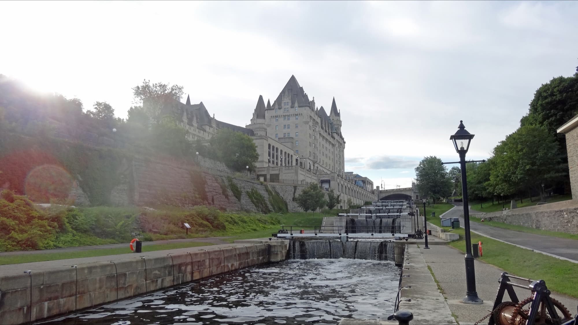
An 1820s military canal that never fought a war. A commercial route that lasted forty years. A skating rink since 1971 that did not open at all in 2022 to 2023. One piece of infrastructure, six use-eras, four kilometres of urban canal.
Start · The Ottawa Locks at the Bytown Museum
DirectionsStops
- 1
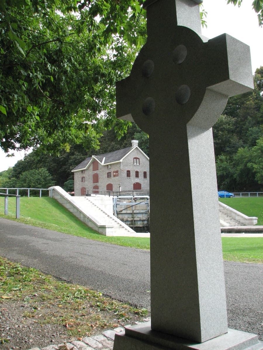
The Ottawa Locks at the Bytown Museum
The entry flight of eight locks. The 1827 Commissariat Building, the oldest stone structure still standing in Ottawa. The 29 May 1832 inaugural transit. Unceded Algonquin Anishinabeg territory.
- 2
Plaza Bridge at Confederation Square
Plaza Bridge, completed December 1912, on the site of the 1827 Sappers' Bridge. The preserved arch stones below carry a 2004 NCC plaque commemorating Canadian military engineers.
- 3
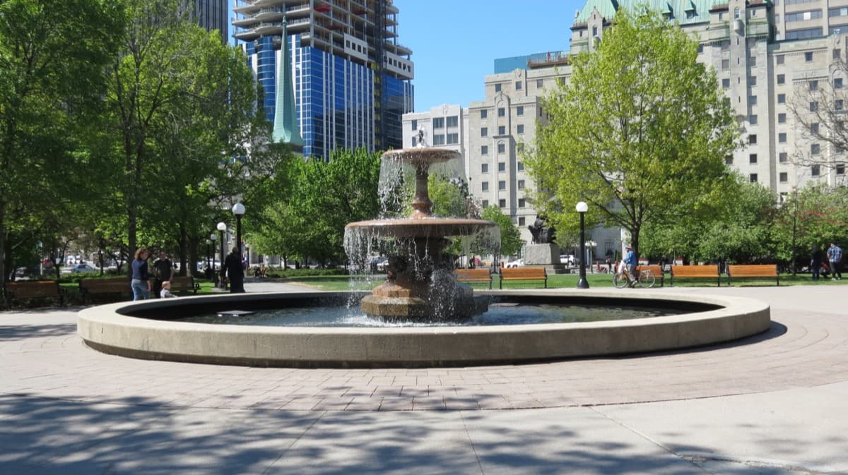
Confederation Park: The John By Memorial Fountain
A British imperial monument that stood in Trafalgar Square from 1843 to 1948, first dedicated in Ottawa in 1955, re-erected in Confederation Park in 1975. A Royal Engineer commemorated in a centennial park in a country that did not exist when the canal was built.
- 4
Patterson Creek Inlet
An 1820s canal dam blocked a small creek into an inlet. The Ottawa Improvement Commission landscaped it in the 1890s and filled the western portion to create Central Park. The 1923 Patterson Creek Pavilion is now a federal heritage building.
- 5
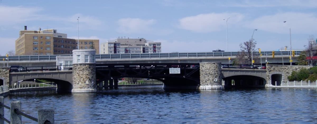
Pretoria Bridge
A 1915 table-lift bridge replacing an earlier wooden swing bridge. The central section elevates to let summer boats pass. The engineering specimen of the canal's recreational era.
- 6
Queensway Crossing
A 1960s federal-mobility intrusion. A concrete viaduct carrying Highway 417 over an 1820s slack-water reach. The first major non-canal infrastructure intrusion in the urban corridor.
- 7
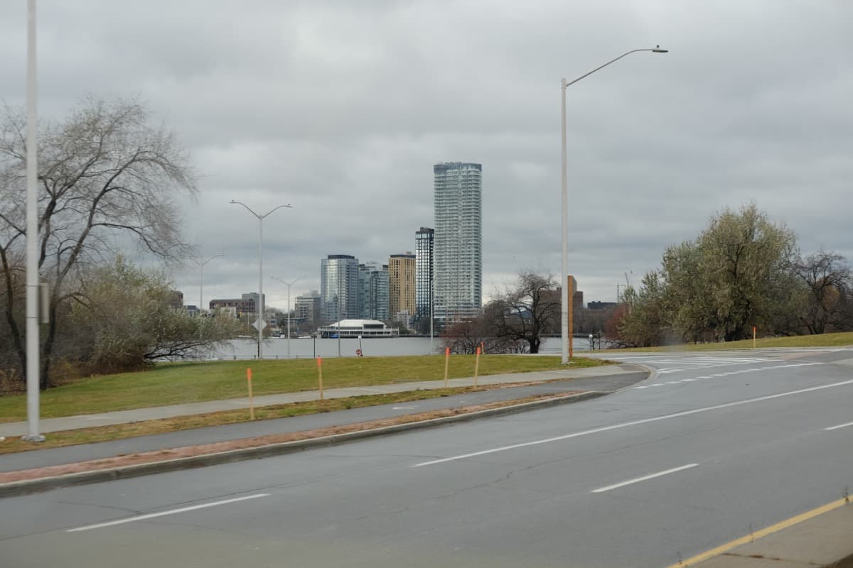
Dow's Lake East Shore
An 1826 dam inundated Dow's Great Swamp into a navigable lake. The 18 January 1971 Skateway southern terminus. The 2022 to 2023 zero-day season. A climate-aware beat, not a celebration.
- 8
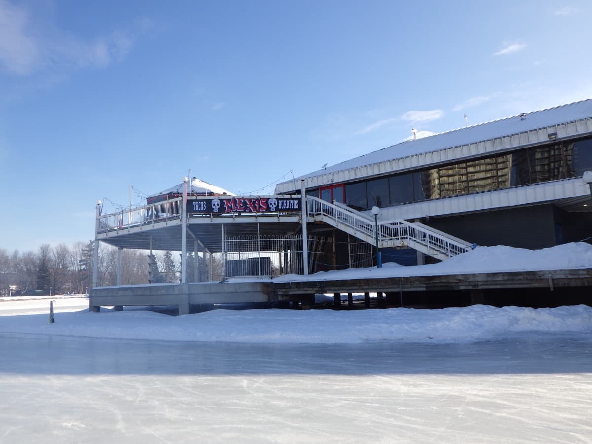
Dow's Lake Pavilion Plaza
The closer. Six identifiable use-eras, one piece of infrastructure, four kilometres of urban canal walked. The thesis restated.
Details
Best Time to Visit
Year-round. The corridor is walkable in all four seasons. Late April to early October offers the active canal, with boats operating on the navigation lock schedule and Pretoria Bridge lifting on operator request. Late January to late February, in the years the Skateway opens, you can walk the corridor with the maintained ice surface visible from every overlook; check the National Capital Commission Skateway status page before counting on it, since the 2022 to 2023 season had zero open days and the 2023 to 2024 season ran only ten days. Shoulder seasons (early May, October, late March) are quietest. The Bytown Museum at Stop 1 is open most days mid-May to late October and has reduced winter hours; the building's exterior anchors the stop year-round.
Pro Tips
- •OC Transpo bus and the O-Train Line 1 station at Parliament are the closest transit to Stop 1; from Parliament station, walk five minutes east along Wellington Street to the Plaza Bridge approach and descend to the Ottawa Locks staircase
- •Bytown Museum admission is roughly $8 CAD adult for the interior; the Stop 1 audio works fully from the public overlook above the lock flight, and the Commissariat Building's exterior reads exactly as the transcript describes
- •The canal-side pathway between Confederation Park and Dow's Lake is paved and continuous; flat shoes work in summer, traction footwear in winter when the path is icy
- •The Skateway at Stop 7 is operational only when the National Capital Commission opens it; check the NCC Skateway status page on the day of your walk, and treat the transcript's climate-aware framing as load-bearing whether or not the ice is open
- •The preserved Sappers' Bridge arch stones at Stop 2 are below Plaza Bridge at canal level; descend via the Mackenzie Avenue ramp or the Confederation Square staircase to see them in person, or listen with the image from the railing above
- •Ken Watson's rideau-info.com is the working primary-source archive for canal history and is the source the audio cross-checks the named Royal Engineers and contractors against
Safety & Precautions
- •The staircase at the Ottawa Locks is steep and the stone steps are uneven; use the handrail and consider the Mackenzie Avenue accessible route around the Château Laurier if mobility is a concern
- •The Queensway crossing at Stop 6 is loud; traffic noise from the viaduct overhead is part of the stop and audible through the audio
- •The Pretoria Bridge mechanism is active during the navigation season and the deck can rise without long warning when a vessel requests passage; stand clear of the marked lifting zone if barriers are in place
- •In winter, the canal-side pathway can be icy where the maintained Skateway surface meets the bank; the Skateway itself is maintained ice and requires skates, not walking shoes, when it is open
Travel advisory: Exercise Normal Precautions (Level 1).
Gallery
Related Reading
Go deeper on what you'll see, hear, and walk through.
Overview
Best Self-Guided Walking Tours in Ottawa (2026)
4 min
Overview
One Day in Ottawa: A Walkable Capital Itinerary (2026)
5 min
Overview
Ottawa Travel Guide: How Many Days, Getting Around, When to Go (2026)
5 min
Thematic
Best Architecture Walking Tours in Ottawa (2026)
2 min
Thematic
What to Eat in Ottawa: A Food Guide (2026)
4 min
Read the walk
The full story of The Rideau Canal: A War That Never Came, in words. Prefer to listen? Play it narrated, from home or on location.
Introduction
In eighteen twenty-six the British Empire authorised a two-hundred-and-two-kilometre inland canal from the Ottawa River to Lake Ontario, four million pounds, six years of construction, to fight an American invasion the Empire was convinced was coming.
The Americans never invaded. The Rideau Canal saw no military use across its entire operational life. Not in the Oregon Crisis of eighteen forty-six, not in the Trent Affair of eighteen sixty-one, not in the Fenian Raids. The infrastructure built for one war has spent two centuries serving every purpose except the one it was built for.
The canal became a commercial route, then a recreational corridor, then on the eighteenth of January, nineteen seventy-one, the world's largest naturally frozen ice rink, then a UNESCO World Heritage Site in two thousand and seven. In the winter of two thousand and twenty-two to twenty-three the Skateway did not open at all. The first zero-day season on record. The infrastructure does not erase. It accretes, and the most recent layer is the one under climate pressure.
The walk is eight stops, about seven kilometres, two to two and a half hours through the urban slice of the canal in Ottawa, Canada. It starts at the entry flight of eight locks below the Château Laurier and ends at the basin of Dow's Lake, with the eighteen twenty-seven Commissariat Building, the preserved Sappers' Bridge arch stones, a Trafalgar Square fountain relocated for Canada's centennial, and the Queensway viaduct in between. When you arrive at the Ottawa Locks, begin with stop one.
1. The Ottawa Locks at the Bytown Museum
Welcome to the Ottawa Locks. Stand at the railing at the top of the staircase facing north toward the Ottawa River. Below you is a flight of eight stone chambers stepping down between two walls. The water in the lower chambers is roughly twenty-four metres, about seventy-nine feet, below the water at your feet. To your right is a long three-storey limestone building with a small clock. That is the Commissariat Building. It houses the Bytown Museum today.
This is the gate of the tour.
The canal you are looking at is a slack-water canal. The Engineer voice for a minute. A slack-water canal is not a parallel ditch beside a river. It is the river itself, dammed at intervals into a chain of navigable reaches connected by locks. To climb from the Ottawa River up to the canal's first reach behind the Parliament Hill bluff, a vessel passes through eight chambers in sequence. Each chamber lifts about three metres. Gates close behind, valves open, the chamber fills from the higher reach, gates open ahead, the vessel proceeds. The flight of eight is the steepest concentrated rise on the two-hundred-and-two-kilometre canal. The hydraulic logic was state of the art in eighteen twenty-six. It still works.
Construction began here in the fall of eighteen twenty-six. The superintending engineer was Lieutenant-Colonel John By of the Corps of Royal Engineers, selected by General Gother Mann the previous March. By's operative rank was lieutenant-colonel, promoted second of December, eighteen twenty-four. The honorific Colonel that Ottawa later attached to his name is post-canal civic memory.
The building was done by civilian contractors under Royal Engineers' designs. Thomas McKay held the contract for these locks and for the Commissariat on your right. Captain Daniel Bolton served as By's second in command and succeeded him as Superintending Engineer in eighteen thirty-two.
The Commissariat Building was completed in eighteen twenty-seven. Limestone walls eight-tenths of a metre thick. Three floors plus attic. Georgian style. A fortified vault on the first floor for black powder, alcohol rations, and workers' wages. It is the oldest stone structure still standing in Ottawa. In nineteen seventeen the Women's Canadian Historical Society of Ottawa moved their museum into it. The Bytown Museum has been here since.
On the twenty-second of May, eighteen thirty-two, a steamboat called the Rideau, owned and captained by the contractor Robert Drummond, departed Kingston Mills carrying Colonel By, his family, and a party of officers. It arrived at Bytown on the twenty-ninth of May. That transit was the canal's opening. By sailed back to England later that year. The Treasury was already auditing the canal's cost overruns. He died in Frant, England, on the first of February, eighteen thirty-six, without his name cleared.
The construction had a cost the canal does not advertise. An estimated four to ten thousand workers came through the project over six years, between two thousand five hundred and four thousand at any one time. Half to two-thirds were Irish immigrant labourers; the rest were French Canadians, skilled masons, and the Royal Sappers. Roughly one thousand died. About five hundred of those deaths were attributed to malaria, mostly in the marshy southern sections between Kingston and Newboro. Quinine was reserved for the Royal Sappers, only one hundred and sixty-two of whom were ever present, and for skilled workers. The general Irish labour force did not get it. The number is a population. No name list survives.
Now look upstream on the Ottawa River, to your right past the locks. The white water visible there is the Chaudière Falls, called Akikodjiwan in Anishinaabemowin. That is the foundational ceremonial site of the Algonquin Anishinabeg.
The land under your feet is unceded Algonquin Anishinabeg territory. The Anishinaabemowin name for the Rideau River is Pasapkedjiwanong, the river that passes between the rocks. Grand Chief Pierre Louis Constant Pinesi, seventeen sixty-eight to August eighteen thirty-four, described his hunting grounds as south of the Ottawa River, centred on the Rideau. On the thirty-first of May, eighteen nineteen, the Principal Men of the Mississauga Nation signed a treaty with the government of Upper Canada that surrendered more than two and seven-tenths million acres, including the Rideau River watershed. The Algonquin were not parties to that treaty. Chief Pinesi filed roughly twenty petitions seeking acknowledgement of Algonquin title. The petitions were not honoured. Chief Pinesi and his wife both died of cholera in August eighteen thirty-four, in the epidemic the canal-era immigration carried into Upper and Lower Canada. The treaty was signed seven years before the canal was built. The deaths came two years after the canal opened.
The gate holds the tour. The locks are the engineering specimen. The Commissariat is the oldest stone in the city. The transit of eighteen thirty-two is the opening. The deaths are the construction's cost. The unceded territory is the layer beneath all of it.
Now walk back up to Wellington Street and west onto Plaza Bridge. Stand at the south railing. The next stop is the bridge under your feet.
2. Plaza Bridge at Confederation Square
You have arrived at Plaza Bridge, at the south side of Confederation Square. Stand at the south railing facing east toward the National War Memorial. Below you is the canal. The bridge under your feet is the second one at this site.
The first was built in eighteen twenty-seven, the same year as the Commissariat Building you just left.
In eighteen twenty-seven, the Royal Sappers and Miners, two companies of military engineers serving under Lieutenant-Colonel John By, built a stone arch bridge across the canal here. Its purpose was practical. The canal cut Bytown in two. Rideau Street, in what was called Lower Town, on the river-flat side north of the canal, needed to connect to the bluff above, Upper Town, where the Sappers were quartered. The Sappers' Bridge, named for the corps that built it, was a single arch of locally quarried limestone. It stood for eighty-five years.
On the twenty-third of July, nineteen twelve, it was demolished.
The city wanted the site cleared for a major civic square, then called Connaught Place. The crew tried dynamite first. The dynamite failed. The masonry was too solid. They brought in a derrick with a two-and-a-half-ton block. They lifted it, dropped it, lifted it, dropped it. The arch held. The Engineer voice for a sentence. A well-built stone arch is in compression under its own weight; the harder you push down on it, the harder it pushes back. The crew dropped the block again and again for roughly seven hours. The arch finally collapsed into the canal.
The Plaza Bridge that replaced it was completed in December of the same year, nineteen twelve. It replaced not only the Sappers' Bridge but also the parallel Dufferin Bridge, which had carried Wellington Street's traffic. The new bridge unified the two crossings into one wide structure and cleared the space above for Connaught Place. The square was renamed Confederation Square in nineteen thirty-nine.
Now walk to the canal-side path below the bridge. Or, if you are not descending, listen with the image. Beneath the Plaza Bridge, on a small landing the demolition crew preserved, is a pile of arch stones. The original eighteen twenty-seven masonry. In two thousand and four, the National Capital Commission installed a plaque on those stones commemorating the Canadian military engineers who built the first bridge. One bridge built, one bridge demolished, one bridge built on top of the first one's preserved fragments. Two bridges in one place, eighty-five years apart, the second one literally on top of the first.
The Time-jump archetype the tour runs on does this. The corridor is one piece of infrastructure that does not erase its earlier versions. It accretes them. The Plaza Bridge looks like a single Edwardian stone bridge. It is also the burial site of the Sappers' Bridge, marked by the corps that built the second bridge.
One sentence on what we are not narrating. North of you across the canal, on the bluff, is Parliament Hill. That is a different tour. To your north on the river-flat side, Lower Town and the ByWard Market are the working-city district. That is also a different tour. The corridor under your feet is the canal. The argument is the canal.
Now walk south along Elgin Street one block, past the National Arts Centre. Enter Confederation Park at the Elgin and Laurier corner. The next stop is a fountain in the southwest quadrant of the park.
3. Confederation Park: The John By Memorial Fountain
You have arrived at Confederation Park. Walk to the southwest quadrant near the Elgin and Laurier corner. You are looking for a stone fountain on a tiered base, Victorian detailing, a cast-iron canopy. It is the John By Memorial Fountain. This is the literal Time-jump-in-an-object on the tour.
First the park.
In nineteen forty-nine, the French planner Jacques Gréber submitted to the federal government a master plan for the capital. The Gréber Plan reserved this block, between Elgin and the canal, between Laurier and Wellington, as a future civic park. The reservation sat on paper through the nineteen fifties. The National Capital Commission, founded nineteen fifty-nine, took the plan forward. Confederation Park opened in nineteen sixty-seven for Canada's centennial. The block holds the National Aboriginal Veterans Monument, the South African War Memorial, and the fountain in front of you.
Now the fountain.
The John By Memorial Fountain is not a Canadian object. It is a British imperial object that was moved.
The fountain played in Trafalgar Square in London, the imperial square the Nelson Column dominates, from eighteen forty-three to nineteen forty-eight, more than a century. It was designed by Sir Charles Barry, the architect of the British Houses of Parliament. After the war it was given to Canada by the National Art Collections Fund of England. The fountain was first dedicated in Ottawa on the fifth of October, nineteen fifty-five, by the Engineering Institute of Canada, in tribute to the Royal Engineer who superintended the construction of the Rideau Canal between eighteen twenty-six and eighteen thirty-two. It was re-erected and re-dedicated here at Confederation Park on the twenty-third of May, nineteen seventy-five, by the National Capital Commission, the City of Ottawa, and the Engineers of Ottawa.
Read the object slowly.
The man it commemorates was a Royal Engineer in the service of the British Empire. The canal he superintended was a colonial military project, authorised by the British Treasury to fight a war the Empire was convinced the Americans would start. The Americans did not start it. The canal was never used for the war. The Empire that built the canal does not exist in the same form in nineteen sixty-seven. Canada is celebrating one hundred years as a Confederation. The fountain itself is older than the country it now stands in. It was dedicated in London before the British North America Act of eighteen sixty-seven created the Dominion of Canada. The fountain crossed an ocean from the imperial centre to the former colony to be rededicated to the man who built a canal the Empire never used, in a centennial park beside that canal, in a country that did not exist when the fountain was first cast.
That is the Time-jump in a single object. One artefact carrying the full imperial-to-Canadian arc the tour traces. The British Empire's commemoration of its own Royal Engineer, sent across the Atlantic to a Canadian park, on the bank of the canal he built for a war that never came, in a country that came into being after the canal but before the fountain crossed the ocean.
The canal does not erase the imperial origin. The park does not erase the canal. The fountain does not let the visitor pretend the corridor is a Canadian-from-the-beginning story. It is layered. It accretes.
One short note on the park's other monuments. The National Aboriginal Veterans Monument in the northwest quadrant was unveiled in two thousand and one. It is a separate object commemorating Indigenous veterans of the Canadian Armed Forces, on the unceded territory of the Algonquin Anishinabeg.
Now leave the park at the south side and join the canal-side pathway on the west bank, the Queen Elizabeth Driveway path. Walk south. The canal will be on your left for the rest of the tour. The next stop is about one and a half kilometres south, where a small inlet enters from the west just past Linden Terrace. That is Patterson Creek.
4. Patterson Creek Inlet
You have arrived at Patterson Creek. Stand on the canal-side path looking west into the inlet. The water reaches in from the canal a few hundred metres into the Glebe. At the far end of the inlet is a small green pavilion building with a hipped roof. To your right, west of the…
Full narration for this stop unlocks with the tour.
5. Pretoria Bridge
You have arrived at Pretoria Bridge. Walk to the centre of the bridge. Stand at the railing on the south side. Look south down the canal toward the Hartwell stretch, the narrower reach that approaches Dow's Lake. The bridge under your feet is from nineteen fifteen. This is the…
Full narration for this stop unlocks with the tour.
6. Queensway Crossing
You have arrived at the Queensway crossing. Stand on the canal-side path immediately south of the viaduct, facing north. The Queensway, Highway four-one-seven, runs overhead east to west on a concrete grade-separated bridge. The traffic noise above is loud. The canal continues…
Full narration for this stop unlocks with the tour.
7. Dow's Lake East Shore
You have arrived at the east shore of Dow's Lake. Stand at a gravel viewpoint on the Queen Elizabeth Driveway side. Look west across the lake. The Dow's Lake Pavilion is the building cluster on the far shore. The lake is roughly four hundred metres across. The Queen Elizabeth…
Full narration for this stop unlocks with the tour.
8. Dow's Lake Pavilion Plaza
You have arrived at the Dow's Lake Pavilion plaza on the lake's west shore. Stand at the railing facing northeast. Across the lake is the east shore where the last stop ended. Beyond that, four kilometres away, the Peace Tower of Parliament Hill is visible above the trees on a…
Full narration for this stop unlocks with the tour.