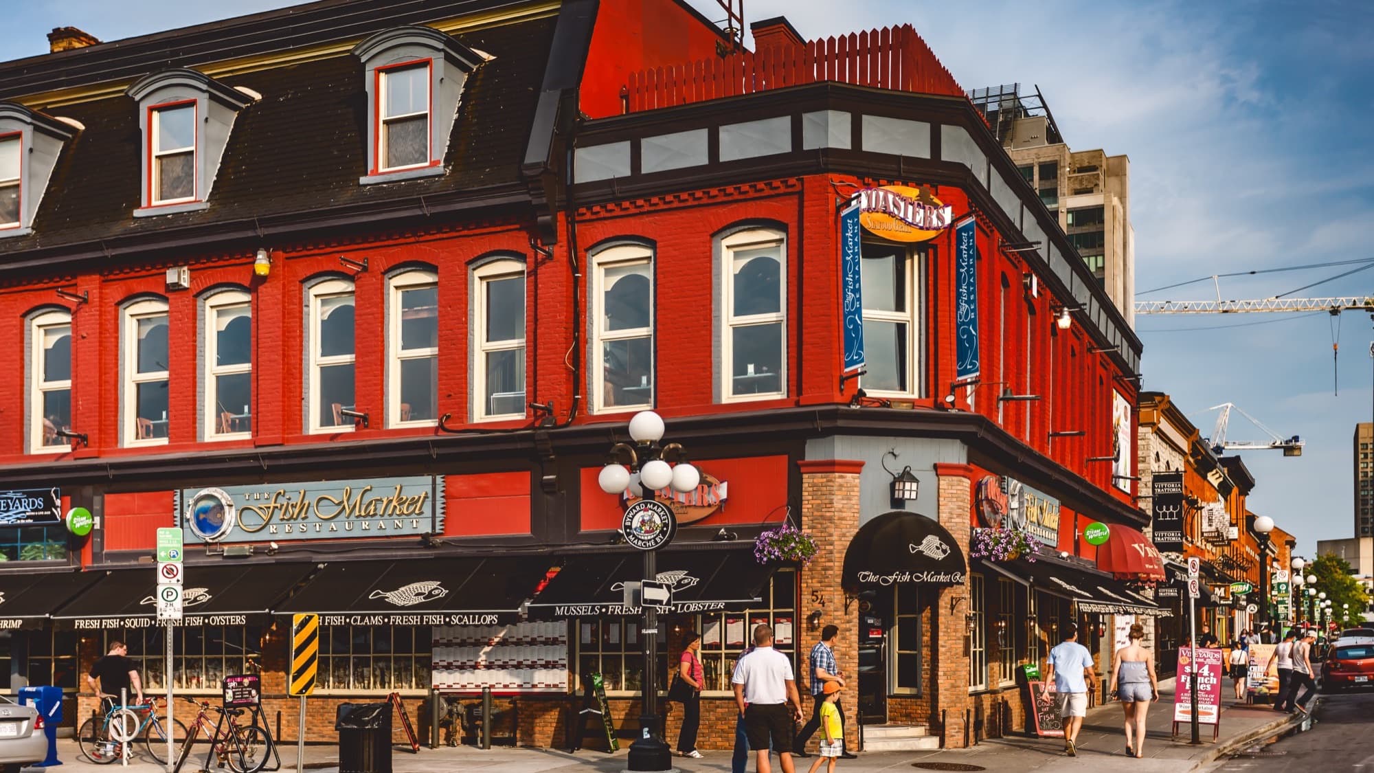
Ottawa was built as two cities glued together. Upper Town on the bluff for the officer class. Lower Town on the riverbank for the French and Irish Catholic workers who built the canal. Two hundred years later the class line in the street grid is still legible, and this corridor walks it stop by stop.
Start · Plaza Bridge: The Seam
DirectionsStops
- 1
Plaza Bridge: The Seam
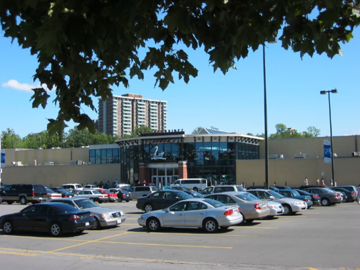
The line between Upper Town and Lower Town. Sappers' Bridge stood here from 1827 until its demolition on 23 July 1912, then Plaza Bridge replaced it in December of that year. The seam did not move.
- 2
Notre-Dame Cathedral Basilica: The Joint Parish
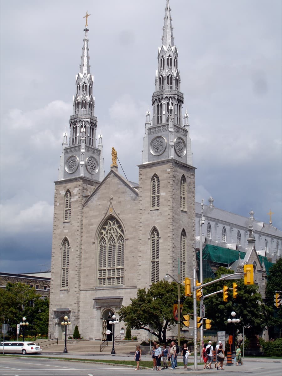
The unified French-and-Irish-Catholic parish of Lower Town from 1832 through 1888. Antoine Robillard's 1841 neoclassical start, Father Pierre-Adrien Telmon's 1844 Gothic Revival redesign, Father Damase Dandurand's 1866 twin spires.
- 3
ByWard Market: The Working City's Institution
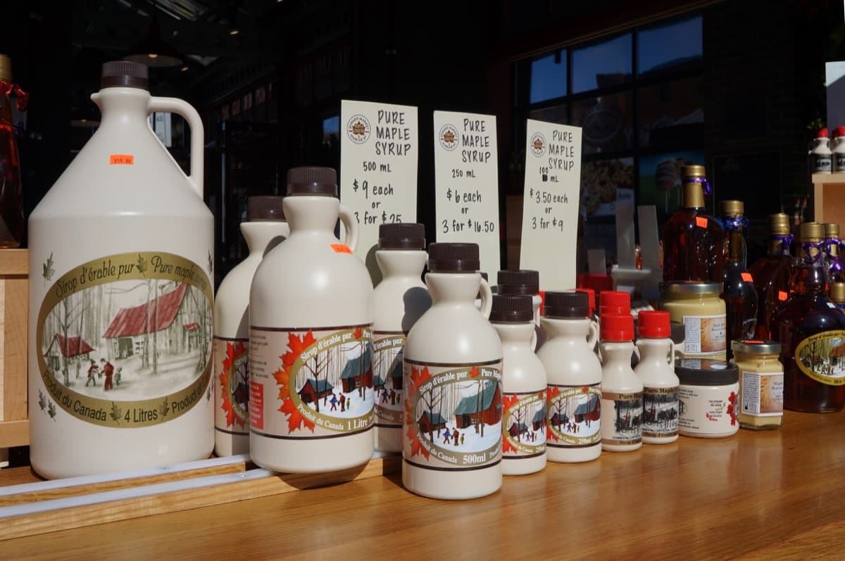
Colonel John By built the first market here in 1827 with one hundred and sixty pounds of Lower Town property-rent revenue. The market has operated on the same site continuously since. Designated a Heritage Conservation District on 6 February 1991.
- 4
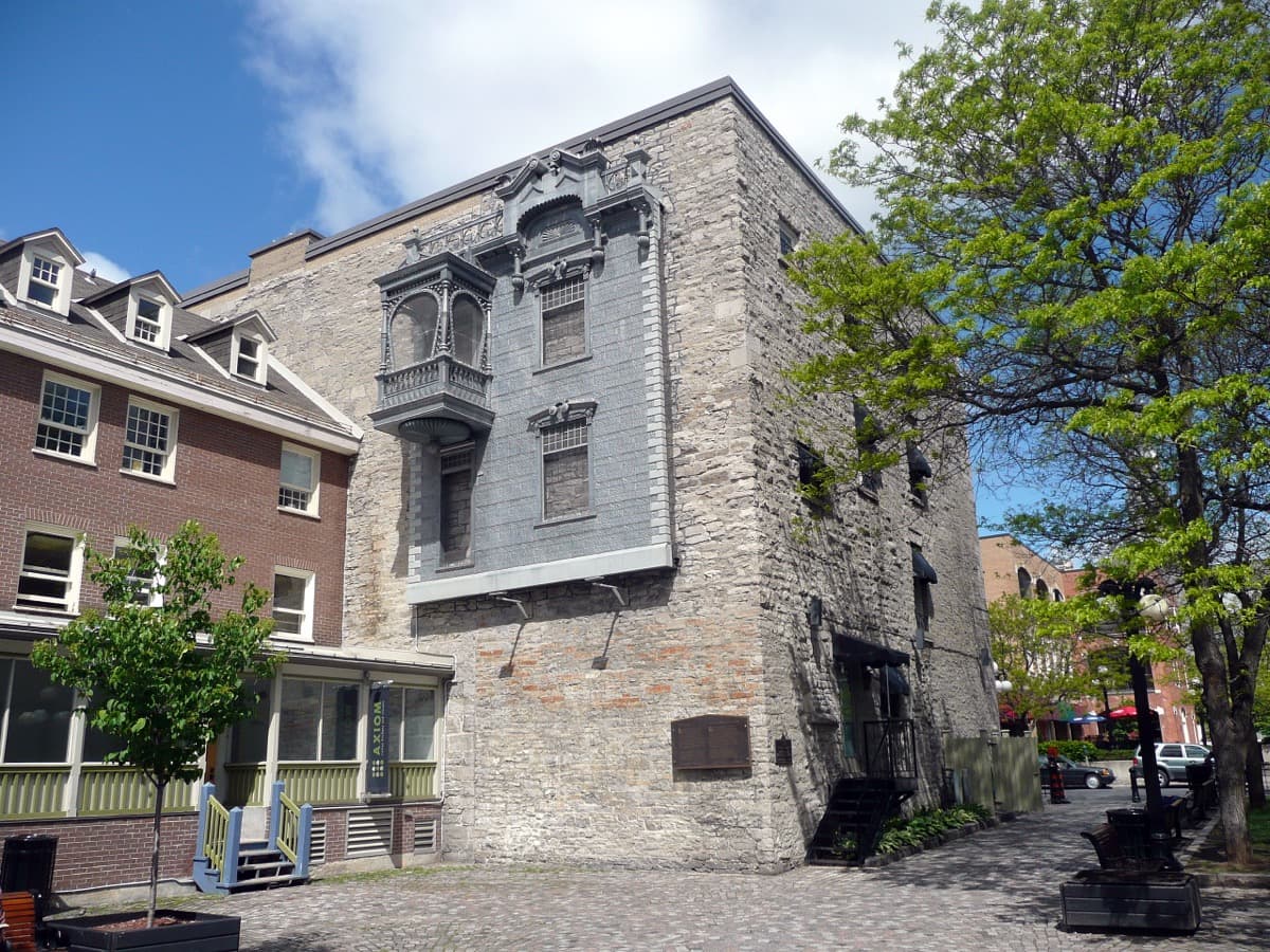
Tin House Court: The Tinsmith Trade Preserved
Honoré Foisy's early-1900s tinsmith-shop facade from 136 Guigues Avenue. The original house was condemned by 1961; the NCC salvaged the facade; sculptor Arthur 'Art' Price restored the metalwork in 1973.
- 5
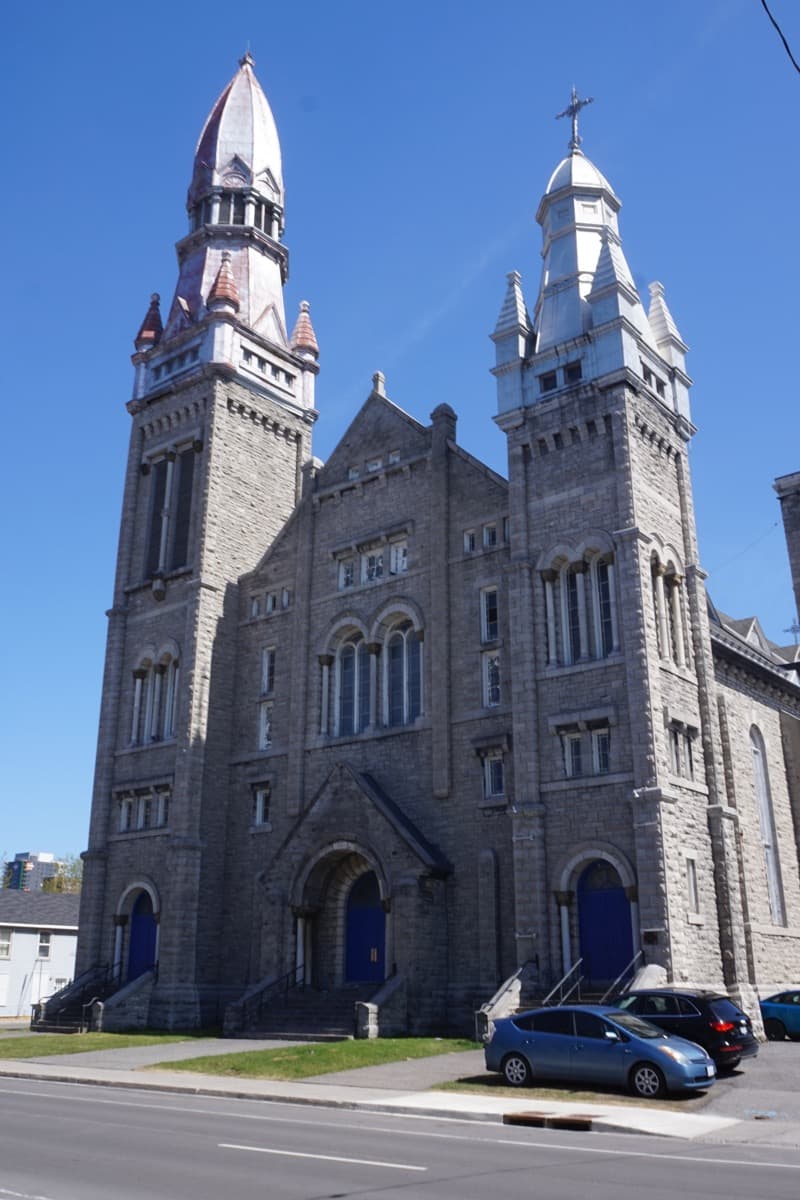
St. Brigid's: The 1888 Parish Split
On 3 August 1890, the Irish Catholic congregation of Lower Town opened its own church at 314 Saint Patrick Street, four blocks east of Notre-Dame Basilica. The split had been negotiated in March 1888 with Archbishop Joseph-Thomas Duhamel. This is the climax stop.
- 6

Major's Hill Park: The Officer's Lookout
The bluff above the canal entry-flight, where the canal officer class lived. Named for Major Daniel Bolton, Royal Engineers, who succeeded John By in command of the Rideau Canal works after By's 1832 recall.
- 7
Bytown Museum: The Commissariat Building
The oldest stone building in Ottawa. Built in 1827 by stonemason Thomas Mackay for Colonel By as the Rideau Canal construction depot. Three storeys, 2.5-foot-thick limestone walls, Georgian masonry. Museum since 1951.
- 8
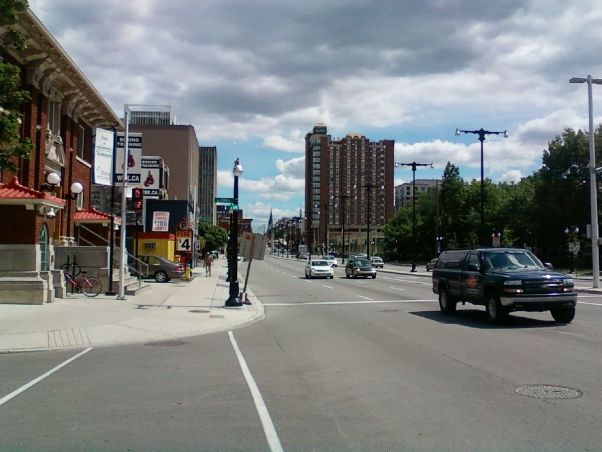
King Edward Avenue: The Closer
The modern dividing line. A residential street widened to six lanes in the mid-twentieth century as a planned arterial to the Macdonald-Cartier Bridge, which opened in 1965. The widening cut Lower Town in half. The corridor is restated.
Details
Best Time to Visit
Weekday mid-morning, Tuesday through Thursday, between nine and noon. Plaza Bridge and the ByWard Market fill with tour buses and lunch-hour foot traffic from late morning through mid-afternoon in summer. The corridor is quieter on weekday mornings in shoulder season (May, early June, late September, October). Saturdays and Sundays during market season are the most crowded; the audio works at those times but pause-stops at the market are tight. Winter walks the corridor with almost no crowds; the path down to the Bytown Museum from Major's Hill Park is icy from December through March, and the Commissariat exterior is the audio anchor when the museum is closed.
Pro Tips
- •Plaza Bridge has sidewalks on both sides; the north sidewalk offers the cleaner east-facing view into Lower Town that the Stop 1 audio describes
- •Notre-Dame Cathedral Basilica is free to enter when no service is in progress; the Stop 2 audio is written for the west facade and works fully from the sidewalk if you choose not to go inside
- •Tin House Court is a small interior courtyard between Clarence and Murray; the entry from Sussex Drive is easy to miss, and the bas-relief is on the east wall once you are inside
- •St. Brigid's Centre for the Arts keeps event-driven hours; the Stop 5 audio is anchored on the exterior at 314 Saint Patrick Street and is complete without interior access
- •The Bytown Museum keeps daily hours May through October and weekend-and-by-appointment hours November through April; verify at bytownmuseum.com before walking the canal-side path down from Major's Hill Park, and treat the exterior as the Stop 7 audio anchor when the museum is closed
- •King Edward Avenue at Saint Patrick is heavily trafficked at all hours; the Stop 8 audio is anchored on the west sidewalk looking south, and the avenue itself is the artefact; the audio does not direct the listener to cross
- •Michael S. Cross's 1973 Canadian Historical Review article The Shiners' War: Social Violence in the Ottawa Valley in the 1830s is the canonical academic source for the Shiners' War material in this audio; Bruce S. Elliott's Irish Migrants in the Canadas, McGill-Queen's University Press, second edition 2004, is the standard source for Irish-Catholic Ottawa-Valley settlement; both are available at the University of Ottawa and Carleton libraries
Safety & Precautions
- •Plaza Bridge has heavy vehicle traffic; stay on the sidewalk and do not stop on the roadway
- •The path down from Major's Hill Park to the Bytown Museum is steep and runs alongside the canal locks; it is slippery when wet and icy in winter
- •The canal locks are deep and unfenced at the lock-side path; keep small children within arm's reach between Major's Hill Park and the Commissariat
- •King Edward Avenue carries through-truck traffic; do not cross the avenue at Stop 8 to reach St. Brigid's from the closer position, the avenue itself is the artefact the audio describes
- •ByWard Market sidewalks are uneven cobblestones in places; flat soles with grip serve better than smooth leather
- •Saint Patrick Street between St. Brigid's and Sussex Drive has narrow sidewalks in spots; walk single-file where the curb cuts in
Travel advisory: Exercise Normal Precautions (Level 1).
Gallery
Related Reading
Go deeper on what you'll see, hear, and walk through.
Read the walk
The full story of Lower Town and ByWard: The City Beneath the Capital, in words. Prefer to listen? Play it narrated, from home or on location.
Introduction
A topographic line that became a class line, and is still legible in the street grid almost two centuries later.
When Lieutenant-Colonel John By laid out Bytown in eighteen twenty-six, he split it in two. Upper Town, on the bluff west of the canal, for the officer class and the small Scottish and English Protestant elite. Lower Town, below the bluff east of the canal, for the French-Canadian raftsmen and the Irish Catholic labourers who built the canal and worked the timber drives that followed. By eighteen forty, Lower Town had about fifteen hundred people. Upper Town had about five hundred. The working city outnumbered the political city by three to one, and the working city was below.
This tour walks the city below in Ottawa, Canada. The Catholic basilica the French and Irish working class built together in the eighteen forties. The market the canal labourers were paid in eighteen twenty-seven to buy bread at. The church the Irish community split off from the basilica to build for themselves in eighteen ninety. The oldest stone building in Ottawa. And the avenue a nineteen-sixties federal highway department widened to six lanes, which now bisects the neighbourhood the eighteen eighty-eight parish split once defined.
The argument is one sentence. Ottawa was built as two cities glued together, and the corridor a visitor walks below Parliament Hill is the city the political one was built on top of and would prefer the visitor not see.
Eight stops, about four kilometres, one hundred minutes including pauses. The walk starts on Plaza Bridge over the Rideau Canal, looking east, and ends at King Edward Avenue. When you arrive at Plaza Bridge, begin with stop one.
1. Plaza Bridge: The Seam
Welcome to Plaza Bridge. Stand at the centre of the bridge facing east. The canal runs north below you, down through the entry-flight of eight stone locks toward the Ottawa River. Parliament Hill rises behind you to the west. The ByWard Market and Lower Town spread out in front of you to the east. This is the seam.
Until the morning of the twenty-third of July, nineteen twelve, the bridge you are standing on was a stone arch called Sappers' Bridge. It was built in eighteen twenty-seven by the Royal Sappers and Miners under the assistant overseer Thomas Burrowes, working to Lieutenant-Colonel John By's plans. The name is theirs: sappers, the Royal Engineers' field corps. The bridge connected Rideau Street, on the Lower Town side, to what is now Wellington Street on the Upper Town side. On the morning of the twenty-third of July, nineteen twelve, the city dynamited it to make way for the development of Connaught Place, which is now Confederation Square. The dynamite failed. The crew finished the demolition with a derrick and block. Plaza Bridge opened in December of that year. The bridge changed. The seam did not.
Now look east. Two hundred years ago, the rooftops you can see in that direction belonged to a working city of about fifteen hundred people, mostly French and Irish Catholic, who built the canal you are standing over. In the same year, eighteen forty, Upper Town behind you held about five hundred people, largely English-speaking, Protestant, wealthy. The numbers come from the Historical Society of Ottawa, citing Bytown-era observers in their published Sappers' Bridge essay. The labour market was the canal. After the canal opened in eighteen thirty-two, the same labour pool moved into the timber drives on the Ottawa River. The workers stayed. Their housing stayed in Lower Town. Their parishes, their market, their taverns, and their fraternal halls stayed with them.
The Lower Town lot tenure was structurally different from Upper Town's. Lower Town properties could only be leased for thirty years under the original Crown grant, a restriction not lifted until the eighteen sixties. The labourers could not build equity in their own ground. The political city above was freehold. The working city below was leasehold for two generations.
That is the founding decision. Two cities, glued together at a stone bridge, separated by a canal and by tenure. The bridge was rebuilt in nineteen twelve. The class line was not.
Now walk east off Plaza Bridge along Rideau Street. Turn north onto Sussex Drive. The basilica is four blocks ahead on your right, at three hundred and eighty-five Sussex. The next stop is its west facade.
2. Notre-Dame Cathedral Basilica: The Joint Parish
Welcome to Notre-Dame Cathedral Basilica, three hundred and eighty-five Sussex Drive. Stand on the west sidewalk facing the entrance. Two slender spires of grey limestone, each topped with a metal cross. A central rose window above the doors. Carved stone saints in niches across the facade. This is the cathedral basilica of the Archdiocese of Ottawa-Cornwall, and it is the load-bearing institution of nineteenth-century Lower Town.
The building you are looking at is three buildings. One basilica, three architectural phases.
Phase one. In eighteen thirty-two, the year the Rideau Canal opened, Reverend Murty Lalor celebrated the first mass in a small wooden chapel on this ground, called Saint-Jacques. The Catholic population of Lower Town, French-Canadian and Irish together, worshipped in that wooden chapel for nearly a decade. In eighteen forty-one, under the parish priest Jean-Francois Cannon, construction began on a permanent stone church. The original designer was the builder Antoine Robillard. The original style was neoclassical, modelled on Saint Patrick's Church in Quebec City.
Phase two. In eighteen forty-four, midway through construction, the partially-built structure was redesigned. The Oblate father Pierre-Adrien Telmon took the neoclassical plan and converted it to Gothic Revival, also called neo-Gothic. The walls had already been started. The redesign worked within them. On the fifteenth of August, eighteen forty-six, Bishop Patrick Phelan of Kingston blessed the completed church. It had no spires yet. In eighteen forty-seven, Pope Pius the Ninth designated it the cathedral of the new Bytown diocese. The first bishop was Joseph-Bruno Guigues.
Phase three. In eighteen sixty-six, twenty years after the blessing, the Oblate father Damase Dandurand added the twin Gothic spires you are looking at now. In eighteen seventy-nine, Pope Leo the Thirteenth raised the cathedral to the status of minor basilica. In eighteen eighty-six, Ottawa became an archdiocese. In nineteen ninety, Parks Canada designated the basilica a National Historic Site of Canada.
One building, three phases. One parish, two languages. The French-Canadian and Irish Catholic populations of Lower Town worshipped here together from eighteen thirty-two through eighteen eighty-eight. Fifty-six years of joint parish life. Then the Irish congregation walked.
That is the next stop's argument. Hold the date. Eighteen eighty-eight. Notre-Dame loses half its parish.
Now walk south on Sussex Drive about three blocks, then turn east into the ByWard Market between William and George Streets. The market building is the long brick structure at the centre of the market square.
3. ByWard Market: The Working City's Institution
You have arrived at the ByWard Market. Stand in the open square on the west side of the market building, the long brick structure with the row of arched openings. You are standing in the only Bytown-era institution still operating on its original site in Lower Town.
In eighteen twenty-seven, the year the Sappers' Bridge went up, Colonel John By used one hundred and sixty pounds of revenue from Lower Town property rents to build a market here, with a courthouse behind it on George Street. The figure and the funding source are documented in the ByWard Market District Authority's institutional history. The first building was a timber structure with dovetailed corners and an attached weighing machine. It was dismantled in eighteen forty-two. A second market building opened on the sixth of November, eighteen forty-eight. That second building burned in eighteen sixty-two. Subsequent reconstructions followed. The market has operated on this site, continuously, since eighteen twenty-seven.
The name carries the founding. ByWard is two words run together, By and Ward, after By's Ward, the administrative ward Colonel By laid out around the market. The capital W is not a typo. It is the founder.
This is the working city's institution. It was not built for the visitor. It was built for the canal labourer in eighteen twenty-seven who needed bread and meat at the end of a fourteen-hour day, and for the timber raftsman in eighteen thirty-five who came in off the Ottawa River drives with a season's wages and needed to feed a family in Lower Town until the next contract. The market did not romance itself. It supplied the working city.
Between eighteen thirty-five and eighteen thirty-seven, this square was inside the territory of the Shiners' War. The Shiners were a faction of Irish raftsmen organised by Peter Aylen, born in Liverpool in seventeen ninety-nine, partner from eighteen thirty-two in the timber monopoly called the Gatineau Privilege. The seminal scholarly account is Michael S. Cross, writing in the Canadian Historical Review in nineteen seventy-three. Aylen used Irish labour gangs to drive French-Canadian raftsmen off Ottawa River timber drives. The conflict ran inside Lower Town. The market was open the whole time. The class line in the street grid did not bend.
On the sixth of February, nineteen ninety-one, Ottawa City Council unanimously designated approximately fifty acres around this square as the ByWard Market Heritage Conservation District, under Part Five of the Ontario Heritage Act. The by-law passed the sixth of March. Fifteen city blocks. One hundred and sixty buildings. Bounded by Saint Patrick Street on the north, George Street on the south, Mackenzie Avenue on the west, Dalhousie Street on the east. The legal recognition came one hundred and sixty-four years after the founding.
Now walk north on Sussex Drive about two blocks. Turn west into Tin House Court, a small alley between Clarence and Murray Streets. The bas-relief is on the east wall of the courtyard.
4. Tin House Court: The Tinsmith Trade Preserved
You have arrived at Tin House Court. Stand in the courtyard facing the east wall. Mounted on the brick is a metal bas-relief: rosettes, pediments, a moulded cornice, panels of decorative architectural ornament in galvanised iron. It is the front of a house, hung as wall…
Full narration for this stop unlocks with the tour.
5. St. Brigid's: The 1888 Parish Split
You have arrived at St. Brigid's, three hundred and fourteen Saint Patrick Street, at the corner of Cumberland. Stand on the west sidewalk and face the building. Rusticated limestone walls. A heavy square bell tower at the south-west corner. Round-arched windows. This is…
Full narration for this stop unlocks with the tour.
6. Major's Hill Park: The Officer's Lookout
You have arrived at Major's Hill Park, at the south overlook. Stand at the edge of the bluff looking south-east. The canal entry-flight of eight stone locks drops away below you. Across the locks, the Bytown Museum sits at the canal's east bank, the squat three-storey building…
Full narration for this stop unlocks with the tour.
7. Bytown Museum: The Commissariat Building
You have arrived at the Commissariat Building, One Canal Lane. Stand on the path on the west side facing the building. Three storeys of locally-quarried limestone, rough-coursed, in a Georgian rhythm of three bays. A gabled roof. Walls roughly two and a half feet thick. The…
Full narration for this stop unlocks with the tour.
8. King Edward Avenue: The Closer
You have arrived at King Edward Avenue at Saint Patrick Street. Stand on the west sidewalk and look south down the avenue. Six lanes of traffic. Concrete median. Transport trucks. Behind you to the west is the basilica of Notre-Dame, four blocks back. Across the avenue to the…
Full narration for this stop unlocks with the tour.