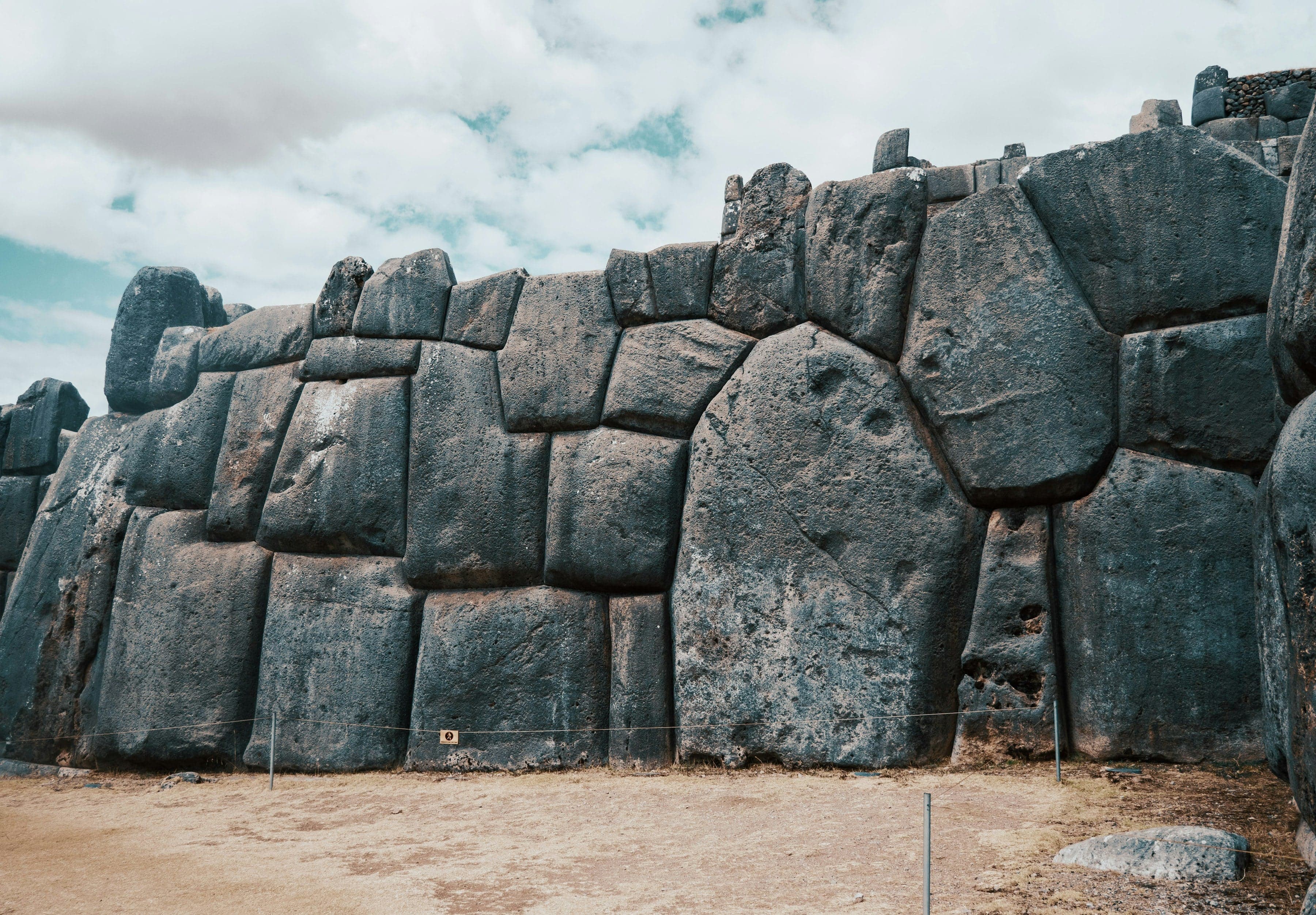
From Cristo Blanco down past Sacsayhuamán's stone channels, an old road and the Sapantiana arches to San Cristóbal and the Plaza de Armas, with optional ticketed stops inside the zigzag walls.
Inside Sacsayhuamán · ticketed · 3 stops you tap
Start · Cristo Blanco: The City From Above
DirectionsStops
- 1
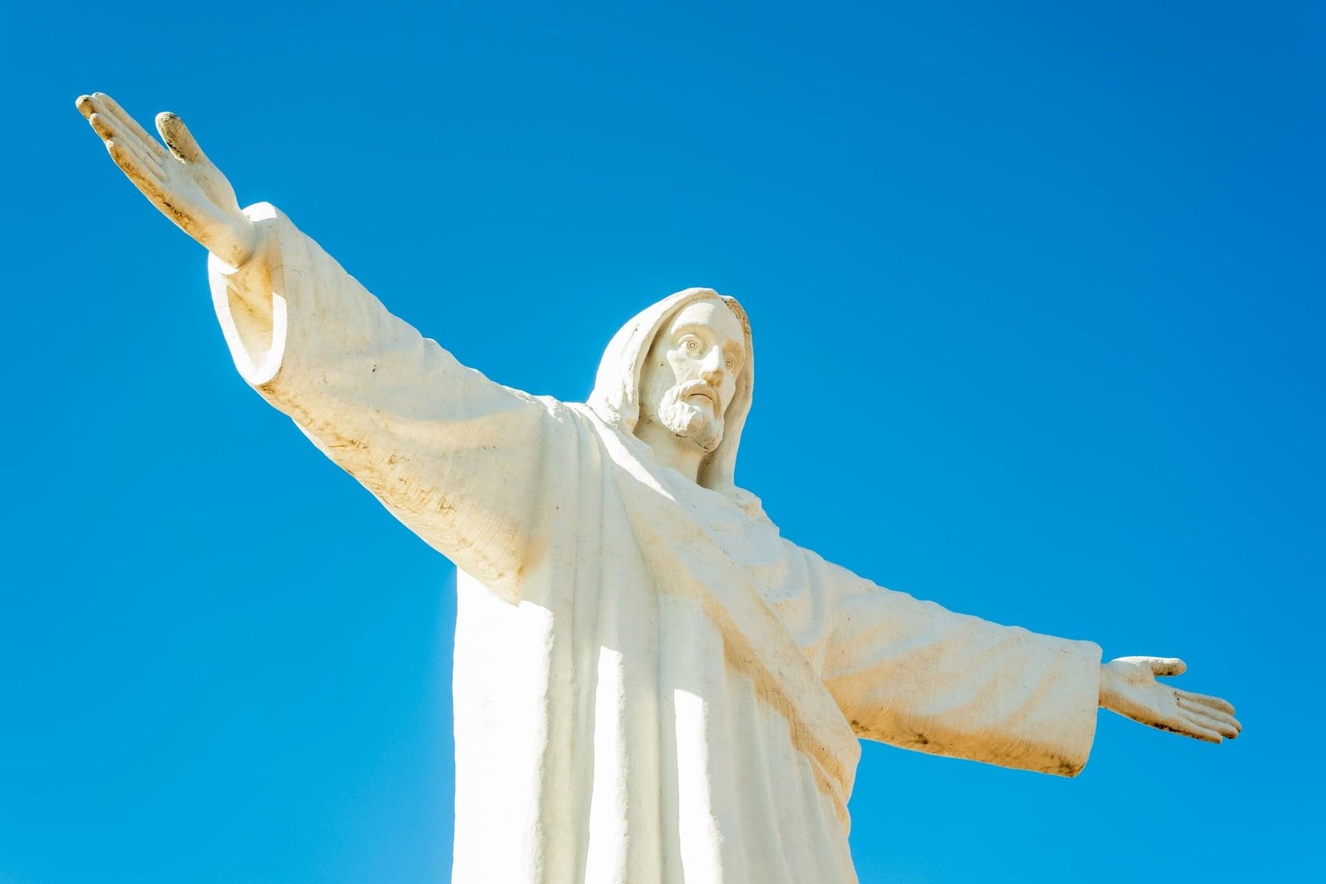
Cristo Blanco: The City From Above
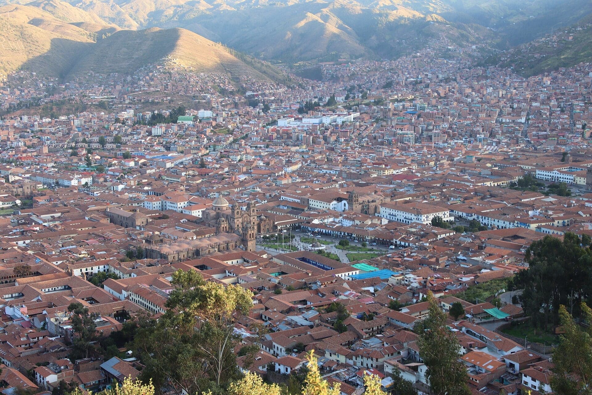
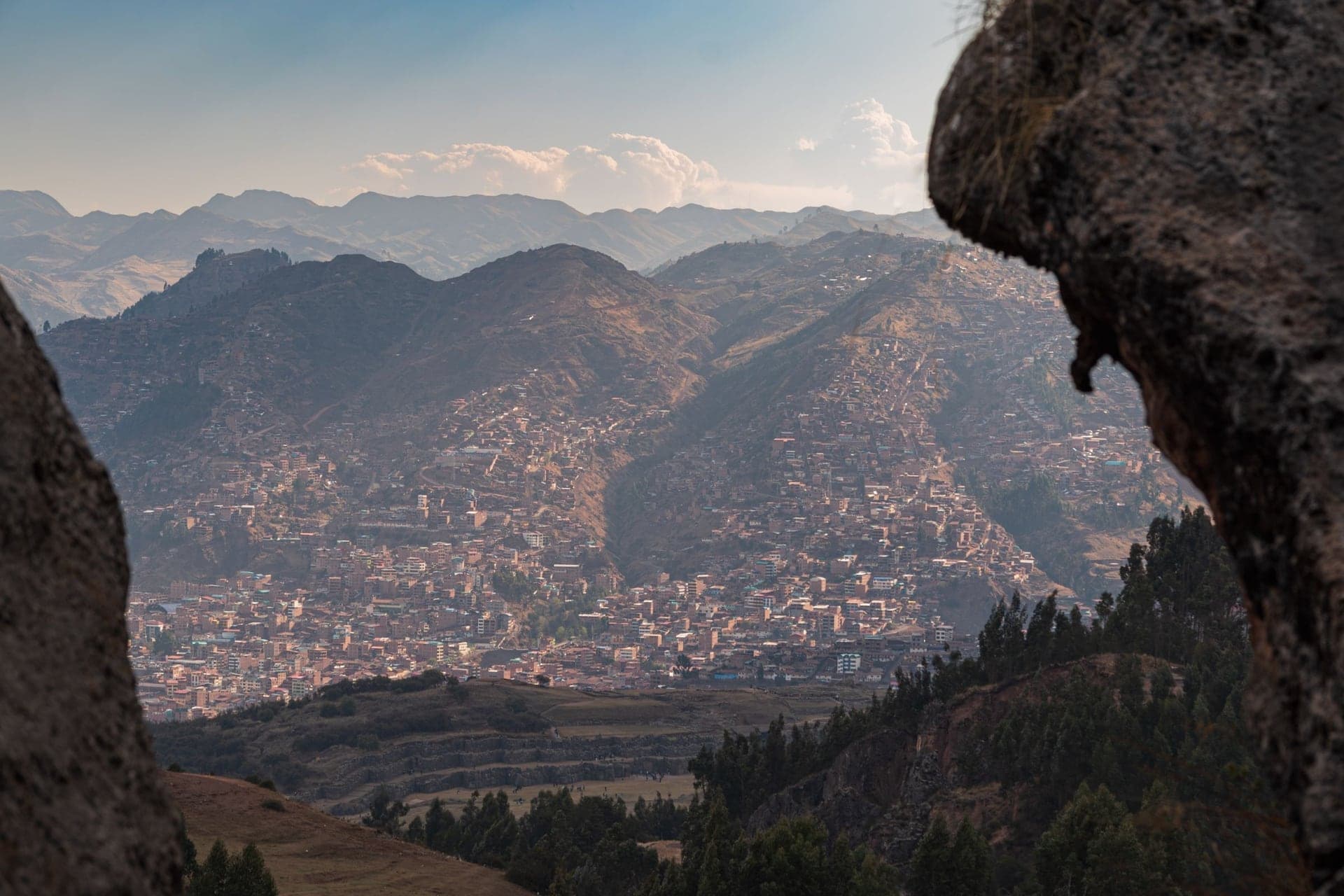
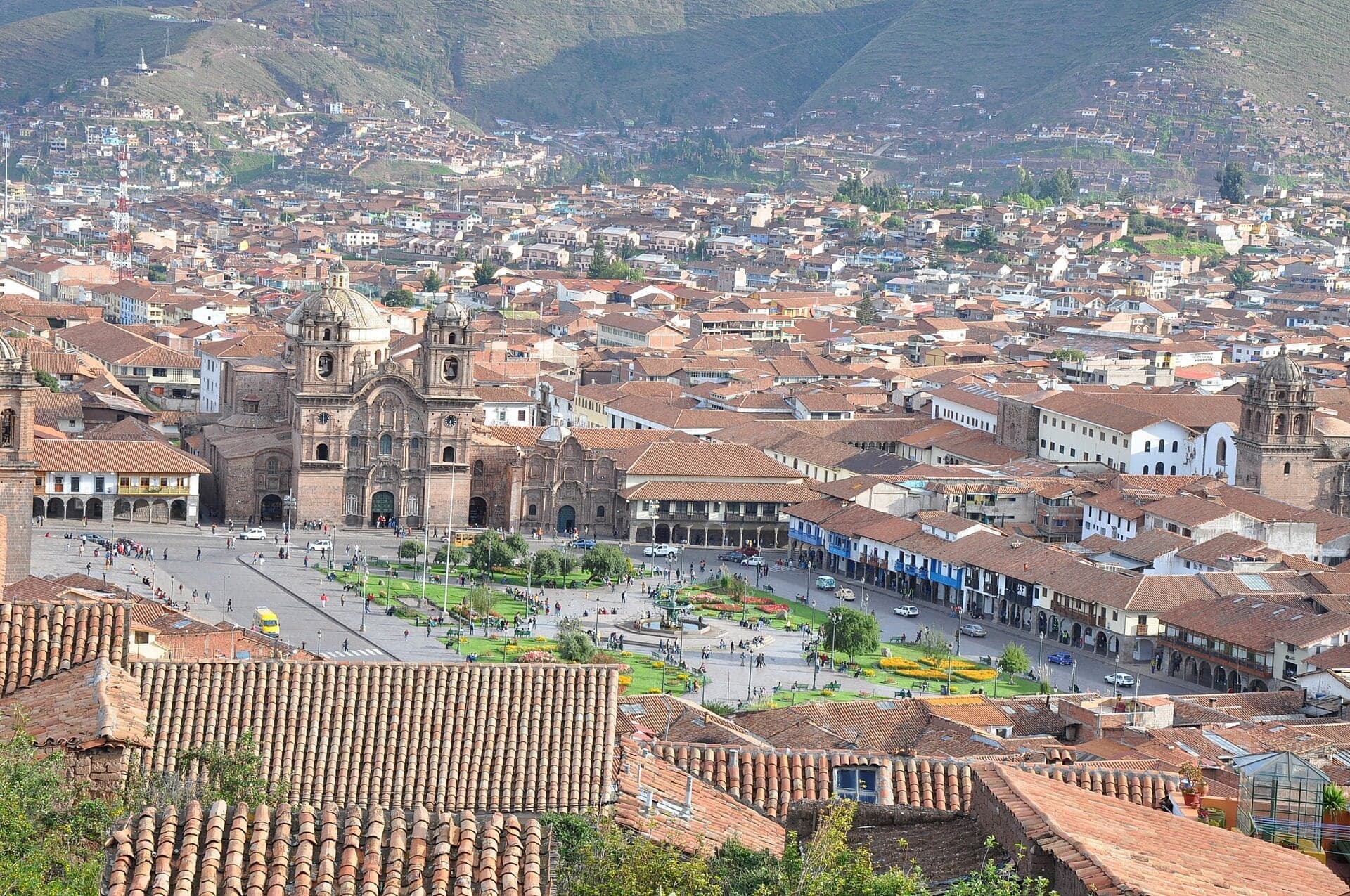
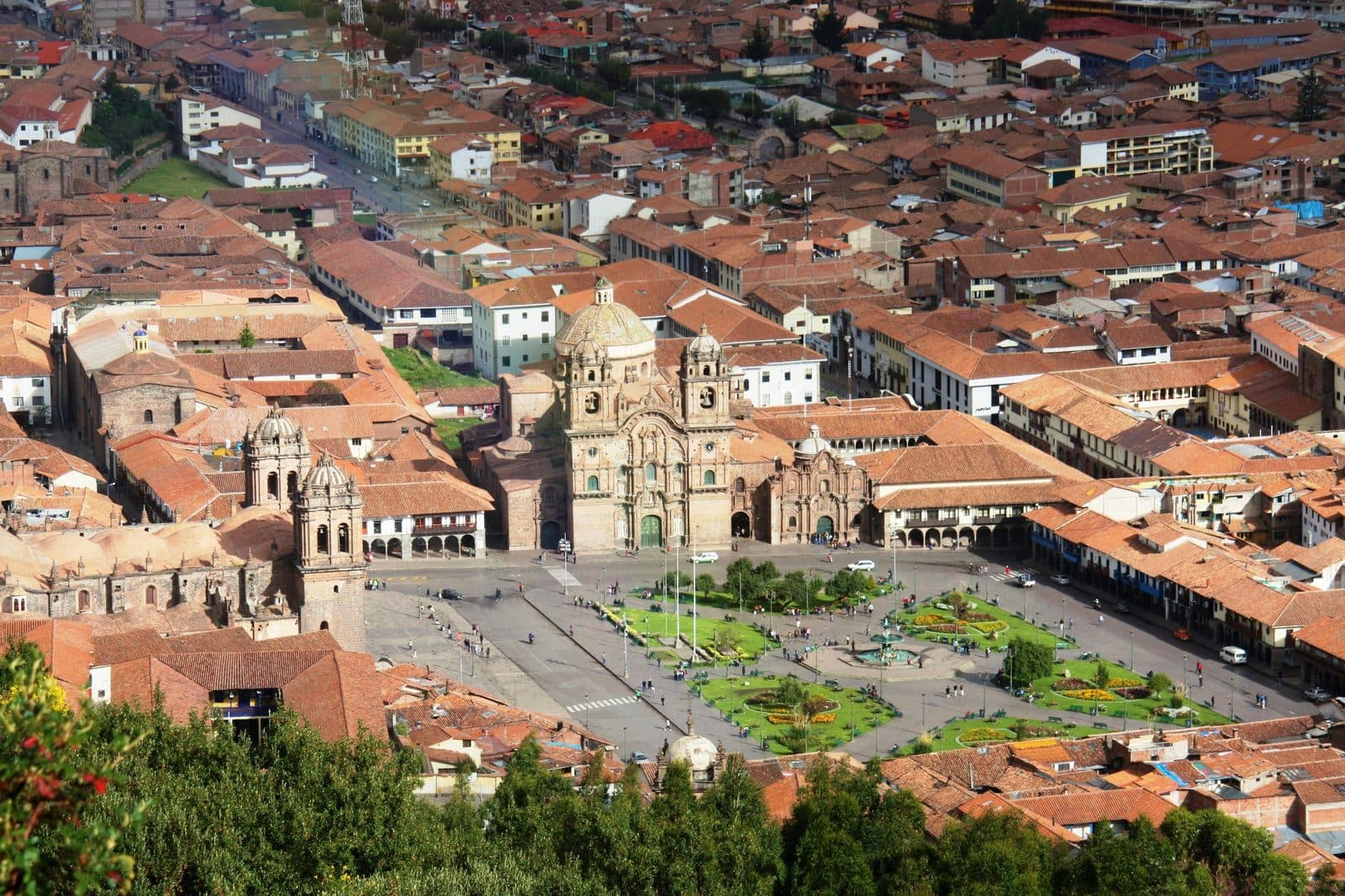
A white Christ stands with open arms over Cusco. From the free viewpoint below it, the red roofs of the whole city spread down to the Plaza de Armas.
- 2
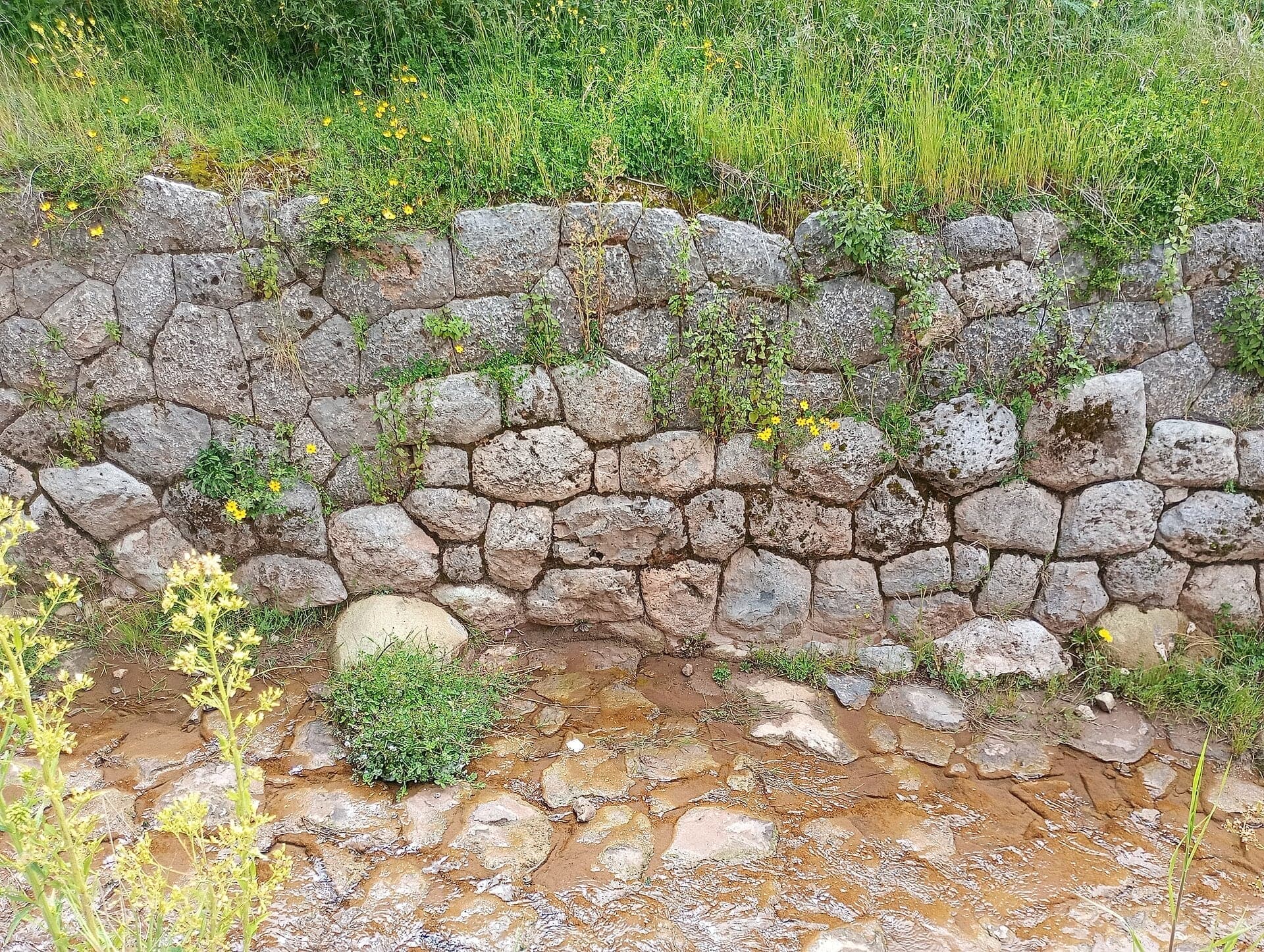
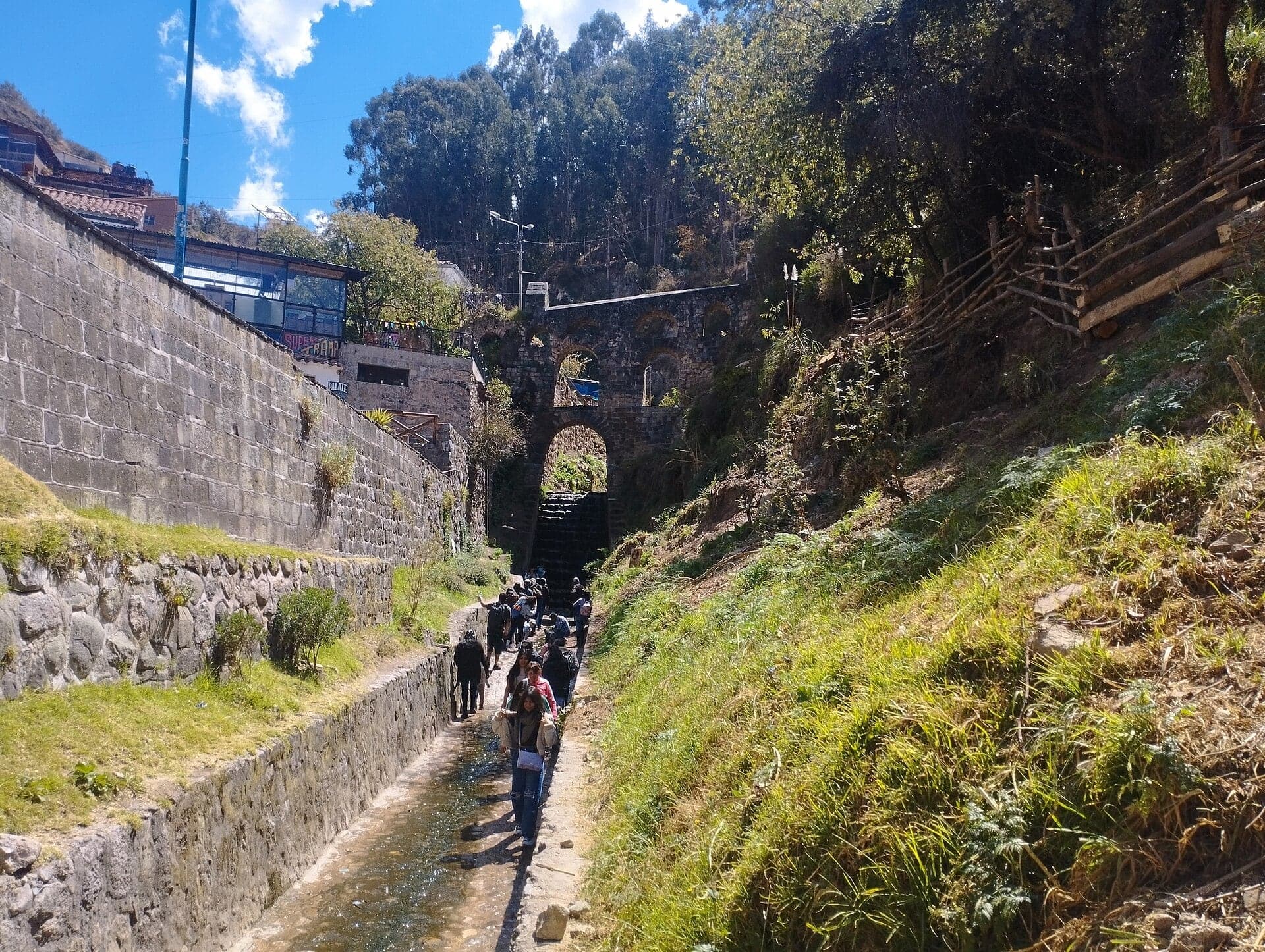
Puqro: A Stream Lined in Stone
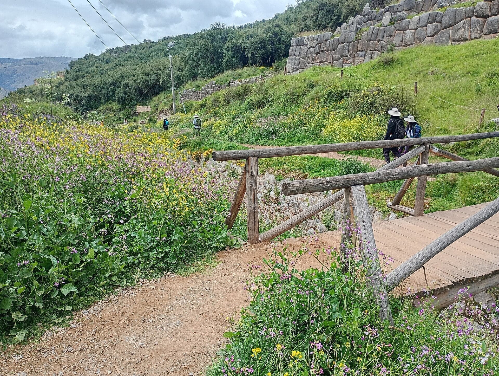
A stream runs in a stone channel below Sacsayhuamán's walls. A megalithic wall rises beside the path, and the ticketed park begins just above.
- Inside Sacsayhuamán · ticketed · tap each stop to play
- 3

Zigzag Walls: Fortress or House of the Sun
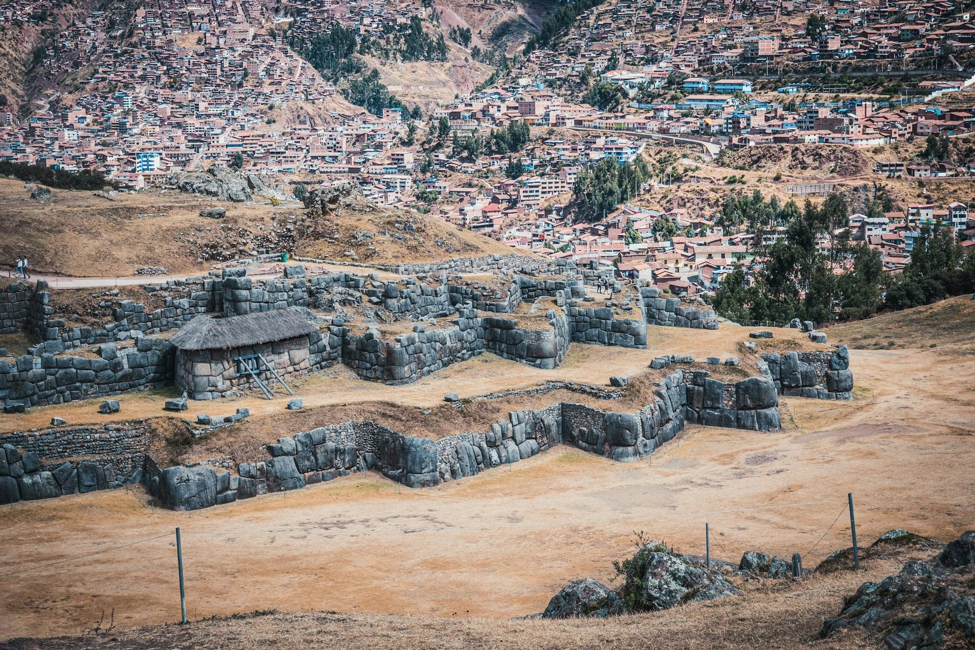
Three great terraced walls zigzag across the hill, one above another. Their lowest tier holds blocks three to five meters tall.
- 4
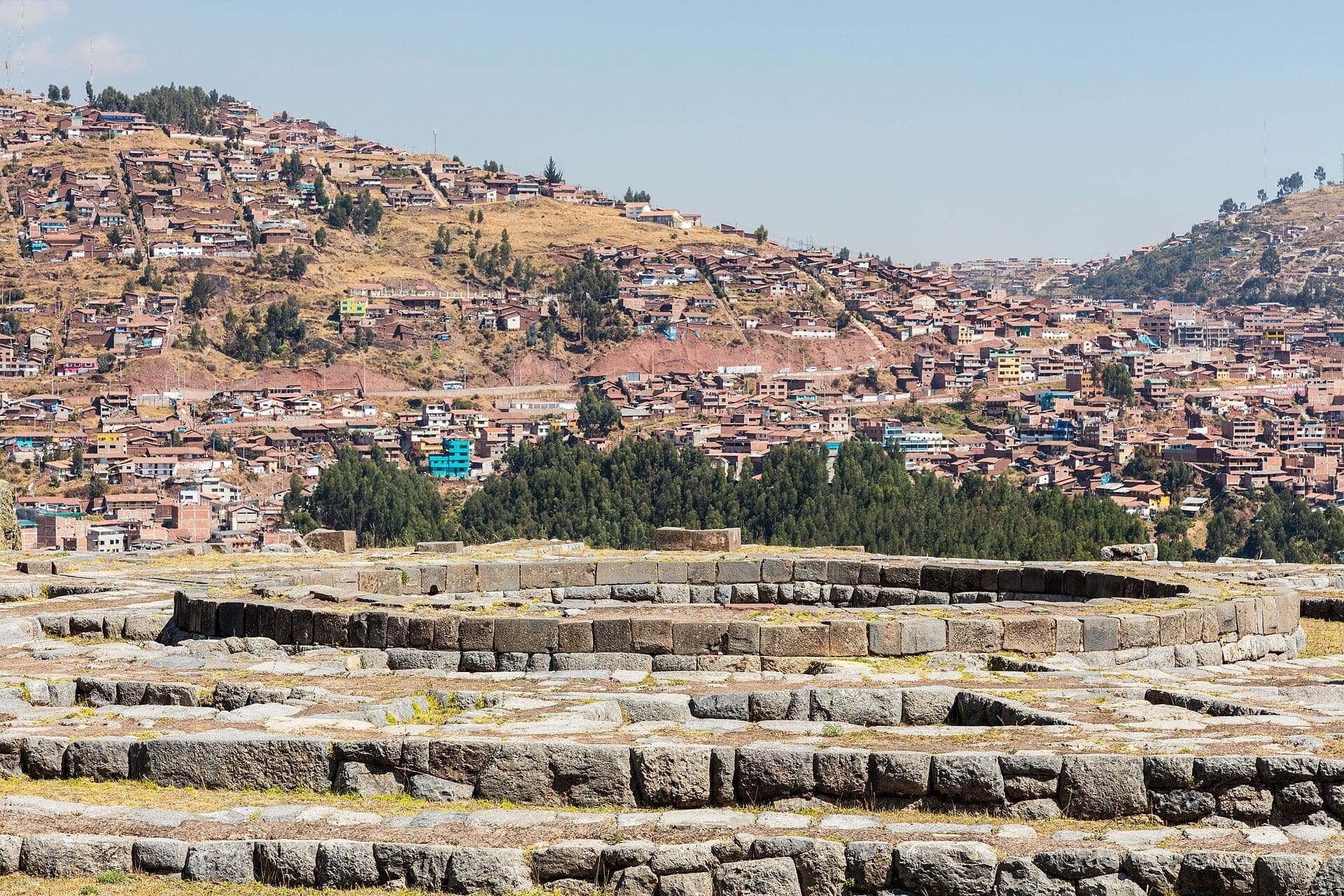
Muyuqmarka: Where a Round Tower Stood
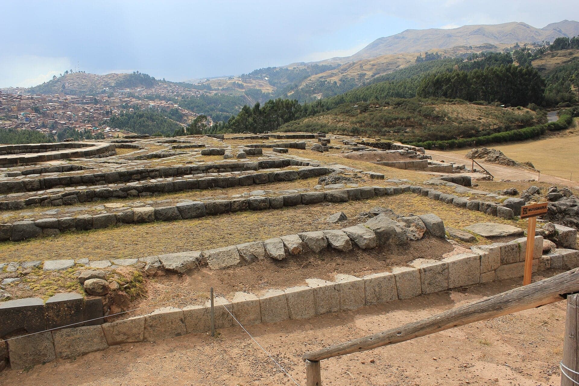
Rings of stone foundations mark a round Inca tower on the hilltop. A chronicler remembered water brought to it from far away underground.
- 5
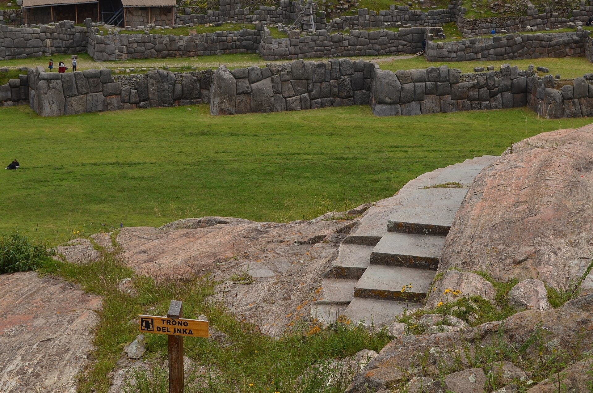
Rodadero: A Slide of Rock and the Inca's Throne
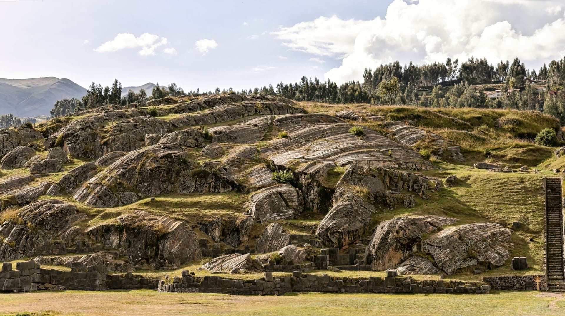
A natural outcrop of polished rock forms slides beside carved stone seats. From here all three zigzag walls rise across the open ground.
- 6
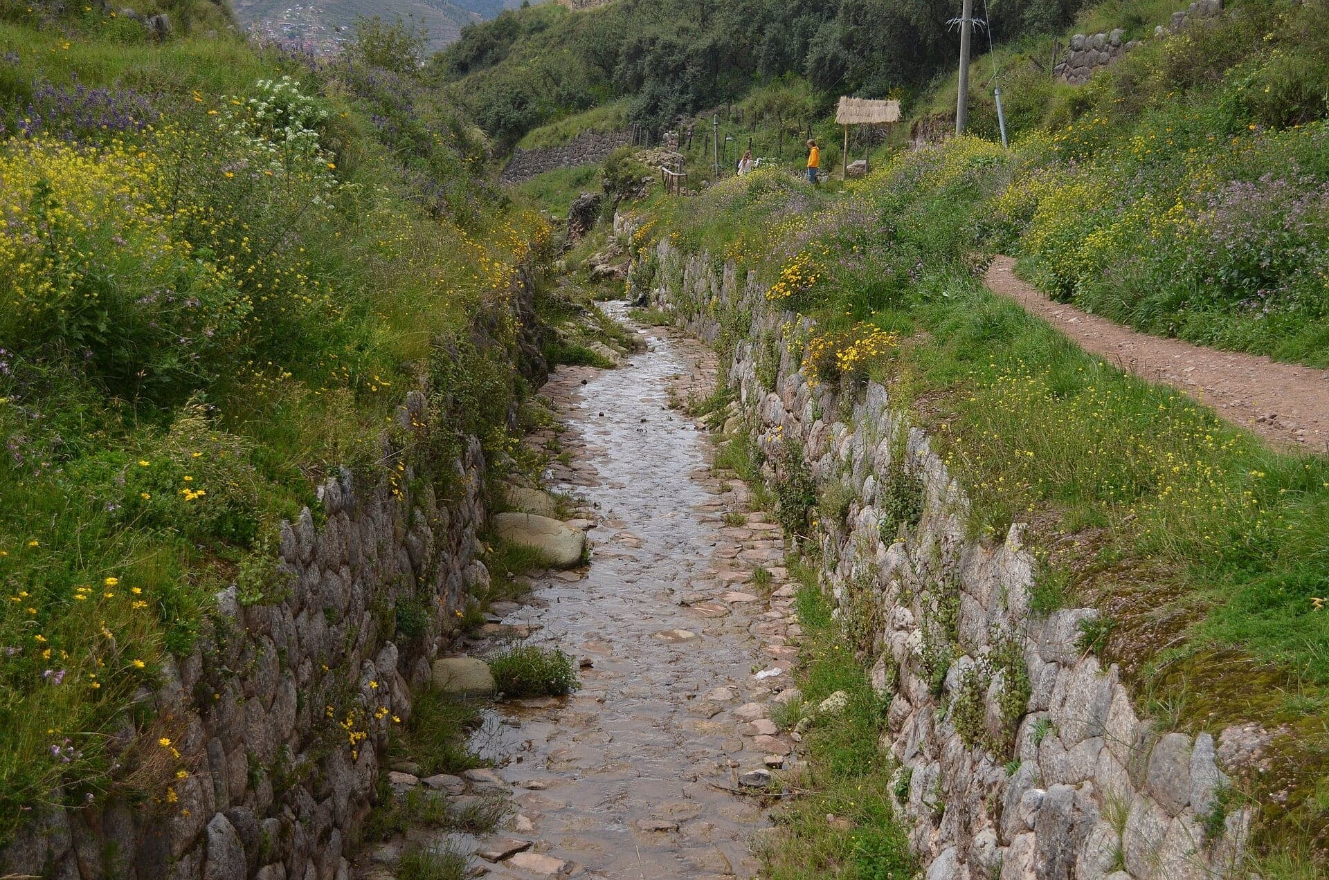
The Stone Channel: An Old Road Beside the Water
A stairway follows an old road down beside the stone channel. The Incas built channels like it to water the city and its terraces.
- 7
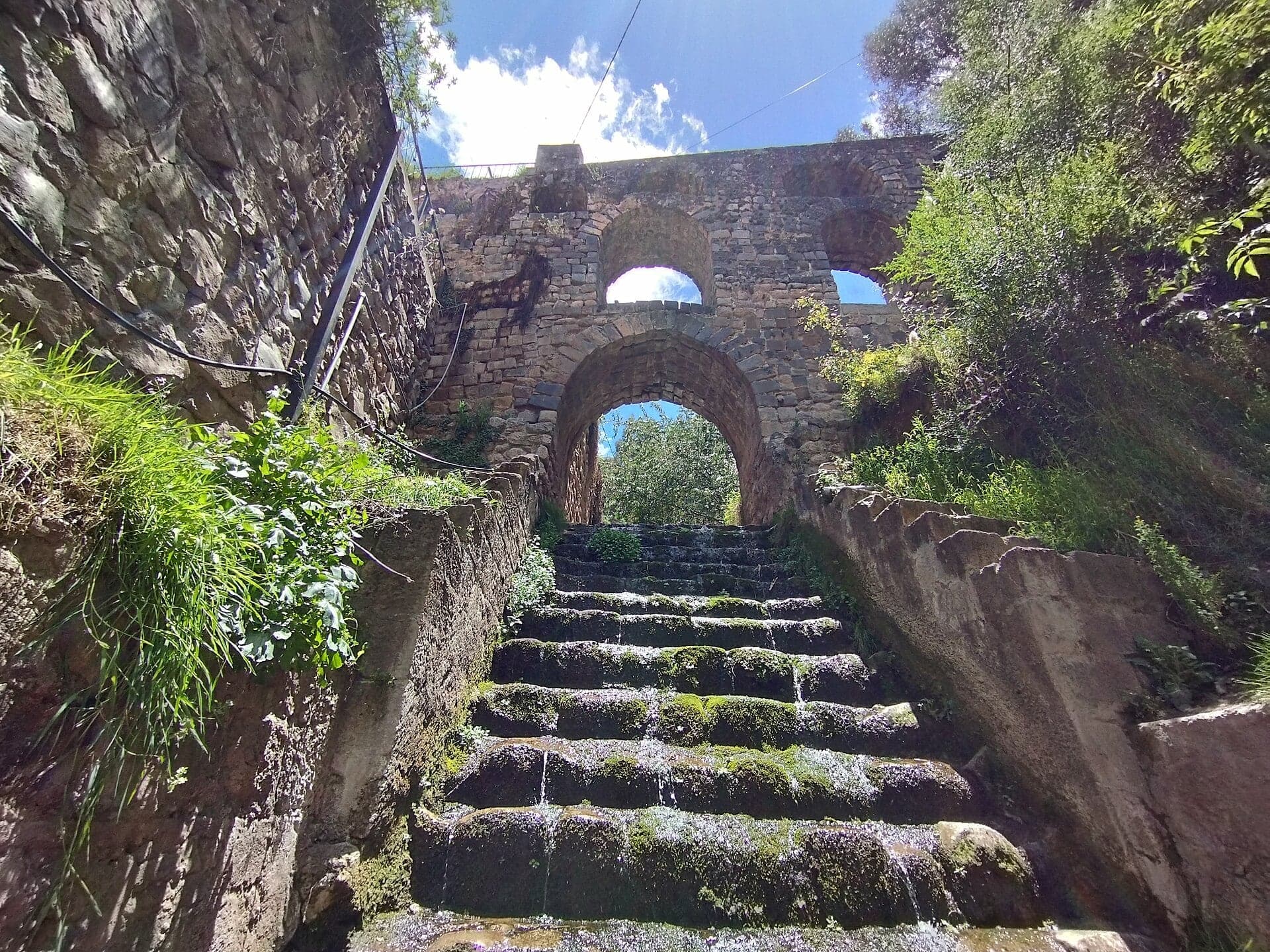
Sapantiana: Inca Channel, Colonial Arches
Old stone arches carry a water channel across a ravine. A short side path from the steps leads to the free archaeological site.
- 8
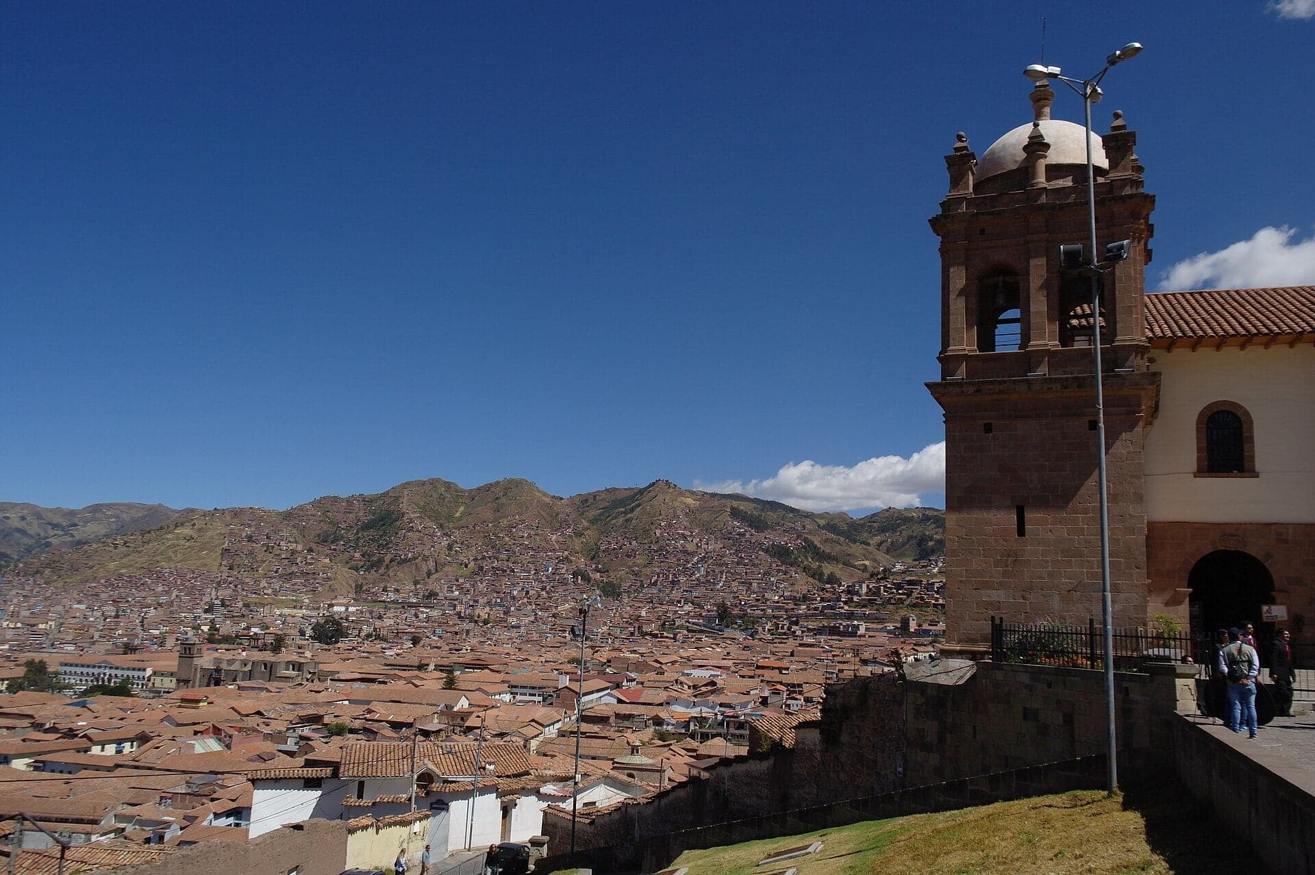
San Cristóbal: An Inca Prince's Church
An Inca prince built this church beside a wall of eleven niches. The terrace in front looks out over the whole city.
- 9
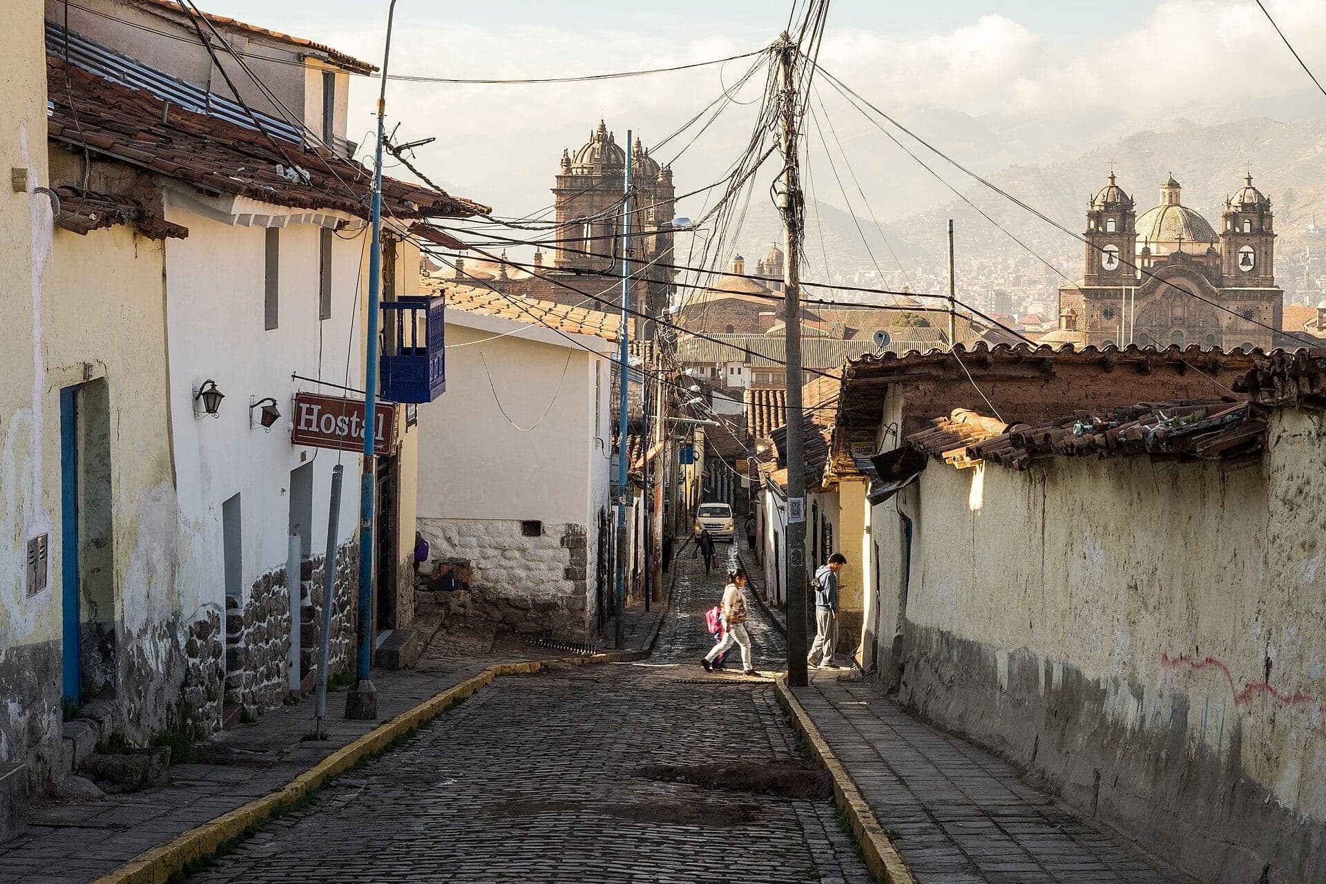
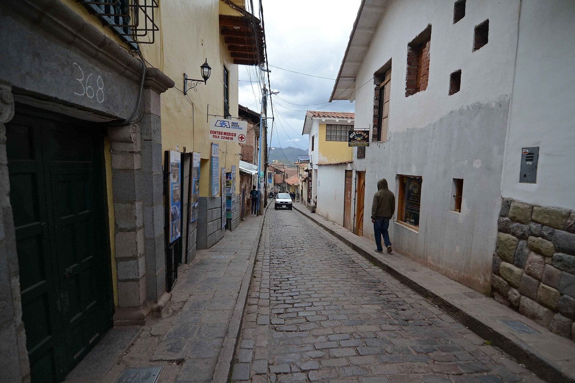
Calle Suecia: Down Through Upper Cusco
A steep stone lane drops toward the Plaza de Armas. It runs down through what the Incas called upper Cusco.
- 10
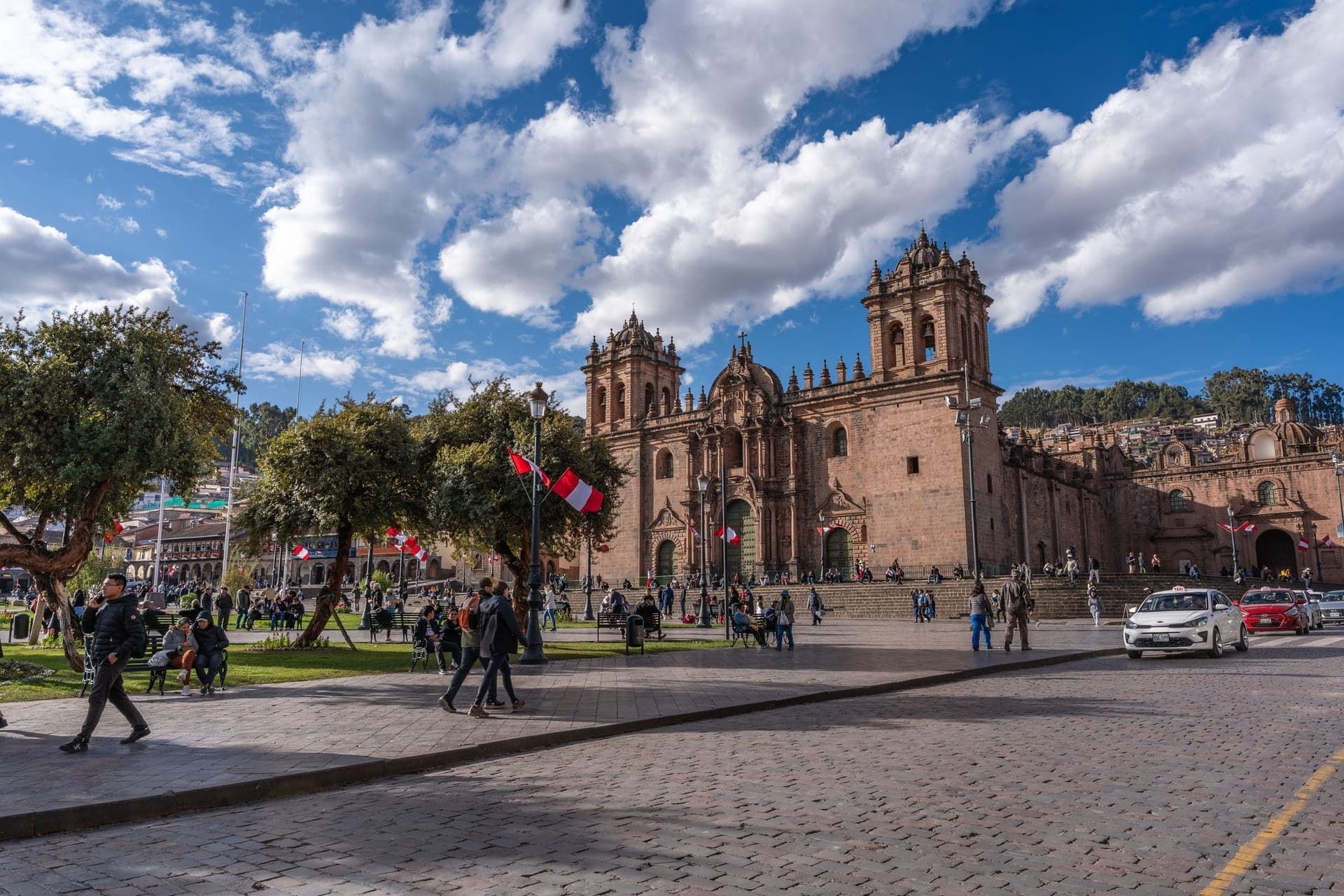
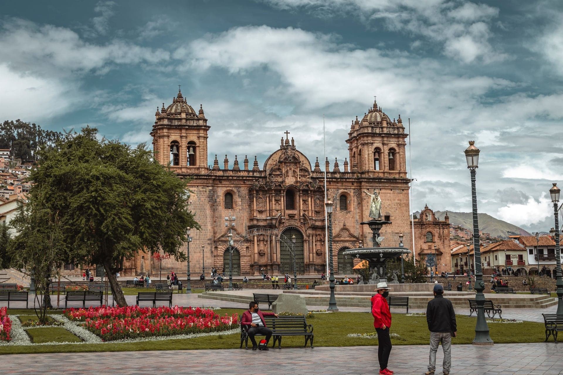
Plaza de Armas: Where the Stone Came Down
The walk ends on Cusco's great square, ringed by churches and colonial houses. Some of their stone came down from the hill above.
Details
Best Time to Visit
Morning, in daylight. The archaeological park is open daily from 07:00 to 17:30 (Ministry of Culture, Cusco, checked 6 October 2026), the hillside paths and stairways are unlit, and an early start leaves time for the inside visit before the park closes.
Pro Tips
- •Getting to the start: take a taxi from the Plaza de Armas up to Cristo Blanco, a short ride by road. Cusco's taxis have no meters, so agree the fare before you get in. A local bus line named Cristo Blanco also runs up the Pisac road. Walking up instead means about 170 meters of steep climbing: only if you are used to the altitude.
- •Sacsayhuamán has no single-site ticket. The cheapest way in is the Boleto Turístico partial ticket for Circuit I: 70 soles for foreign visitors, valid one day, also covering Q'enqo, Puka Pukara and Tambomachay. The full ticket is 130 soles for 10 days. Both are sold in person only, at the sites and at the COSITUC office, Avenida El Sol 103, daily 07:30 to 18:00. Bring your passport or ID: the ticket is personal (COSITUC, checked 6 October 2026).
- •The inside visit adds about forty-five minutes and about 45 meters of climbing. The official visitor circuit starts at the Llaullipata control on the far side of the walls and ends at Puqro, by stop 2.
- •If a guard asks you for a ticket on the outside paths and you have none, there is a public way down that avoids the park: from Cristo Blanco take the stepped street called Calle Cristo Blanco down into upper San Blas, follow Tandapata, then take the Siete Borreguitos steps over the Sapantiana canal to the Pumacurco steps, where you rejoin this walk at stop 7, Sapantiana. It is a little over a kilometer, all public lanes and steps (Tandapata has no pavement: keep to the edge), and skips stops 2 to 6.
- •The church of San Cristóbal (stop 8) has its own ticket, part of the archdiocese's religious circuit; prices and hours could not be confirmed from an official source on 6 October 2026, so ask at the door.
- •The Sapantiana arches (stop 7) are about fifty meters along a footpath that leaves the steps; walk out to them and come back to the steps.
- •Our Historic Center walk starts on the Plaza de Armas, where this walk ends.
Safety & Precautions
- •Altitude: the walk starts at about 3,570 meters. The CDC advises only mild exercise and no alcohol for the first 48 hours at high altitude. If you have a severe headache, nausea or dizziness, stop and rest, and go down.
- •The walk is not step-free: most of it is steep stone steps, including a long stairway and the Pumacurco steps, which have no handrail. It is not suitable for wheelchairs or strollers. The footpath from Cristo Blanco is bare ground and can be muddy after rain.
- •You cross one busy road, Don Bosco, three times with no crossing or signal: at the foot of the stairway, before the San Cristóbal terrace, after a few steps along its edge, and on the steps below the terrace, where they cross the road at a sharp bend with traffic coming round from both sides. Look both ways and cross quickly.
- •Walk in daylight only. The archaeological park closes at 17:30, and the hillside paths and stairways are unlit and empty after dark.
- •Inside the park, climbing on the walls is forbidden, as are food, alcohol, drones without a permit and animals (Ministry of Culture, checked 6 October 2026). Do not lean on or climb the Inca walls anywhere on the walk.
- •Around 24 June the Inti Raymi festival uses the esplanade at Sacsayhuamán, and access may be restricted.
Travel advisory: Exercise Increased Caution (Level 2).
Gallery
Related Reading
Go deeper on what you'll see, hear, and walk through.
Read the walk
The full story of Sacsayhuamán and Cristo Blanco: Down the Hill the Stone Came From, in words. Prefer to listen? Play it narrated, from home or on location.
Introduction
Cusco, in the Andes of Peru, was the capital of the Inca empire, and on the hill above it stand the zigzag walls of Sacsayhuamán. The Spaniards called it a fortress, because they had to fight for it. The people of Cusco, a Spanish chronicler wrote, called it the House of the Sun.
This walk comes down from the top, the way the hill's water and much of its stone came into the city. It begins with a short taxi ride up from the Plaza de Armas to Cristo Blanco, the white Christ. Cusco's taxis have no meters, so agree the fare first. From the statue it is ten stops and about one point three kilometers, under a mile, nearly all downhill to the Plaza de Armas: about an hour and a quarter.
You start nearly three thousand six hundred meters up. Doctors advise only mild exercise in your first two days at this height. Most of the walk is steep stone steps, not step-free, and three times you cross a busy road with no crossing. It is a walk for daylight.
Three stops are inside the ticketed ruins of Sacsayhuamán: optional, about forty-five minutes more, with a climb of about forty-five meters. The rest works on its own.
Three people come back: Manco Inca, who fought the Spaniards from this hill; Paullu, an Inca prince who took their side; and Garcilaso de la Vega, who climbed these ruins as a boy.
1. Cristo Blanco: The City From Above
Welcome to Cristo Blanco, the White Christ. The statue and the view are free. Three stops further on are inside the ruins of Sacsayhuamán, which are ticketed and well worth it. There is no ticket for Sacsayhuamán alone: the cheapest one that covers it costs seventy soles for foreign visitors, sold in person, not online. The walk works without it.
Now look out over the city. Red tile roofs fill the valley below, and among them you can pick out the open square of the Plaza de Armas, where this walk ends, with the towers of the cathedral and the church of the Compañía on it.
The statue above you is about eight meters tall, arms open over Cusco, a smaller cousin of the Christ above Rio de Janeiro. It went up in nineteen forty-five, a gift to the city from Cusco's Palestinian community. The hill it stands on is called Pukamuqu, and it lies inside the national archaeological park of Sacsayhuamán, which covers about three thousand hectares of these hills.
There is an old way of reading the city from up here. A tradition sees Inca Cusco as a puma lying in the valley, with the hill of Sacsayhuamán as its head. Even the Ministry of Culture's own plan for the park only infers it, so take it as a story, not a map.
From here the route follows a footpath round the hill and down a long stairway, paths the old neighborhoods below still use into the park, which should not need a ticket. If a guard asks you for a ticket anyway and you have none, there is a public way down: the stepped street from this statue into the San Blas neighborhood, which meets this walk again at Sapantiana, stop seven. The tour's tips describe the way.
Follow the route along the footpath round the hill. Next, a stream the Incas lined with stone.
2. Puqro: A Stream Lined in Stone
Walk on to the footbridge over the stone channel and stop there. This is Puqro, the eastern edge of Sacsayhuamán. Just up the slope is the Rumipunku control, one of the park's gates. The next three stops are inside, ticketed, and worth it: the great zigzag walls, the foundations of a round tower on the hilltop, and a slide of polished rock beside carved seats. The details are on this stop's card.
Look down at the channel. The stream runs between straight walls of fitted stone: the Incas tamed the water on this hill.
Now look up the slope beside the path, at the big wall of grey stone. No two blocks are the same shape. Each has many sides, and each is cut to the exact outline of the stones around it. A Spanish chronicler wrote of the walls up here that you could not slip a coin between the stones. Keep that fit in mind: it comes back further down.
There is no ticket for Sacsayhuamán alone. The cheapest way in is a partial Cusco Tourist Ticket, the Boleto Turístico, for circuit one: seventy soles for foreign visitors, good for one day. It is sold in person only, not online. This gate may not sell it: the sure places are the main entrance beyond the walls and the ticket office in town. The park is open from seven in the morning to five thirty in the afternoon. Inside, allow about forty-five minutes, and a climb of about forty-five meters.
If you go in, the inside stops do not start on their own: tap each one as you reach it, in any order. When you come back out, return to this channel and carry on down.
If you are not going in, skip the next three stops: the walk carries straight on down the stairway.
Follow the route down the stairway. Next, the same stone channel, lower down.
3. Zigzag Walls: Fortress or House of the Sun
This is the heart of Sacsayhuamán: three great walls, one above another, laid out in zigzags. The Ministry of Culture's plan for the park compares the line to a bolt of lightning. Three paths once crossed the terraces, and Garcilaso de la Vega, who knew Cusco as a boy and wrote about it, said each wall had a gate near its middle.
Look at the lowest wall first. It holds the biggest stones: blocks three to five meters tall, which the Ministry estimates may weigh ninety to a hundred and twenty-five metric tons. Pick one and follow its edge. Count its sides, then see how the smaller stones around it are cut to its outline. An architect who tested Inca methods by hand found that such fits can be made with hammerstones, river cobbles used to pound the rock, and patience: mark the outline, hammer it out, try the stone, and hammer again until it fits.
So what was this place? A Spanish chronicler wrote that the people of Cusco called it the House of the Sun, and his countrymen called it a fortress. The Ministry weighs three readings: a fortress, a shrine to the thunder, or the House of the Sun. It argues the place became a fortress only in war. In fifteen thirty-six Manco Inca led a great siege against the Spaniards in the city below and turned this hill into his stronghold. One of the Spanish captains was killed leading the attack on it. The Spanish name stuck.
Some gaps in these walls are people's work: stone taken away over the centuries. Parts of the second terrace were filled in by restorers in the nineteen nineties.
The walls are for looking: climbing them is forbidden. When you have seen the three inside stops, head back out to the stone channel on the Puqro side, where the walk carries on down the stairway.
4. Muyuqmarka: Where a Round Tower Stood
This is Muyuqmarka, and at first there seems to be almost nothing here. Look at the ground: rings of stone foundations, one round structure and two rectangular ones, only the foundations and a first course of stone, with circular walls forming a little maze of…
Full narration for this stop unlocks with the tour.
5. Rodadero: A Slide of Rock and the Inca's Throne
This is the Rodadero, which means the slide. Look at the outcrop of dark rock: its surface is smooth and polished, cut by long grooves that run down the slope. It is natural rock, a hard stone called diorite that formed deep underground, and those grooves make natural slides,…
Full narration for this stop unlocks with the tour.
6. The Stone Channel: An Old Road Beside the Water
Walk on down the stairway to where a wooden footbridge crosses the stone channel beside it, and stop there. This is the Puqro stream again, still in its stone channel, dropping fast toward the city. Look at the walls on each side: stones fitted to one another, straight sides,…
Full narration for this stop unlocks with the tour.
7. Sapantiana: Inca Channel, Colonial Arches
Walk on down the steps and stop where a narrow footpath leaves them to your left. This is Sapantiana, the southern edge of the archaeological park, and it is free. The sight here is a row of stone arches, and you cannot see them from the steps. Walk about fifty meters along…
Full narration for this stop unlocks with the tour.
8. San Cristóbal: An Inca Prince's Church
Walk on onto the terrace and stop there, with the city spread out below. Two things stand on this terrace. One is the church of San Cristóbal, which has its own ticket, part of the archdiocese's religious circuit. Look at its tower: eight pilasters rising to round arches, which…
Full narration for this stop unlocks with the tour.
9. Calle Suecia: Down Through Upper Cusco
Walk on down to Calle Suecia, the steep stone lane below, and stop where you come out onto it. Look at the lane itself. It is paved in stone and falls steeply, a lane made for feet, not wheels. Between San Cristóbal's terrace and here you have dropped about forty-five meters,…
Full narration for this stop unlocks with the tour.
10. Plaza de Armas: Where the Stone Came Down
Walk on down to where the lane opens onto the Plaza de Armas, and stop there. This is the end of the walk. Garcilaso de la Vega, who climbed the ruins of the round tower as a boy, called this square Haucaypata. It was the square of the Inca city, and it is still the heart of…
Full narration for this stop unlocks with the tour.
- Cristo Blanco ("white Christ") statue in Cuzco — Draceane, CC BY-SA 4.0 · source
- Vista del sitio arqueológico de Puqro Ubicado en la parte este de la explanada de Chuquipampa, Saqsaywaman Se observa un muro de contención — Rutihsoc, CC BY 4.0 · source
- Vista del sitio arqueológico de Puqro Ubicado en la parte este de la explanada de Chuquipampa, Saqsaywaman Se observa un puente de madera se — Rutihsoc, CC BY 4.0 · source
- Sacsayhuamán, Cusco, Peru — Diego Delso, CC BY-SA 4.0 · source
- Saksaywaman, Saqsaywaman, Sasawaman, Saksawaman, Sacsahuayman, Sasaywaman[1][2] or Saksaq Waman (Quechua language, waman falcon[3] or variab — Laslovarga, CC BY-SA 4.0 · source
- Vista del sitio arqueológico de Suchuna .Ubicado en la parte Norte de la explanada de Chuquipampa, Saqsaywaman .Se observa el afloramiento r — NICOL SILVANA, CC BY 4.0 · source
- Vista del sitio arqueológico de Puqro Ubicado al este de la explanada de Chuquipampa, Saqsaywaman Se observa los muros dentro de la canaliza — NICOL SILVANA, CC BY 4.0 · source
- This is a photo of a monument in Peru, identified by ID — Ordzonhyd Rudyard Tarco Palomino, CC BY-SA 4.0 · source
- This is a photo of a monument in Peru, identified by ID — Ordzonhyd Rudyard Tarco Palomino, CC BY-SA 4.0 · source
- This is a photo of a monument in Peru, identified by ID — Jklamo, CC BY-SA 4.0 · source
- Known in Inca times as Huacaypata, or "the warriors' square", this was the scene for many key events in Cusco's history: it was here that th — Jorge Láscar from Australia, CC BY 2.0 · source
- Street in Cusco — tomscoffin, CC BY 2.0 · source
- Cuzco — Geoff Gallice from Gainesville, FL, USA, CC BY 2.0 · source
Images may be cropped or resized. Other photos via Unsplash and Pexels.