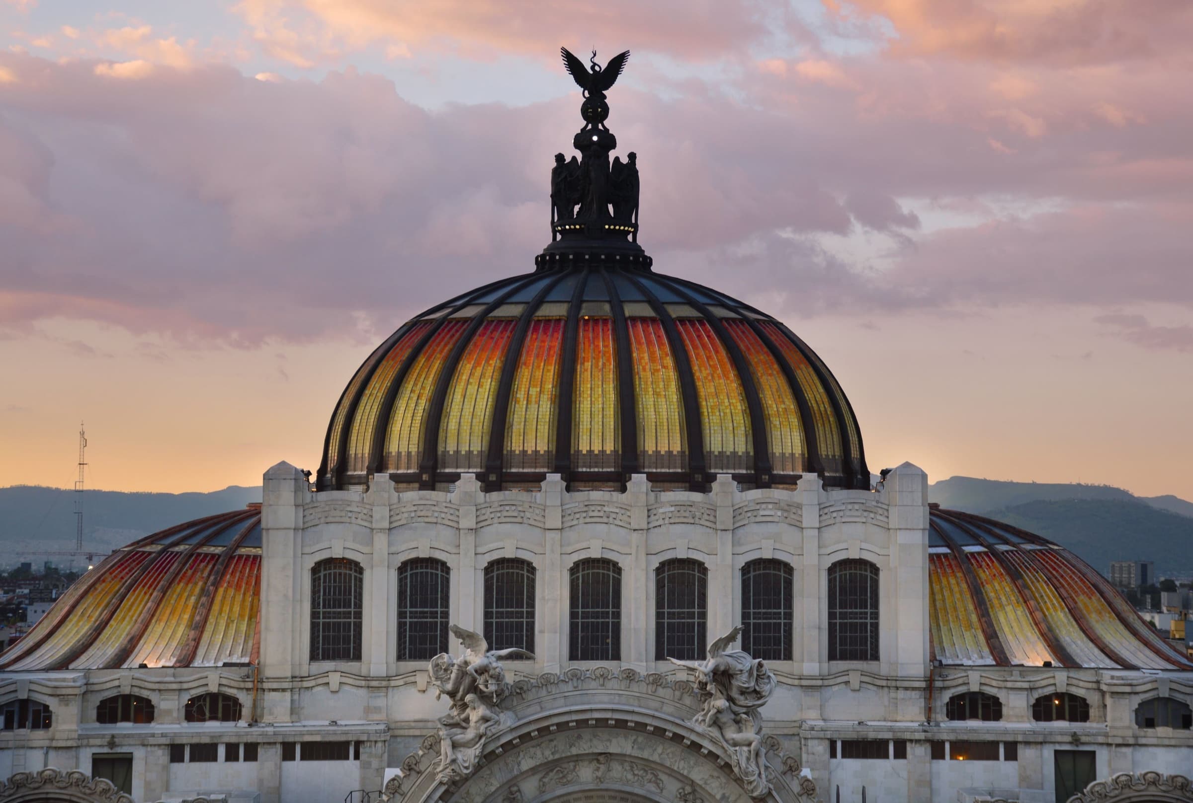
From the Zócalo to Bellas Artes: the Palacio Nacional, Calle Moneda's stone palaces, the Templo Mayor ruins, a cathedral saved by sinking it, Calle Madero and a tower that floats on the old lakebed.
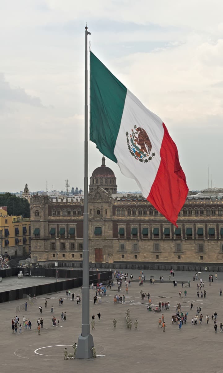
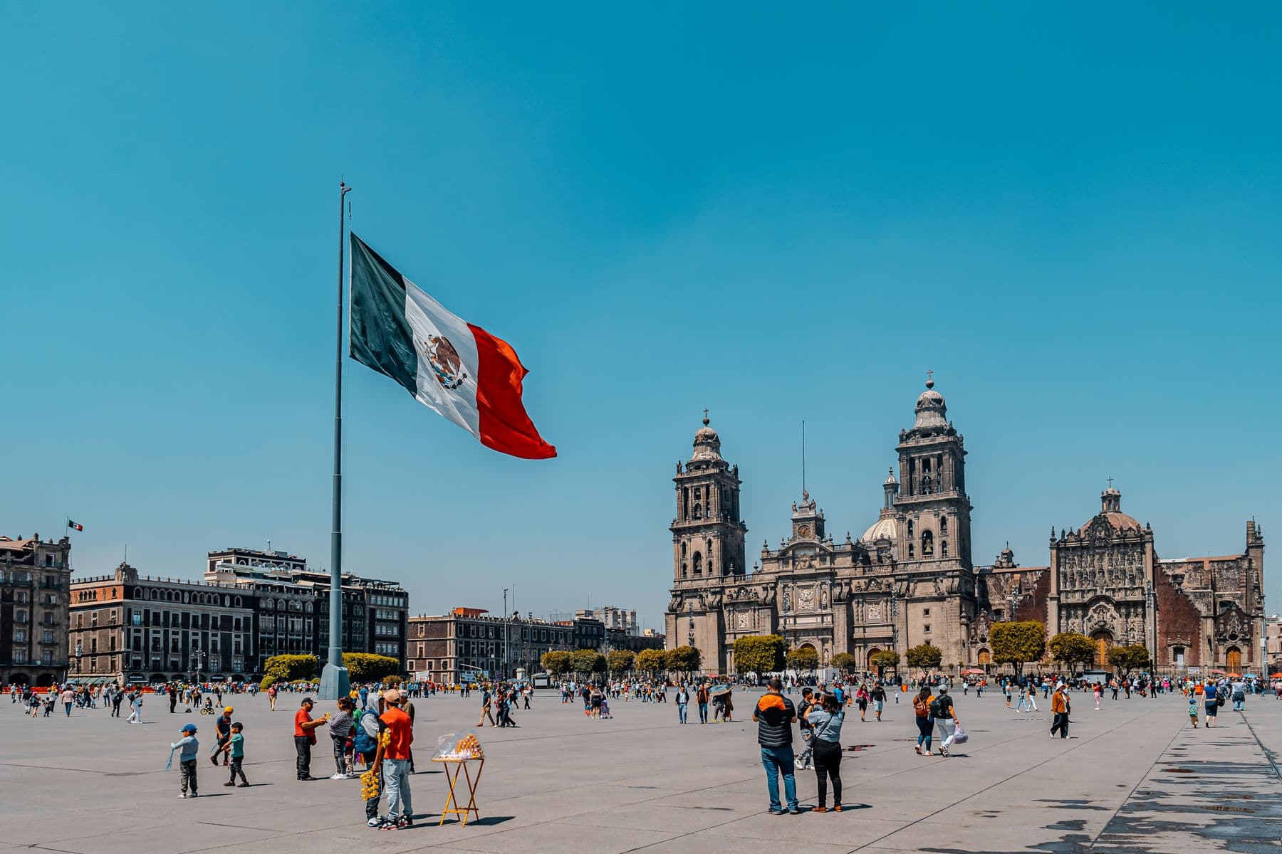
Start · Zócalo: The Square That Is Rarely Empty
DirectionsStops
- 1
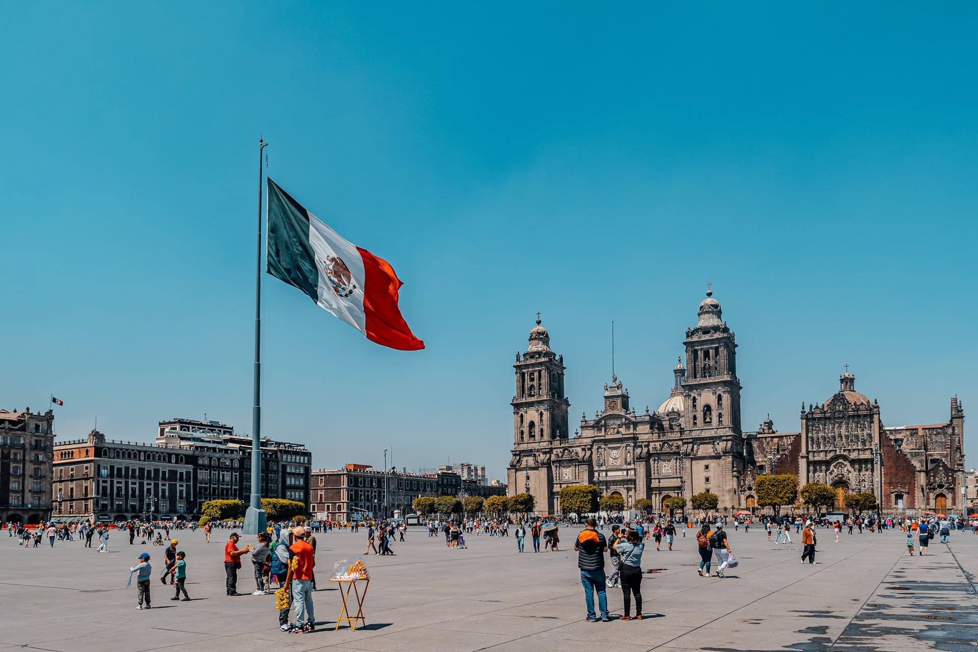
Zócalo: The Square That Is Rarely Empty
Mexico's main square sits on the heart of the Aztec island city. Its name comes from a monument nobody ever finished.
- 2
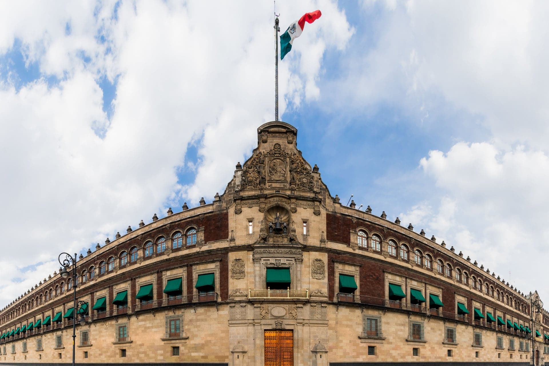
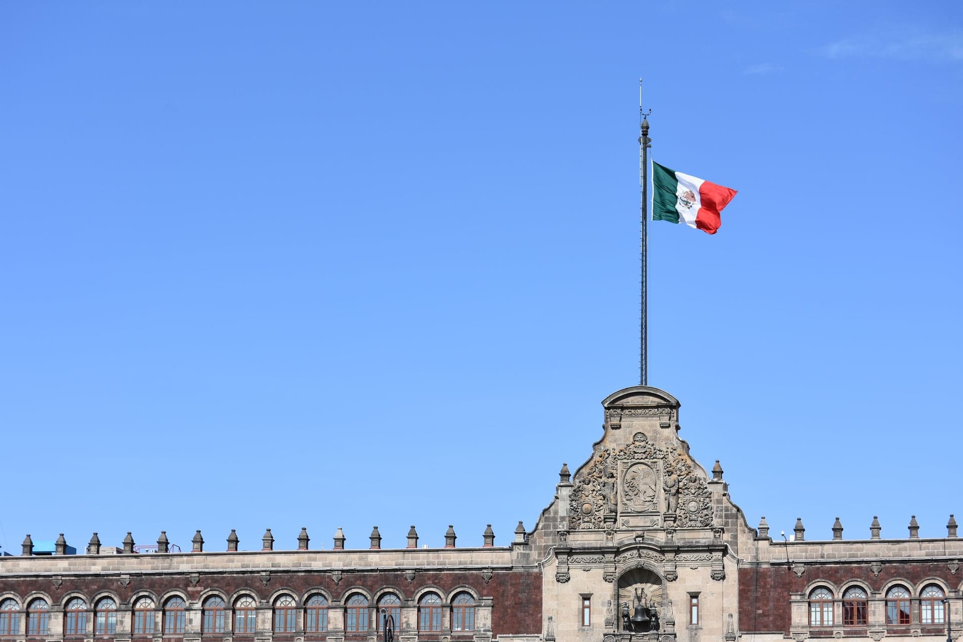
Palacio Nacional: One Address, Three Owners
The seat of Mexico's presidents stands on Moctezuma's palace. Rivera's murals are inside, and the independence bell hangs above the balcony.
- 3
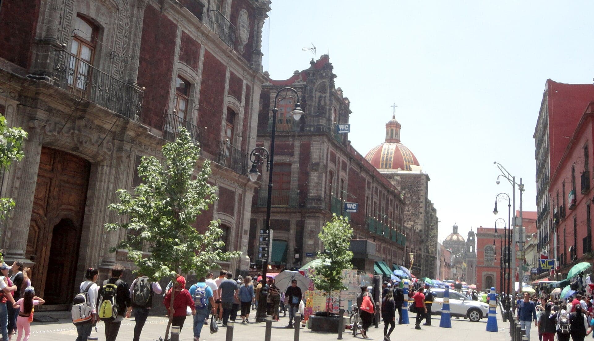
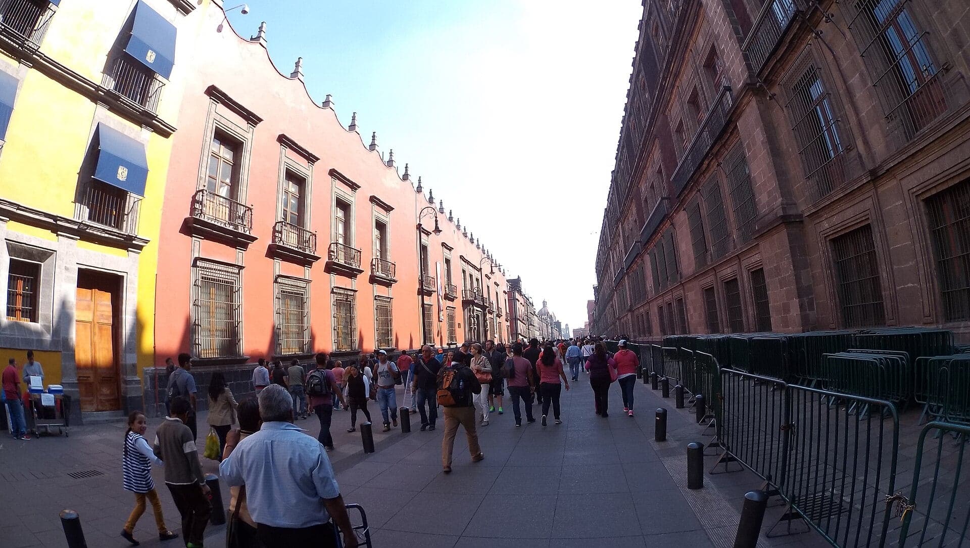
Calle Moneda: The Street of Firsts
One short street held Mexico's first university and first printing press. Here you learn to read the gray cantera and red tezontle stone.
- 4
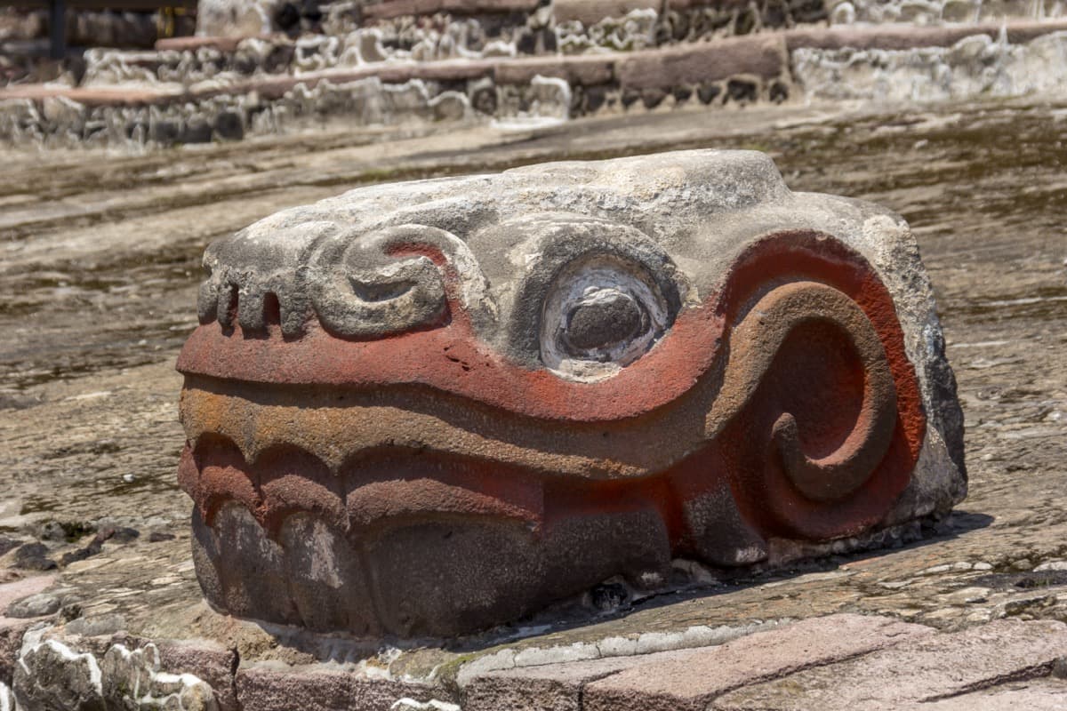
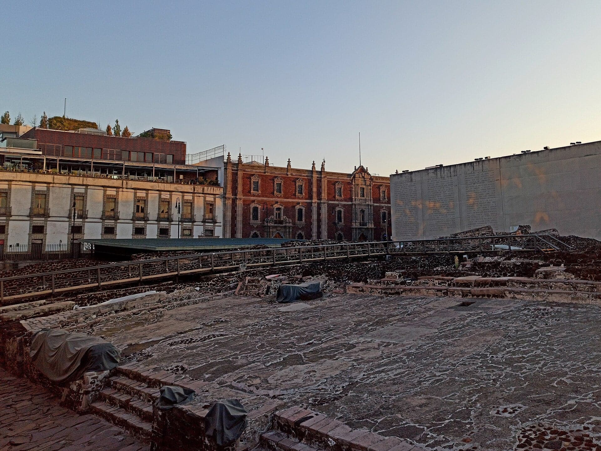
Templo Mayor: Seven Temples, One Stair
The main temple of Tenochtitlan was enlarged seven times on one plan. See into the ruins free from the railing; the site and museum are ticketed.
- 5
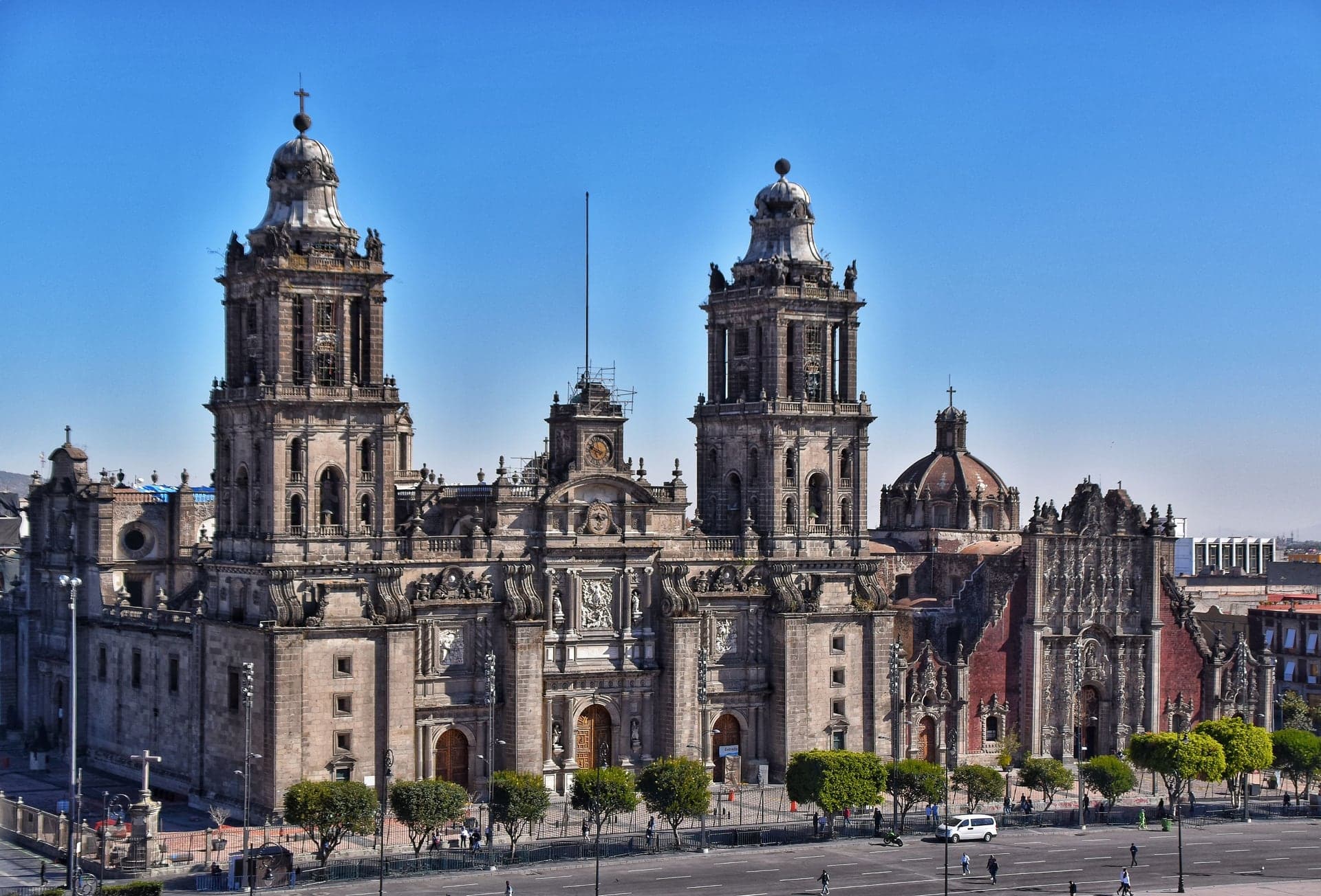
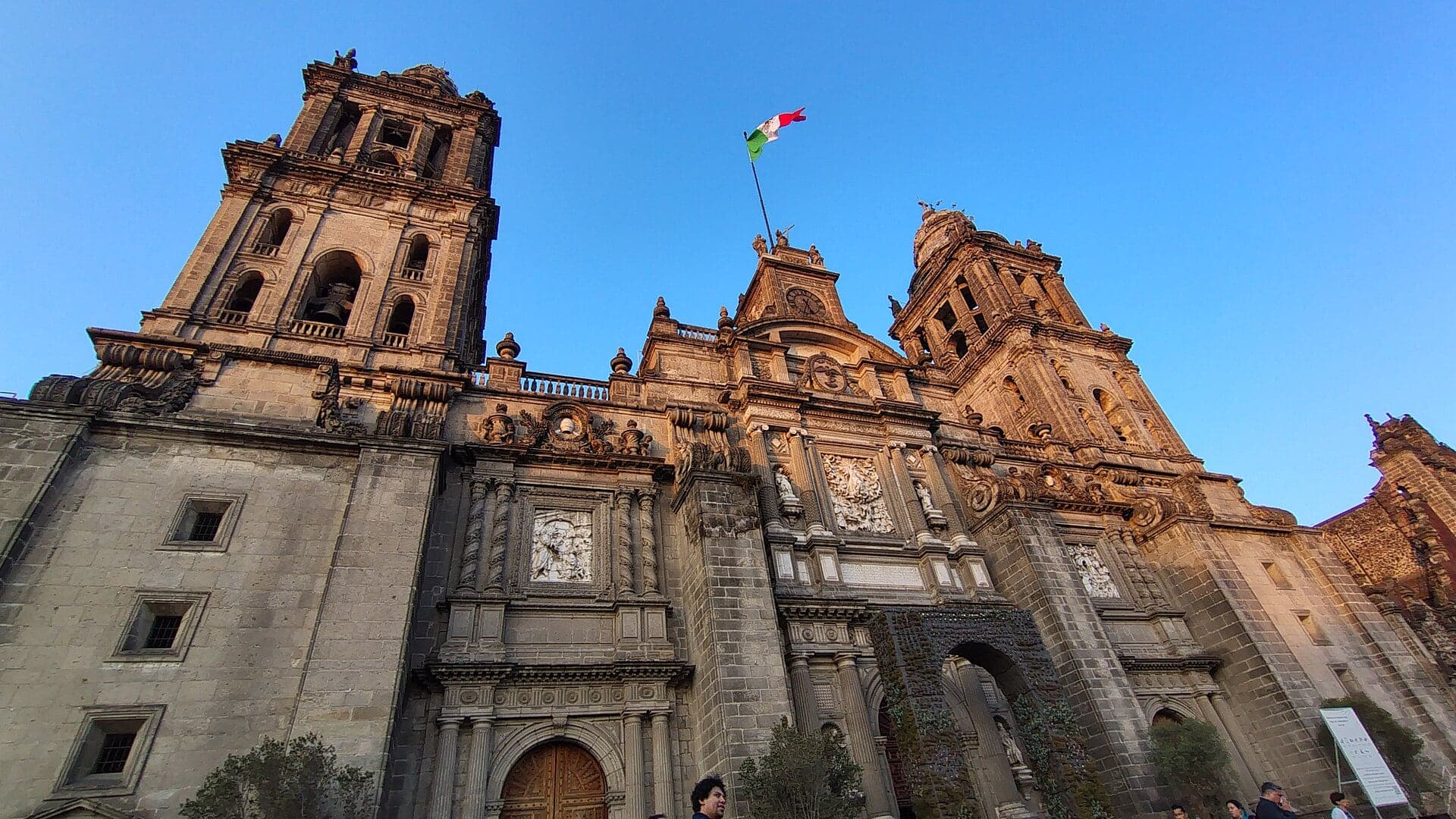
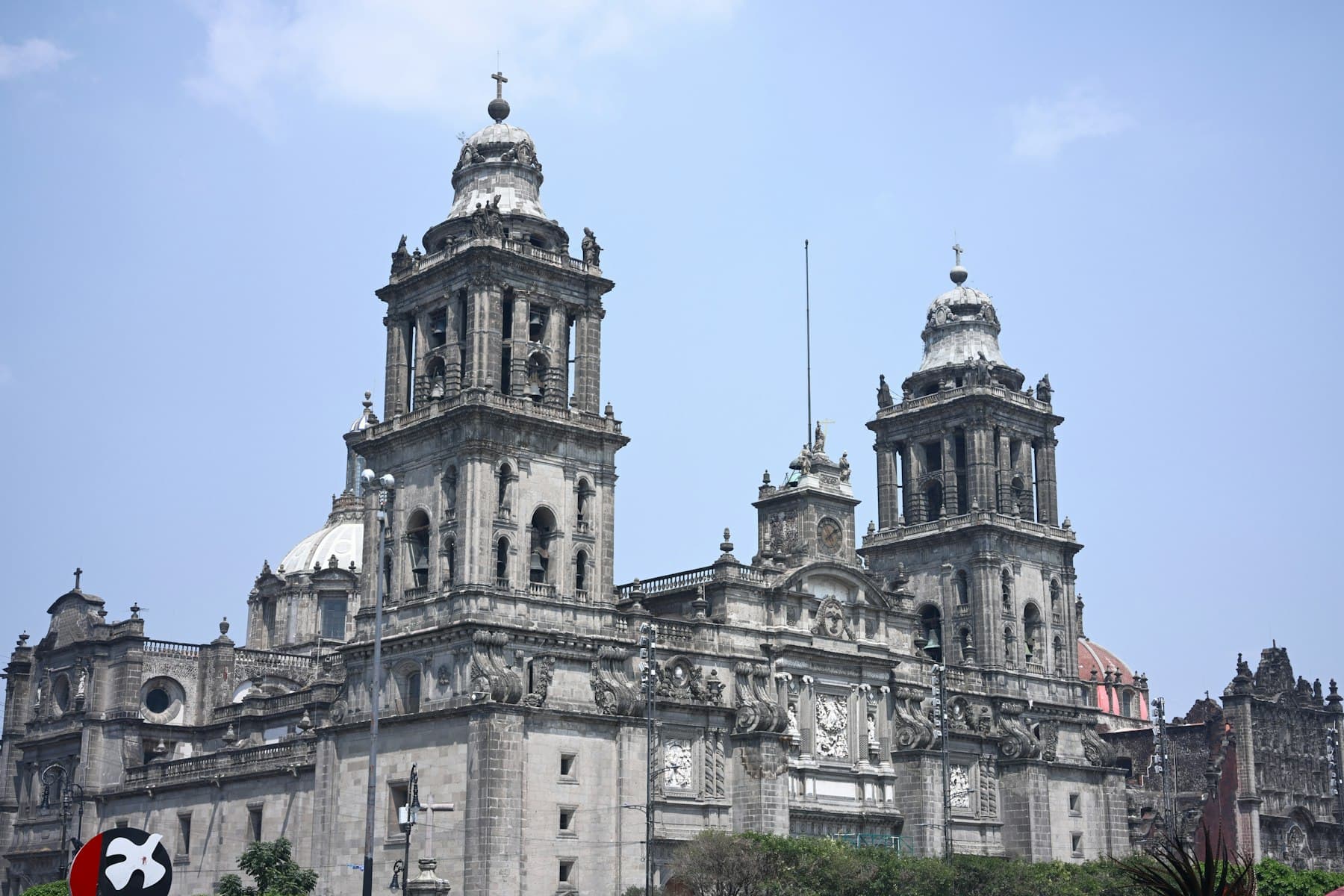
Metropolitan Cathedral: Sinking on Purpose
The soft lake clay tilted this cathedral built over Aztec temples. Engineers saved it by making its high side sink.
- 6
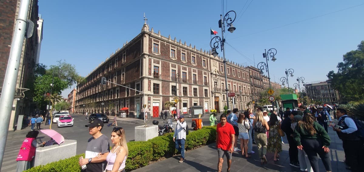
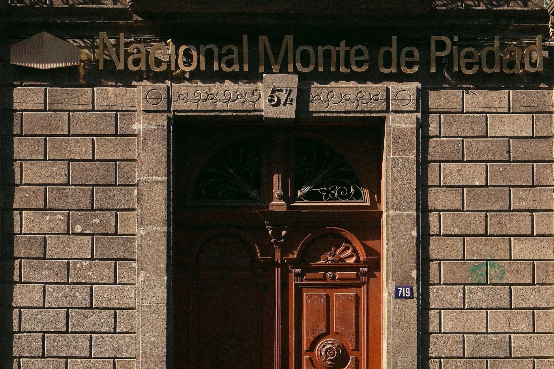
Monte de Piedad: The Block Where the Conquest Turned
The Spanish held Moctezuma on this block before fleeing in 1520. Since 1836 it has been home to a charitable lending house founded in 1775.
- 7
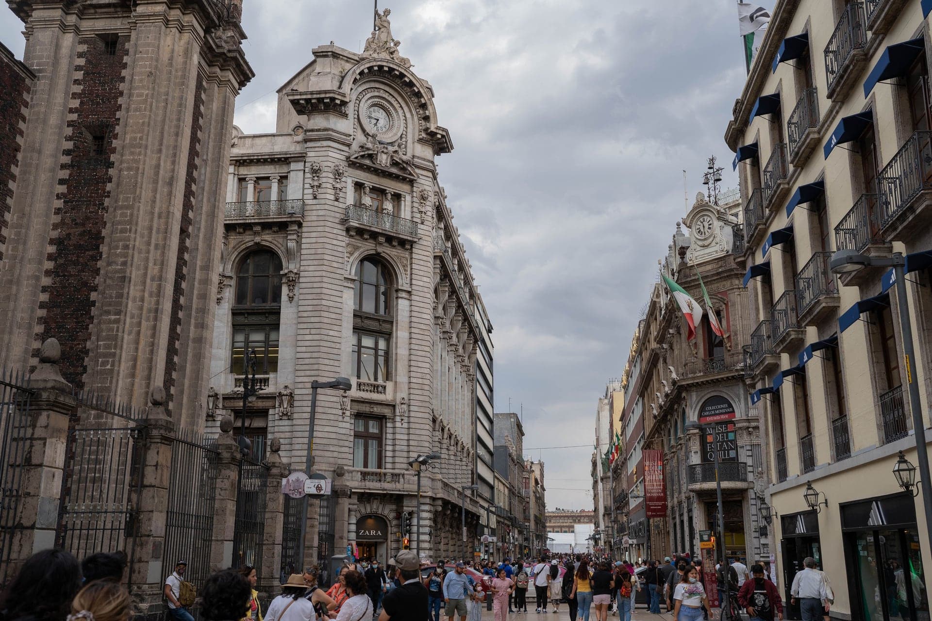
Calle Madero: Pancho Villa's Street Sign
Pancho Villa renamed the old street of the silversmiths in 1914. A bronze Villa on a ladder and a sunken church mark the corner.
- 8
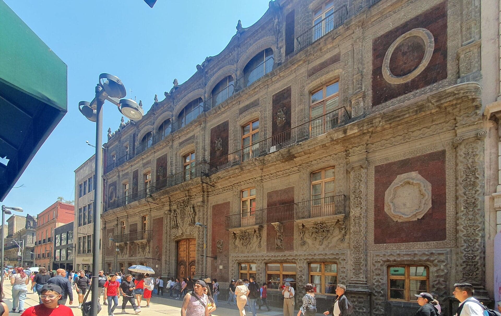
Palacio de Iturbide: An Emperor at the Door
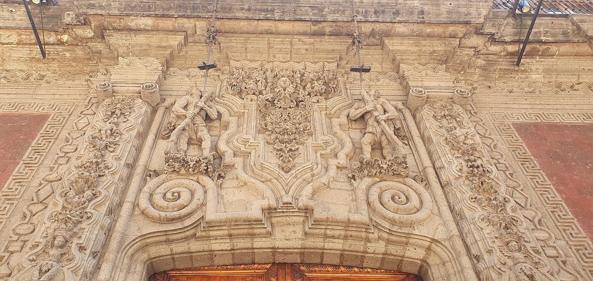
A crowd acclaimed Agustín de Iturbide emperor at this palace in 1822. Its red stone front from the 1780s is carved with flowers and mermaids.
- 9
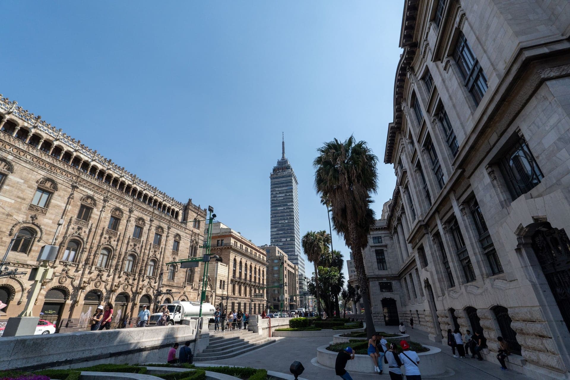
Torre Latinoamericana: The Tower That Floats
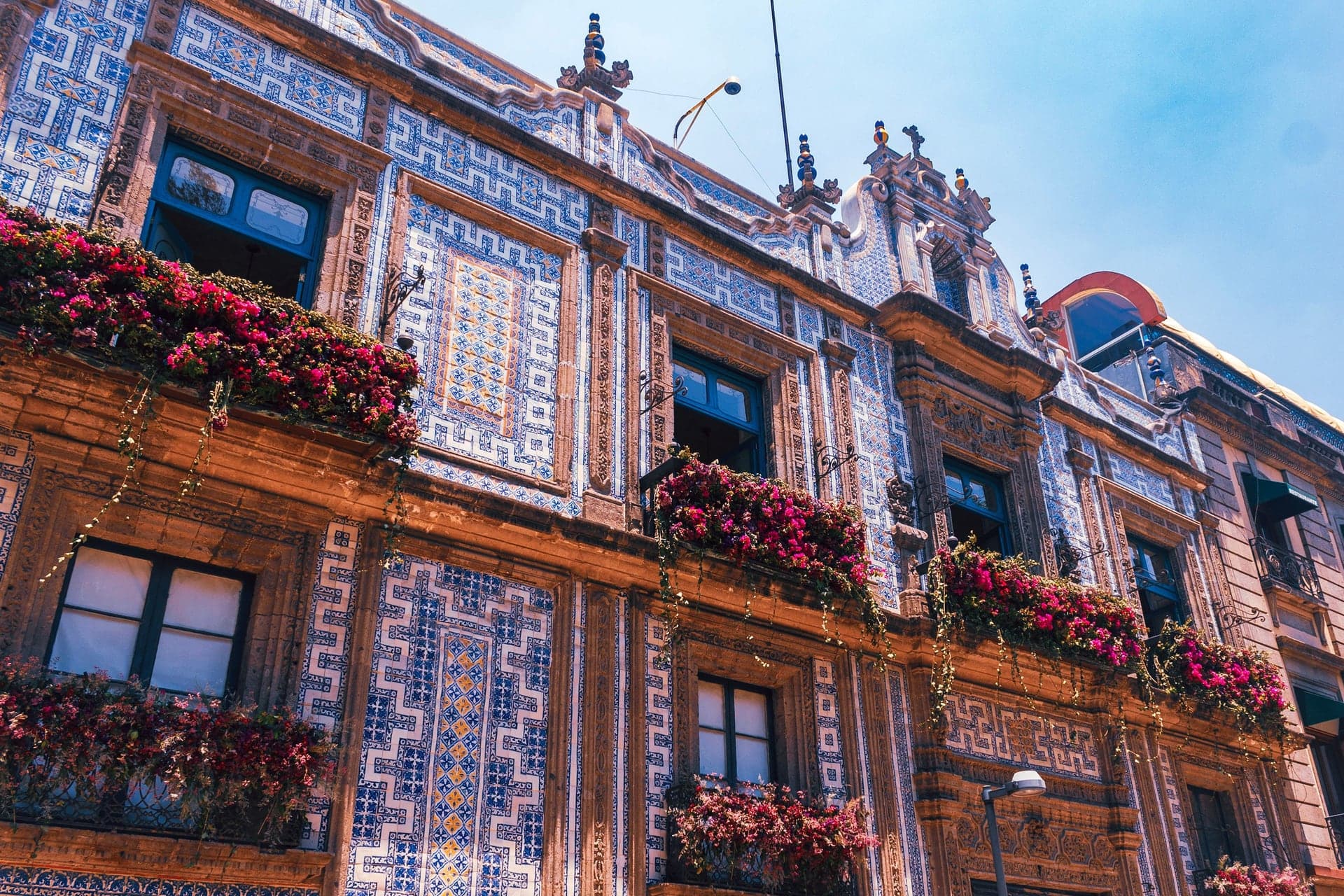
This 1956 skyscraper floats on wet clay and survived great earthquakes. Across the street stands the blue-tiled Casa de los Azulejos.
- 10
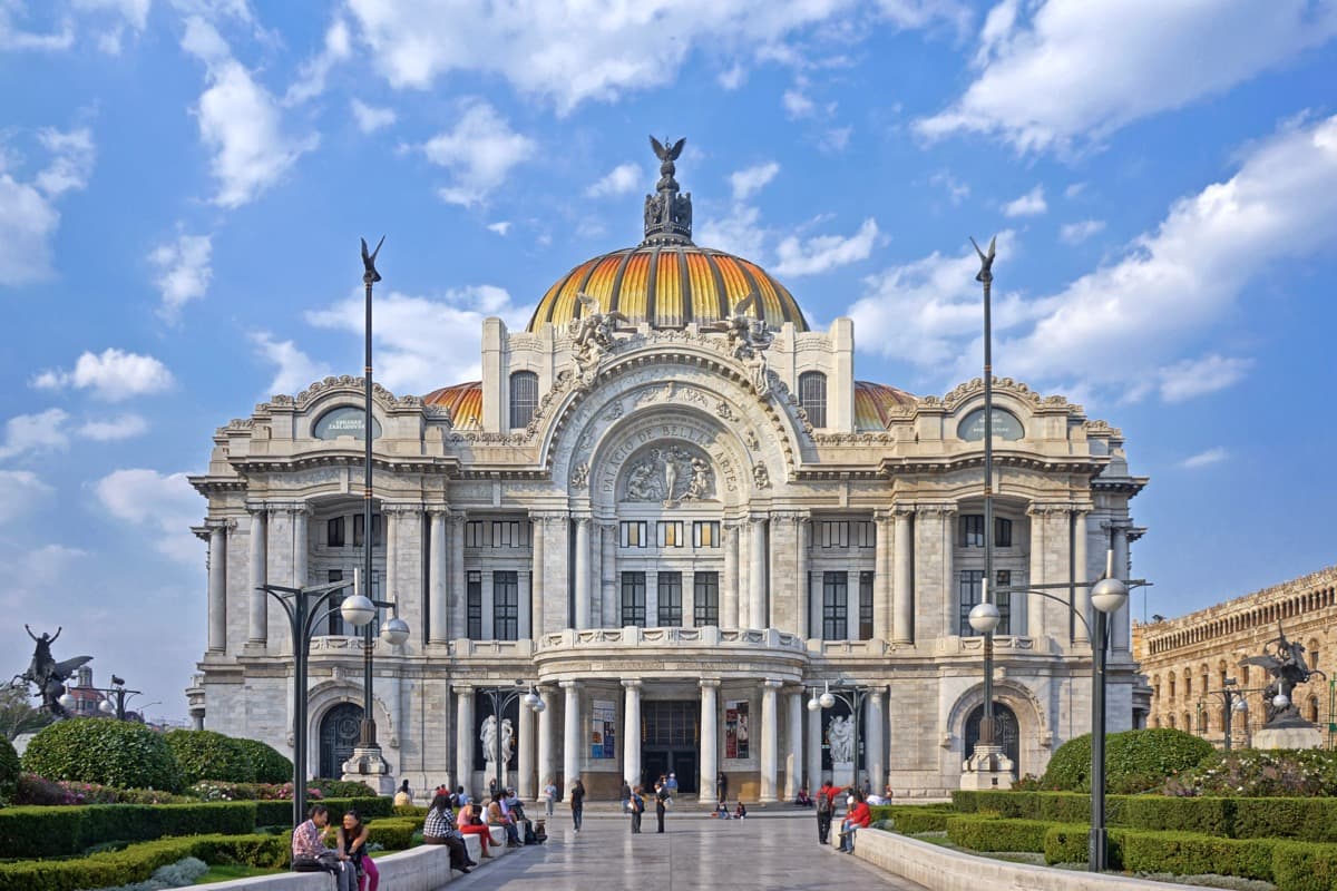
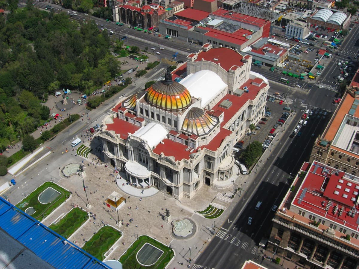
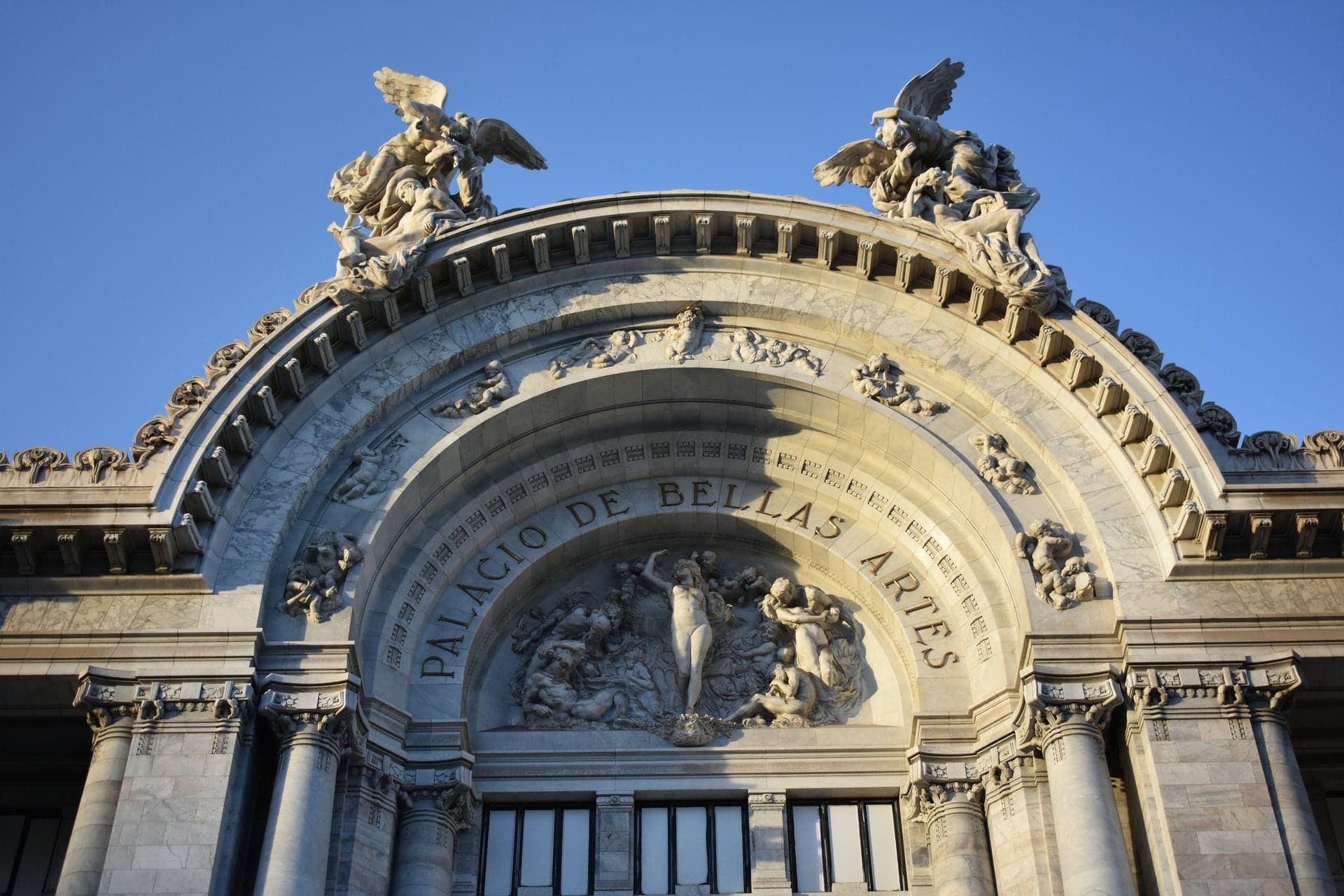
Palacio de Bellas Artes: Two Mexicos in One Building
This white marble palace took thirty years to build. It is Art Nouveau outside, Art Deco inside, with Rivera's remade Rockefeller mural upstairs.
Details
Best Time to Visit
Tuesday to Saturday, starting around 10:00. The Templo Mayor site and the Bellas Artes museum are closed on Mondays, Palacio Nacional mural registration (when visits run) opens at 10:00 at Moneda 4, and Calle Madero is far calmer on weekdays than at weekends. On Sundays some museums, Bellas Artes among them, are free for Mexicans and residents, so crowds are bigger. Walk in daylight: the streets behind the cathedral and around the Templo Mayor are quiet after dark. Checked 14 October 2026.
Pro Tips
- •Metro Zócalo/Tenochtitlan (Line 2) opens onto the square but is often closed for events and protests (it was shut on 25 September 2026, for example). Allende (Line 2) is about five minutes' walk west and Pino Suárez (Lines 1 and 2) about ten minutes south. The walk ends beside Metro Bellas Artes (Lines 2 and 8). Checked 14 October 2026.
- •Palacio Nacional's Rivera murals: free guided visits, when they run, are booked at the Museo de Arte de la SHCP, Moneda 4 (stop 3), Tuesday to Sunday from 10:00 per the 2023 official flyer. Bring ID; bags, hats and sunglasses go to the cloakroom; visits can be suspended without notice. Checked 14 October 2026.
- •Templo Mayor: one ticket covers the archaeological zone and the museum, 105 MXN for Mexicans and residents and 210 MXN for foreign visitors, Tuesday to Sunday 9:00 to 17:00, entrance at Seminario 8. Allow at least 90 minutes if you go in. Checked 14 October 2026.
- •The Museo de Arte de la SHCP at Moneda 4 (stop 3) is free, Tuesday to Sunday 10:00 to 17:00, and its floor windows show the stairs of an Aztec temple. Checked 14 October 2026.
- •Something occupies the Zócalo most weeks: the FIL book fair until 18 October 2026, then the Día de Muertos season. If the center of the square is closed, walk round its edge. Checked 14 October 2026.
- •Bellas Artes museum: 95 MXN, Tuesday to Sunday 10:00 to 18:00, box office only; the murals are on the upper floors. The Torre Latinoamericana deck is open daily until 22:00, so you can go up at dusk after the walk. Checked 14 October 2026.
Safety & Precautions
- •Keep phones and valuables secure in crowds, especially on Calle Madero and around the Zócalo.
- •Marches, rallies and police lines are common around the Zócalo and the Palacio Nacional; crowd barriers often line the palace front. Check local news on the day and be ready to walk round the square's edge.
- •Calle Madero is pedestrian, but Palma, Isabel la Católica and Bolívar meet or cross it with cars, and only Palma has lights: look before you step out. Cross Eje Central only at the lights.
- •Pavements and old floors in the historic center are uneven, and some church floors tilt, a result of the sinking ground. Watch your footing.
- •Mexico City sits at about 2,240 m: drink water, wear sun protection and take it slowly on your first day.
- •The Cathedral and La Profesa are working churches: enter quietly and do not tour during mass.
Travel advisory: Exercise Increased Caution (Level 2).
Gallery
Related Reading
Go deeper on what you'll see, hear, and walk through.
Thematic
Coatlicue: The Statue That Was Buried Twice
3 min
Thematic
Moctezuma's Headdress: The Original Is in Vienna, the Copy Is in Mexico City
4 min
Thematic
Museo Nacional de Antropología: What to See, From the Tlaloc Monolith to Pakal's Jade Mask
9 min
Thematic
The Sun Stone: What the Aztec 'Calendar' Really Is
3 min
Read the walk
The full story of Historic Center: Three Civilizations Deep, in words. Prefer to listen? Play it narrated, from home or on location.
Introduction
Mexico City, the capital of Mexico, is built on the bed of a drained lake. Around thirteen twenty-five, the Mexica, the people often called the Aztecs, settled on an island in that lake. They grew it into the city of Tenochtitlan, winning land from the water with fill and wooden piles. In fifteen twenty-one the Spanish destroyed the island city, built the capital of New Spain on its ruins, and began to drain the lake. And then modern Mexico built on top of both.
The ground under all three cities is soft clay, and it is still moving. As water is pumped from beneath it, the historic center sinks by about ten centimetres a year, and the east of the city faster.
Three names come back along the way: Moctezuma, who ruled Tenochtitlan when the Spanish arrived; Hernán Cortés, who led them; and the painter Diego Rivera, who put the whole story on the walls four centuries later.
The walk is ten stops and about one point seven kilometres, roughly a mile: about ninety minutes. The city sits at about two thousand two hundred and forty metres, so take it slowly if this is your first day. And look up between stops: the route crosses gray and red colonial stone, white marble from the early nineteen hundreds and the glass and steel of the nineteen fifties.
Begin stop one in the Zócalo, as near its middle as today's crowds allow.
1. Zócalo: The Square That Is Rarely Empty
Welcome to the Zócalo, the main square of Mexico City, and to the first stop on this walk. Walk on into the square, toward the giant flag at its center if you can see it, and stop wherever you have open ground and a view of the buildings around the edge.
Look around before anything else, because what you see depends on the day. A stage, a book fair, rows of tents, a protest camp: on most days something fills part of this square. If something is in your way right now, that is the square doing its job. Whatever is set up here today is the latest in a very long run.
Now find the landmarks around the edge. The long red and gray palace filling one whole side is the Palacio Nacional, where Mexico's president works. The great cathedral fills another side. Now look to the corner where those two nearly meet. Just beyond it, behind the buildings you can see there, stood the main temple of Tenochtitlan. Its ruins are a few minutes' walk away. Whatever fills the square today, the palace and the cathedral are your compass.
The official name is Plaza de la Constitución, after the Spanish liberal constitution of eighteen twelve. In the eighteen forties the government held a competition for a tall independence column to stand in the middle of this square. A design was chosen, the base was laid, and the column was never built. People called the lonely stub el zócalo, the plinth. The name stuck, and across Mexico today, a town's main square is its zócalo. A whole country's word for its main square comes from a monument nobody finished.
Under the paving lies the old lakebed, soft clay, and every building around you stands on it.
Follow the route across the square to the long palace. If the middle is fenced off, walk round the edge instead.
2. Palacio Nacional: One Address, Three Owners
Walk on to the long front of the Palacio Nacional and stop there, facing it. Crowd barriers often line this side.
First, what is inside. Up the palace's main staircase and along its corridors, Diego Rivera painted the history of Mexico. He began in nineteen twenty-nine and was still adding panels in nineteen fifty-one. Free guided visits run when the palace allows them, and they can be stopped without notice. Registration has been at Moneda four, the building at the next stop, and you need photo identification. The details are on this stop's card. None of it shows from out here, so read the front instead.
This is one address with three owners. The New Houses of Moctezuma, the palace of the ruler of Tenochtitlan, stood here. In fifteen twenty-two Hernán Cortés began his second house here, built on top of part of that palace. His heirs sold it to the Spanish Crown, and for about three hundred years the viceroys of New Spain lived and ruled here. After independence it housed the government of the new country. Today the president works here again.
Now find the central balcony above the middle door. In the niche above it hangs a bell. The priest Miguel Hidalgo rang it in eighteen ten, in the town of Dolores, calling for independence. In eighteen ninety-six it was brought here. Every year, on the night of the fifteenth of September, the president steps onto that balcony, rings it, and leads the cry of independence for the crowd in the square.
Look at the walls too: dark red, with gray stone framing the doors and windows. Remember that pairing. At the next stop it gets a name.
Five centuries of power on one patch of ground. Is that continuity, or each new ruler taking the last one's address?
Follow the route along the palace front to the corner, and the narrow street beside it.
3. Calle Moneda: The Street of Firsts
Walk on to the corner where a narrow street runs off beside the palace, and stop there. Turn to look down it, with the palace's side wall along one side and a row of old stone mansions along the other. This is Calle Moneda, and few streets hold so many firsts in so few steps. Its archbishop's palace, a few doors along, is a free museum.
That palace, Moneda four on the mansion side, was built in seventeen twenty. It belongs to Mexico's finance ministry, opens Tuesday to Sunday, and has been the desk where you register for the palace murals. Inside, archaeological windows look down onto the stairs of an Aztec temple to the god Tezcatlipoca. The details are on this stop's card.
On this corner, in fifteen fifty-one, the Royal and Pontifical University of Mexico was founded, one of the first two universities in the Americas. Where the first block ends at a narrow alley, the first printing press in the Americas was at work by fifteen thirty-nine. And from fifteen sixty-nine the Royal Mint worked on this street, until eighteen fifty, which is how it got its name. On the palace corner, old tile street signs still give its first name: Calle del Arzobispado, the archbishop's street.
The colonial city put all of this on the sacred ground of the Aztec city. Was that convenience, or a message?
Now read the walls, because this is the code for the rest of the walk. Where an old front shows gray or pale stone, usually carved around the doors and windows, that is cantera. Where it shows a dark red, porous stone, that is tezontle, a volcanic rock, the same stone the Aztecs built with. You will meet this pairing on palace after palace from here on.
Follow the route across the little plaza ahead, to the railing above the ruins of the great temple.
4. Templo Mayor: Seven Temples, One Stair
Walk on to the railing at the edge of the little plaza and stop there. Then turn right, toward the low metal models of the old city and the sunken ruins beyond them. From this railing you can look into the excavation for free. The archaeological site and its museum are one…
Full narration for this stop unlocks with the tour.
5. Metropolitan Cathedral: Sinking on Purpose
Walk on along the railing beside the cathedral's long side wall, and stop about halfway along it. The cathedral is free to enter, and it is a working church, so step in quietly and expect a service. If mass is on, stay at the back or come back later. UNESCO calls this the…
Full narration for this stop unlocks with the tour.
6. Monte de Piedad: The Block Where the Conquest Turned
Walk on across the street to the corner of the big stone building ahead, the Nacional Monte de Piedad, and stop there. Its main front, to your right, faces the cathedral. The Monte de Piedad is a charitable lending house, founded in seventeen seventy-five by a wealthy count to…
Full narration for this stop unlocks with the tour.
7. Calle Madero: Pancho Villa's Street Sign
Walk on along Calle Madero to the corner where a street with traffic crosses it, and stop there. Madero is a pedestrian street, but cars still cut across it at this corner and again at Bolívar, two streets on, so look before you step out. Look around the corners for a bronze…
Full narration for this stop unlocks with the tour.
8. Palacio de Iturbide: An Emperor at the Door
Walk on along Madero, and stop when you reach the tall palace of dark red stone on the other side of the street. Turn to face it. This is the Palacio de Iturbide, now the Palacio de Cultura Banamex. It is free, and open every day when an exhibition is on. The details are on this…
Full narration for this stop unlocks with the tour.
9. Torre Latinoamericana: The Tower That Floats
Walk on to the foot of the tall tower of glass and steel at the end of Madero, and stop there. Its viewing deck, up on the forty-fourth floor, is ticketed and open every day into the evening. The details are on this stop's card. The Torre Latinoamericana opened on the thirtieth…
Full narration for this stop unlocks with the tour.
10. Palacio de Bellas Artes: Two Mexicos in One Building
Walk on to the open paving beside the white marble Palacio de Bellas Artes, and stop there, facing it. Its museum is open Tuesday to Sunday and closed on Mondays. It costs ninety-five pesos, and it is free on Sundays for Mexicans and residents. The details are on this stop's…
Full narration for this stop unlocks with the tour.