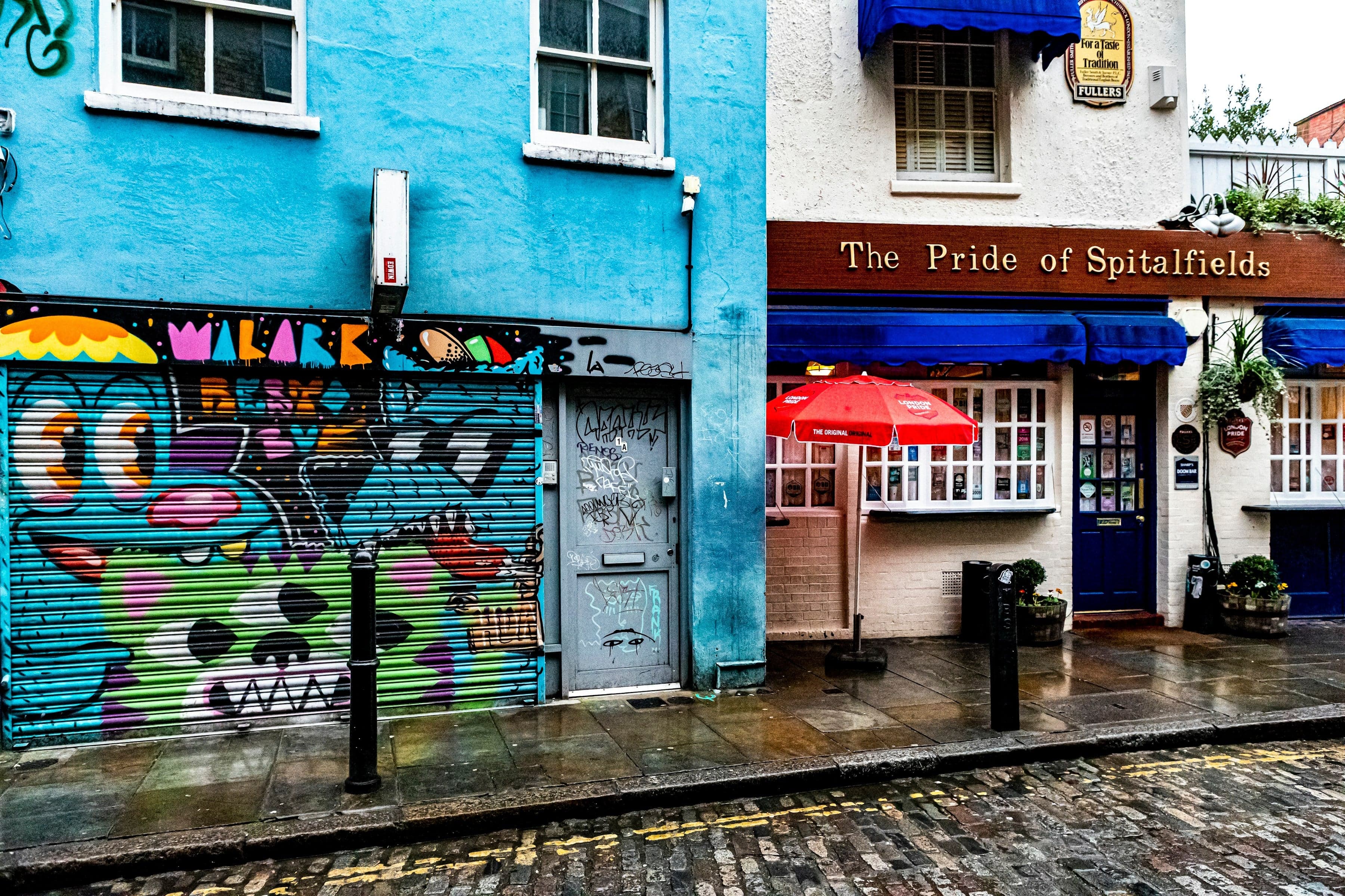
From Liverpool Street through Spitalfields' Huguenot lanes to Hawksmoor's Christ Church, the weavers' houses of Fournier Street, Brick Lane's chapel turned mosque, and Whitechapel's gallery, park and bell foundry.
Start · Liverpool Street: The Edge of the City
DirectionsStops
- 1
Liverpool Street: The Edge of the City
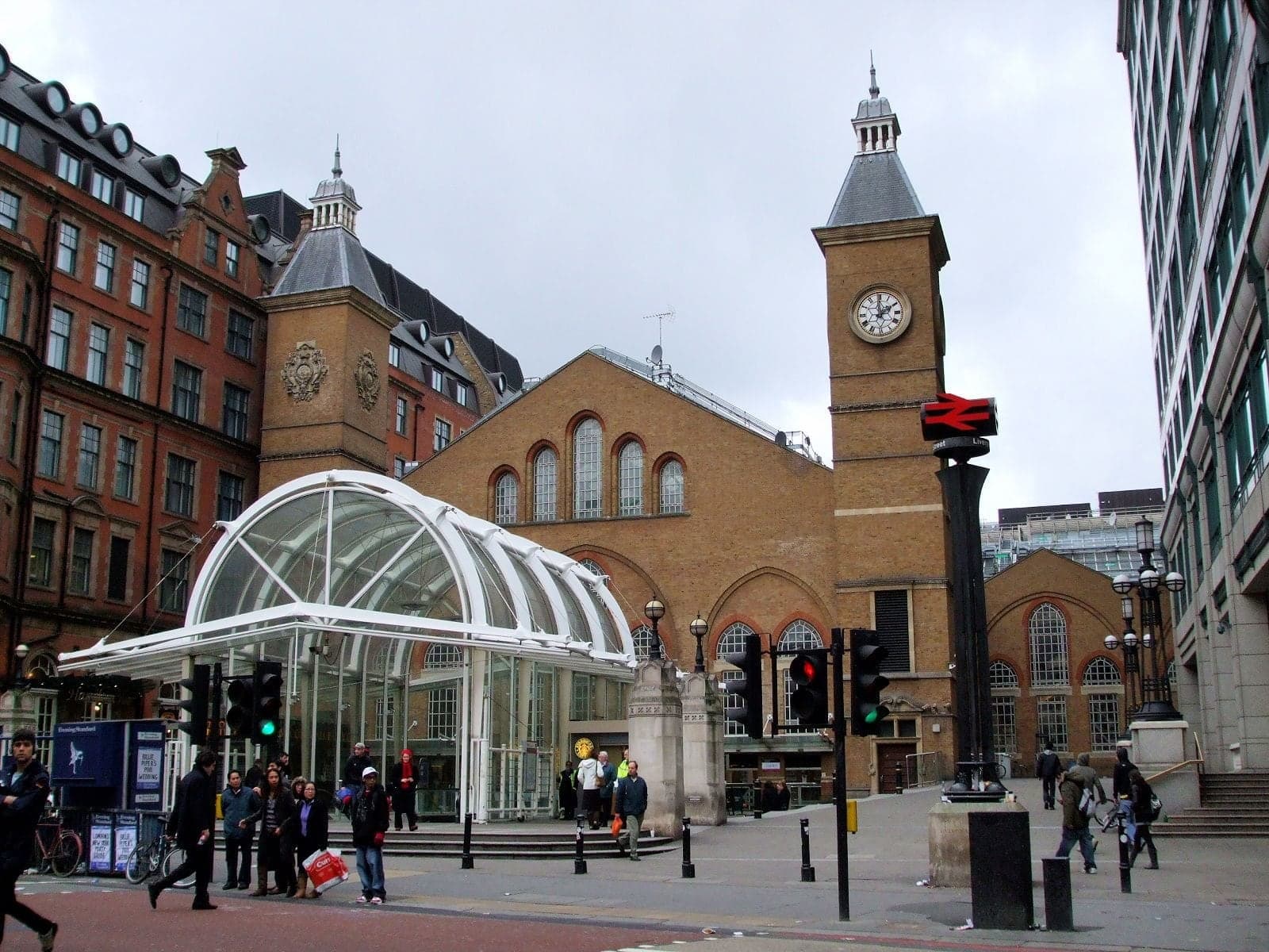
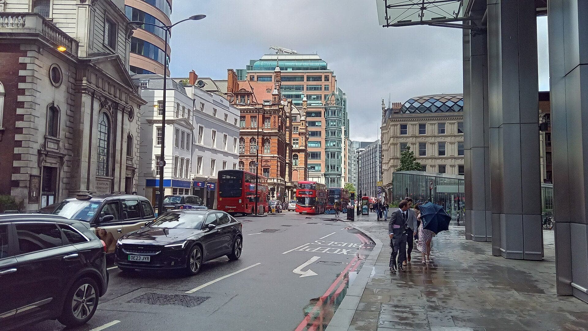
Just outside the old City gate. Bishopsgate follows a Roman road, and beside the station lay Bedlam, a burial ground used from 1569 to 1739.
- 2
Artillery Passage: A Lane of Silk Merchants
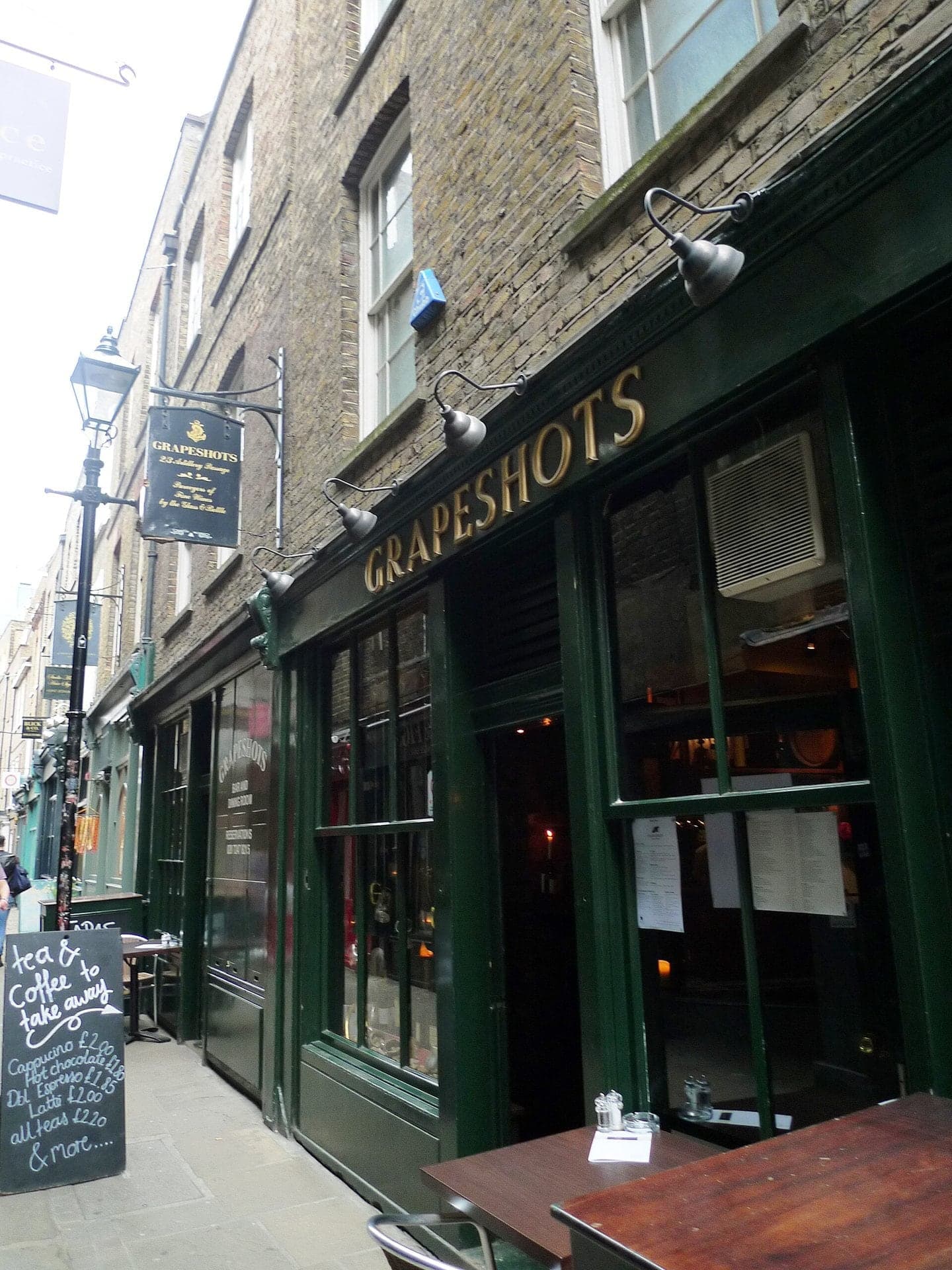
A narrow lane once Smock Alley. Archers and gunners drilled beyond it from the 1530s, and Huguenot silk merchants traded round the corner.
- 3
Brushfield Street: The Hospital's Fields
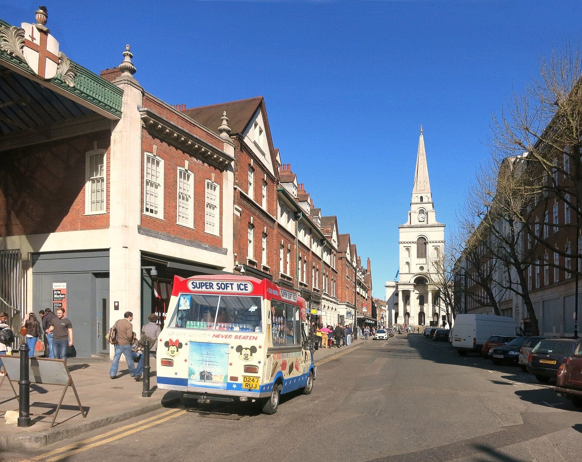
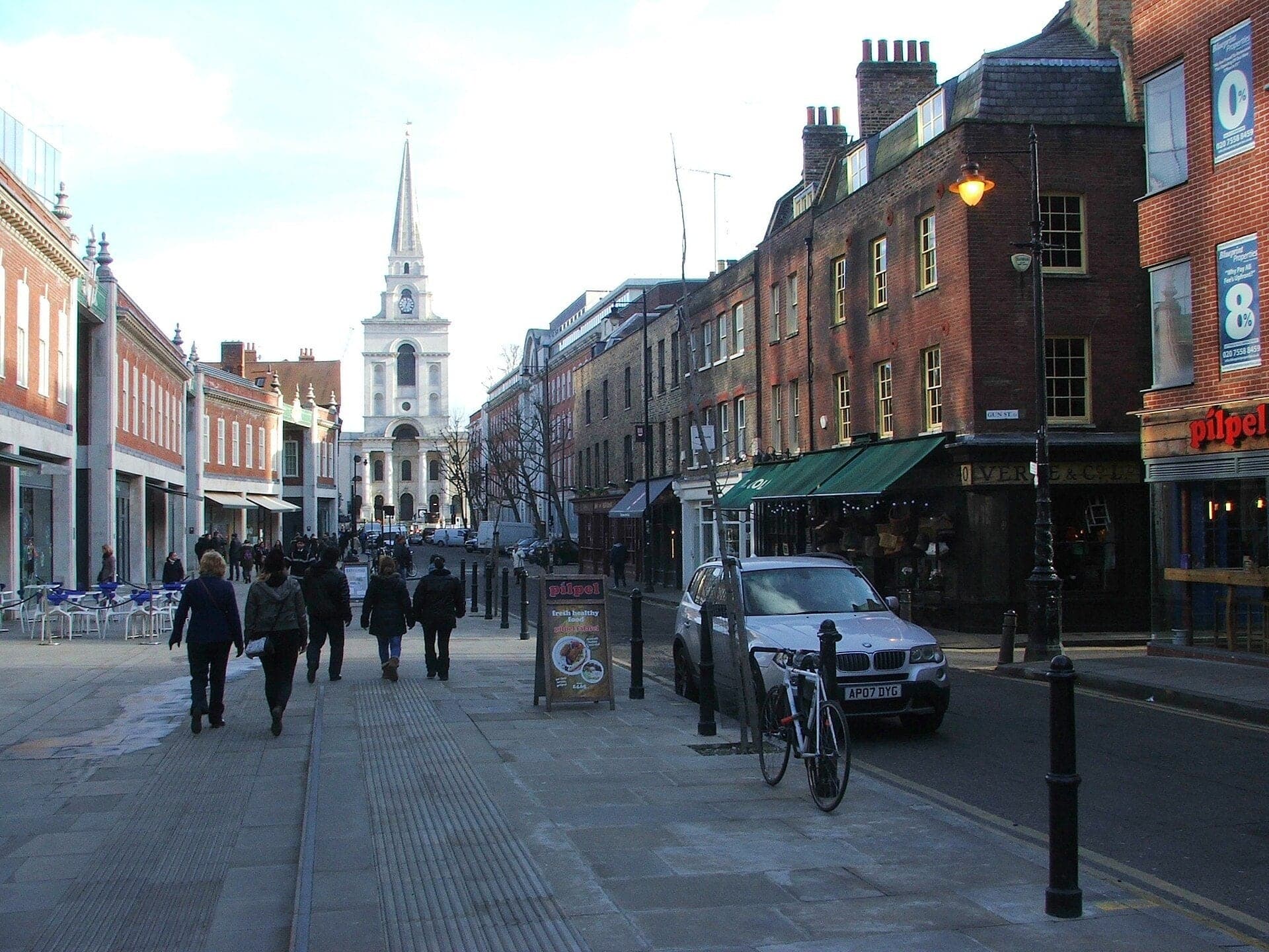
A market on a hospital's fields. Spitalfields is named after the priory of Saint Mary Spital, and the market grew on its fields.
- 4
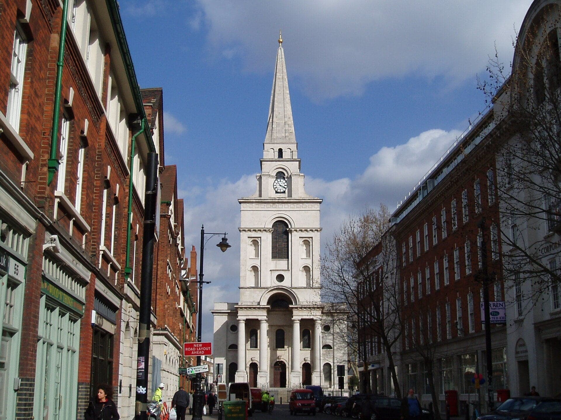
Christ Church Spitalfields: Stone in a Street of Brick
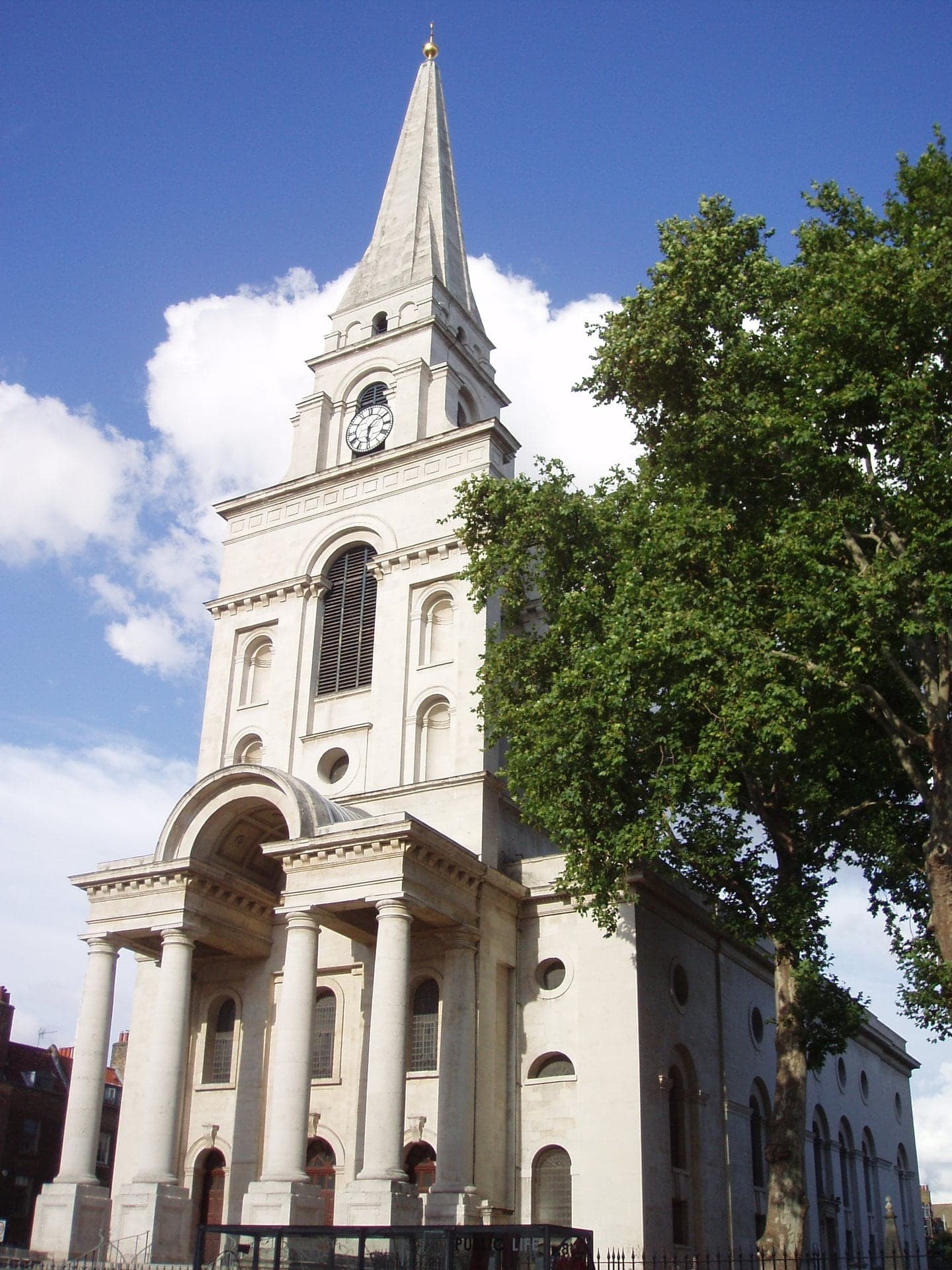
Hawksmoor's white stone church of 1729. Built under the 1711 act for fifty new churches, it was consecrated in 1729.
- 5
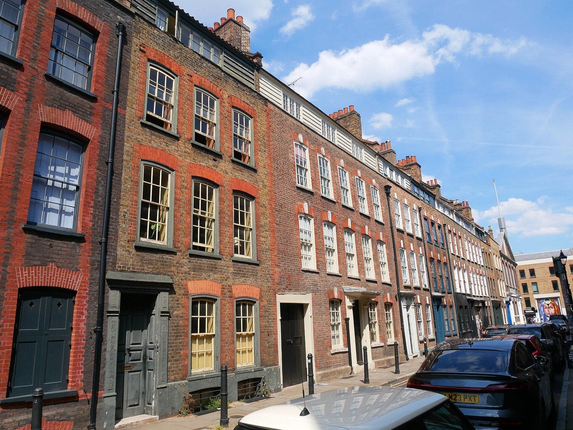
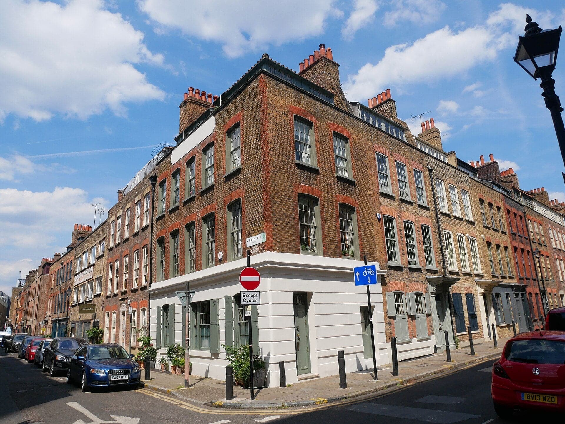
Fournier Street: The Weavers' Windows
Weavers' houses with wide garret windows. Looms stood in these top storeys, and the street was protected as a conservation area in 1969.
- 6
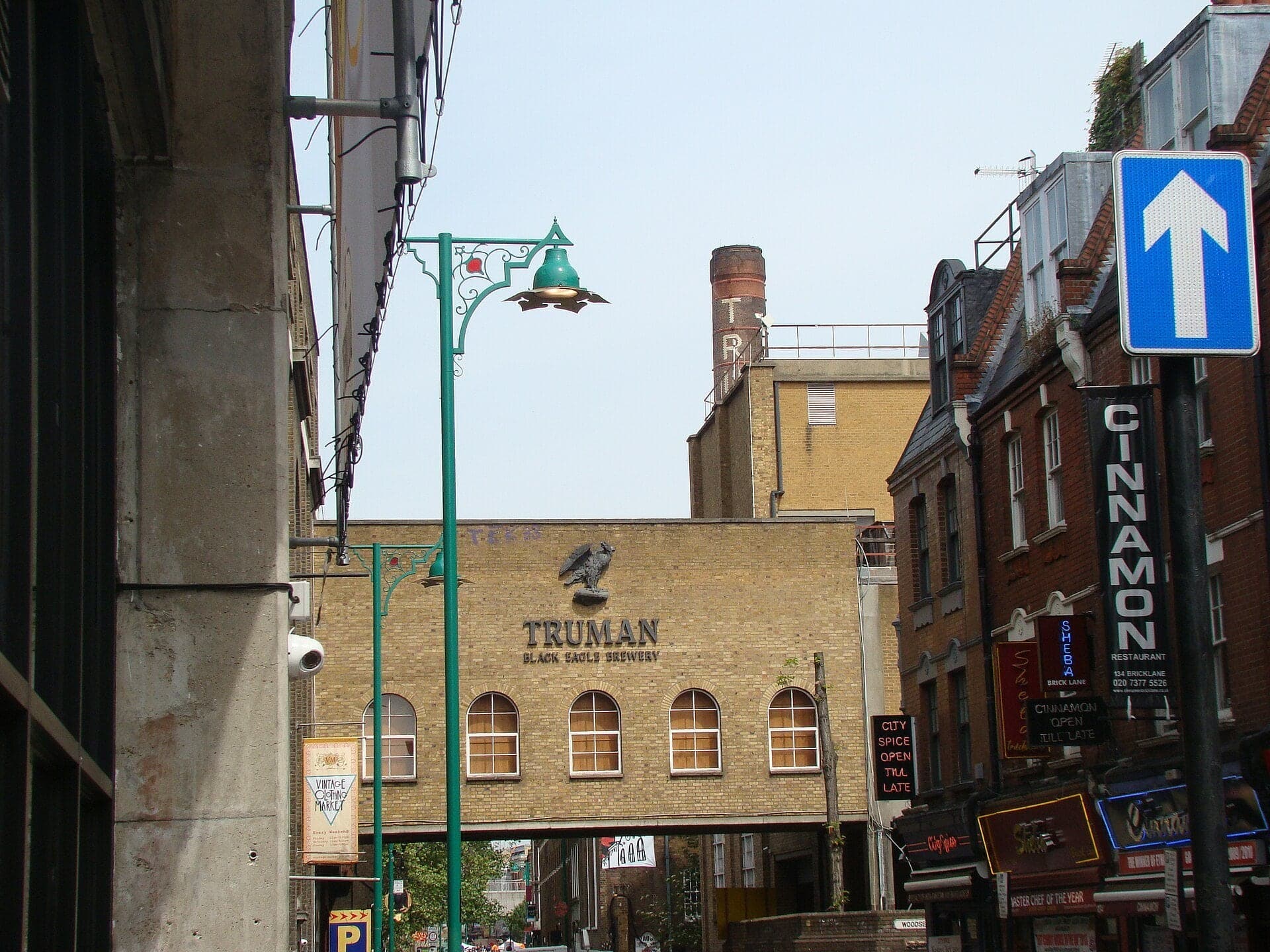
Hanbury Street: The House That Is Gone
A street with a house missing. No. 29, where Annie Chapman was found in 1888, went with the north side around 1970.
- 7
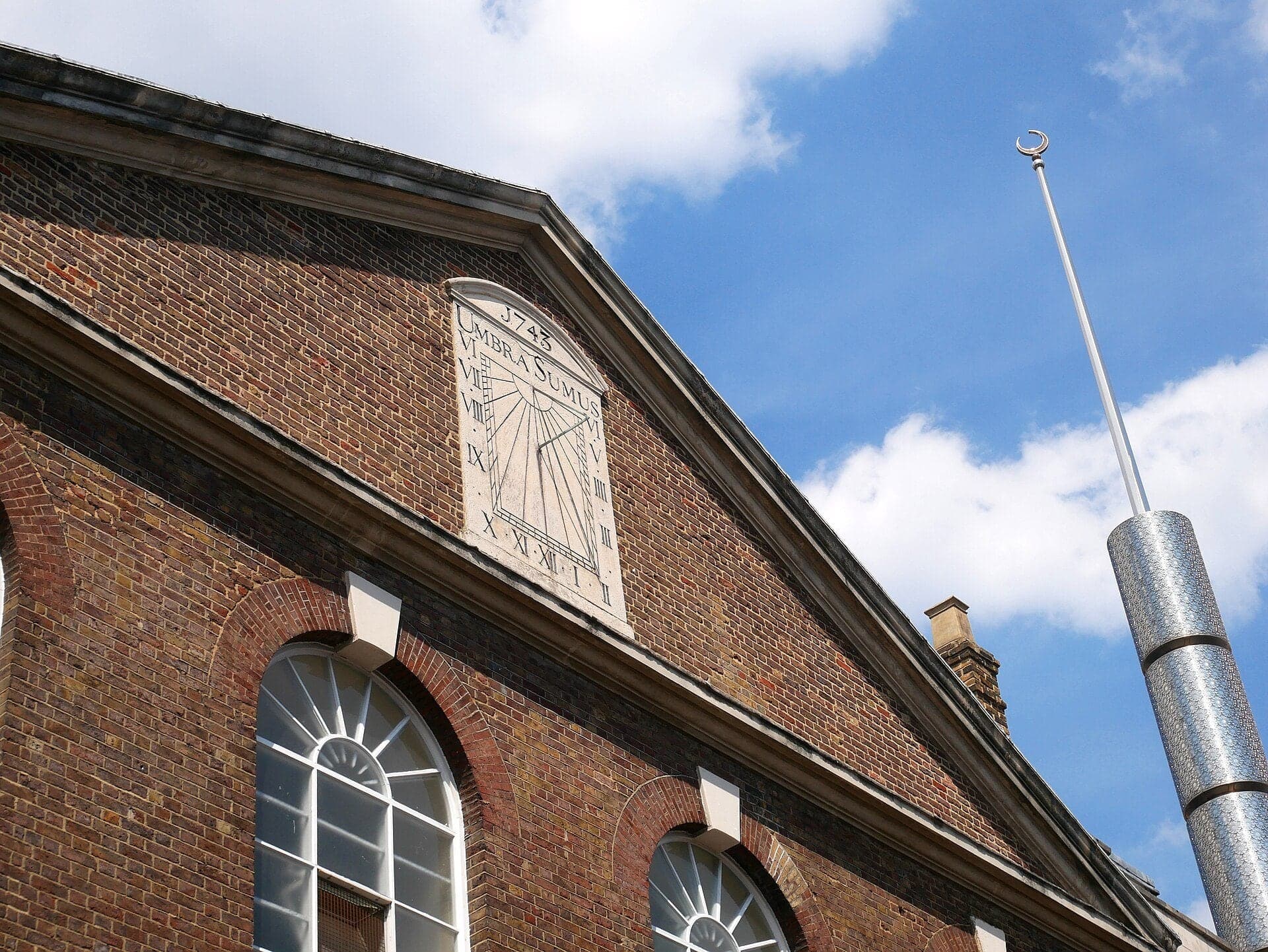
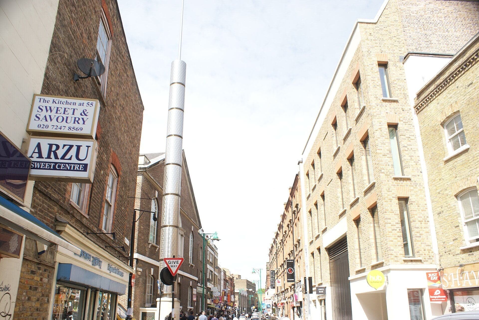
Brick Lane: One Building, Three Faiths
One building for three faiths. Its sundial on the Fournier Street side reads 'we are but shadow'.
- 8
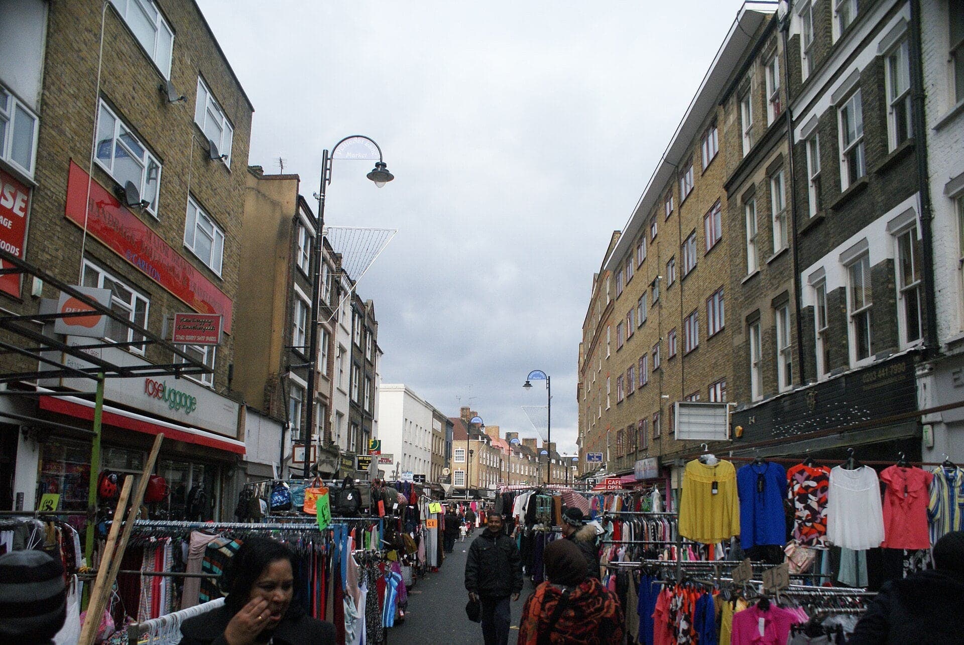
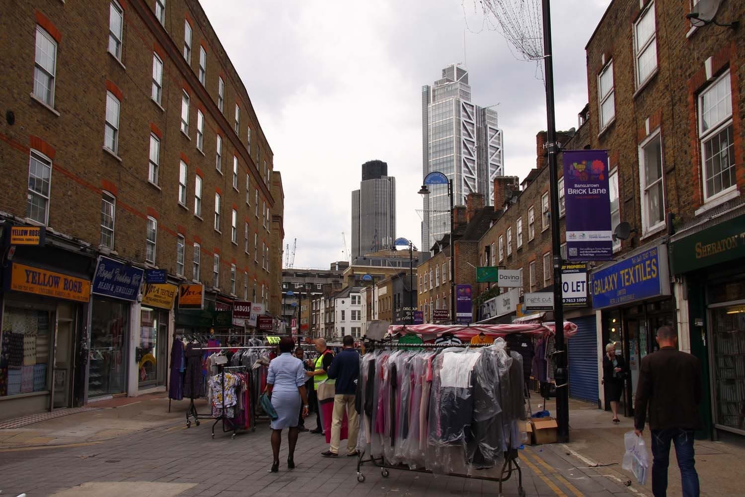
Wentworth Street: Five Women, Remembered by Name
The old lodging house district. In 1888 five women murdered in the East End and the City all had beds within a few minutes of here.
- 9
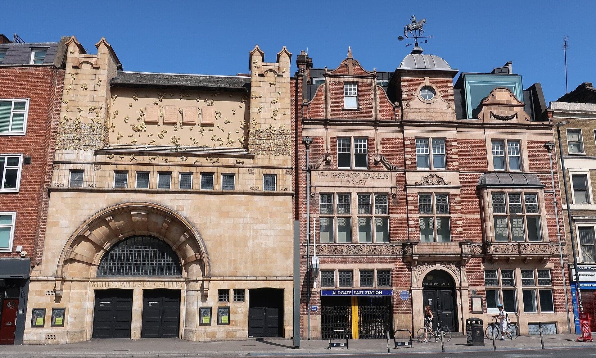
Whitechapel Gallery: Art for the East End
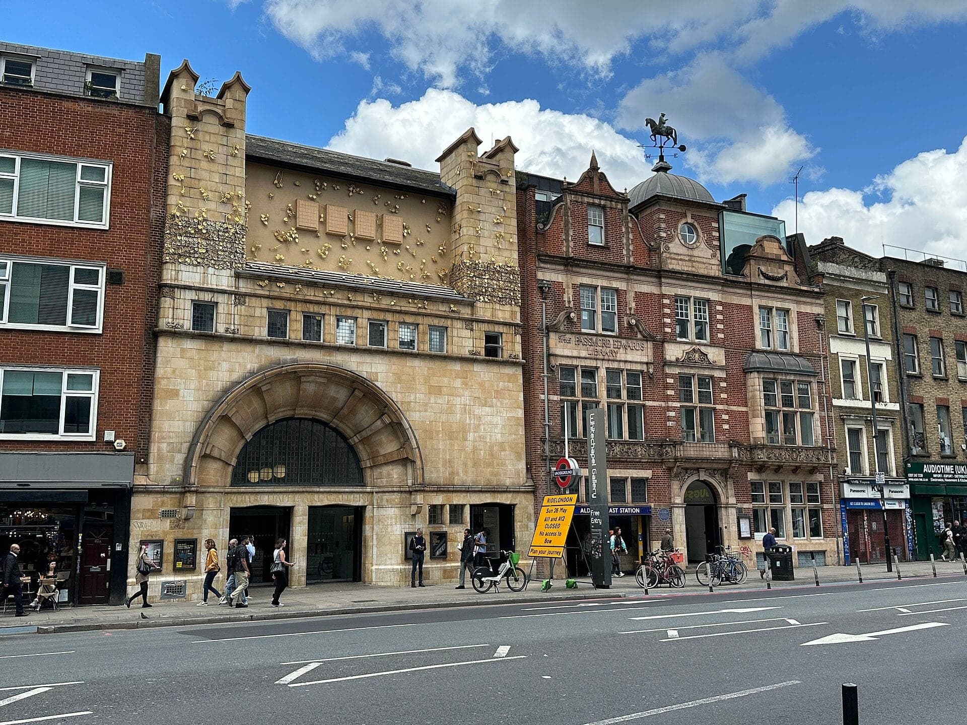
A terracotta front for art. It was founded to bring the finest art to the East End, and showed Picasso's Guernica in 1939.
- 10
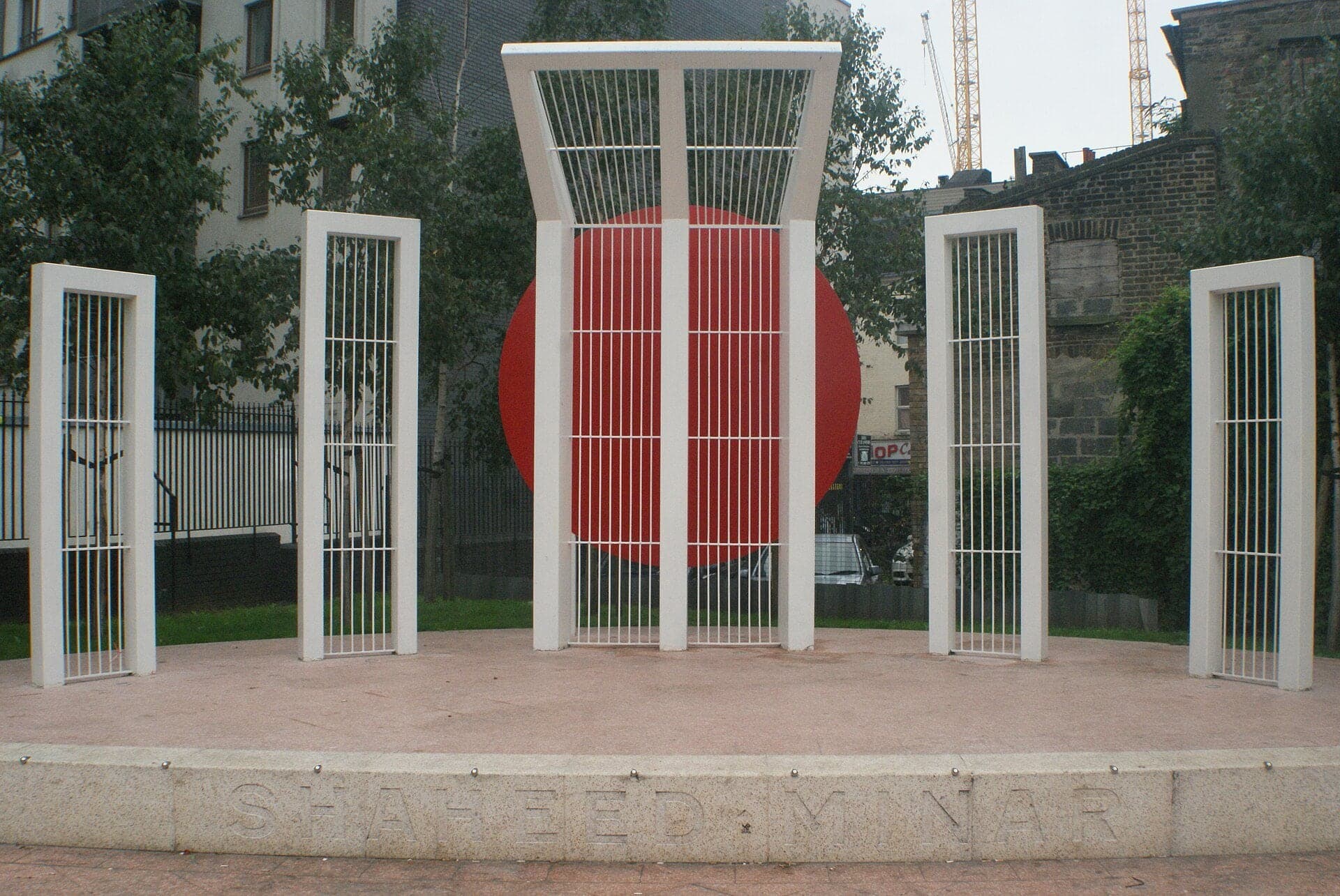
Altab Ali Park: The White Chapel's Churchyard
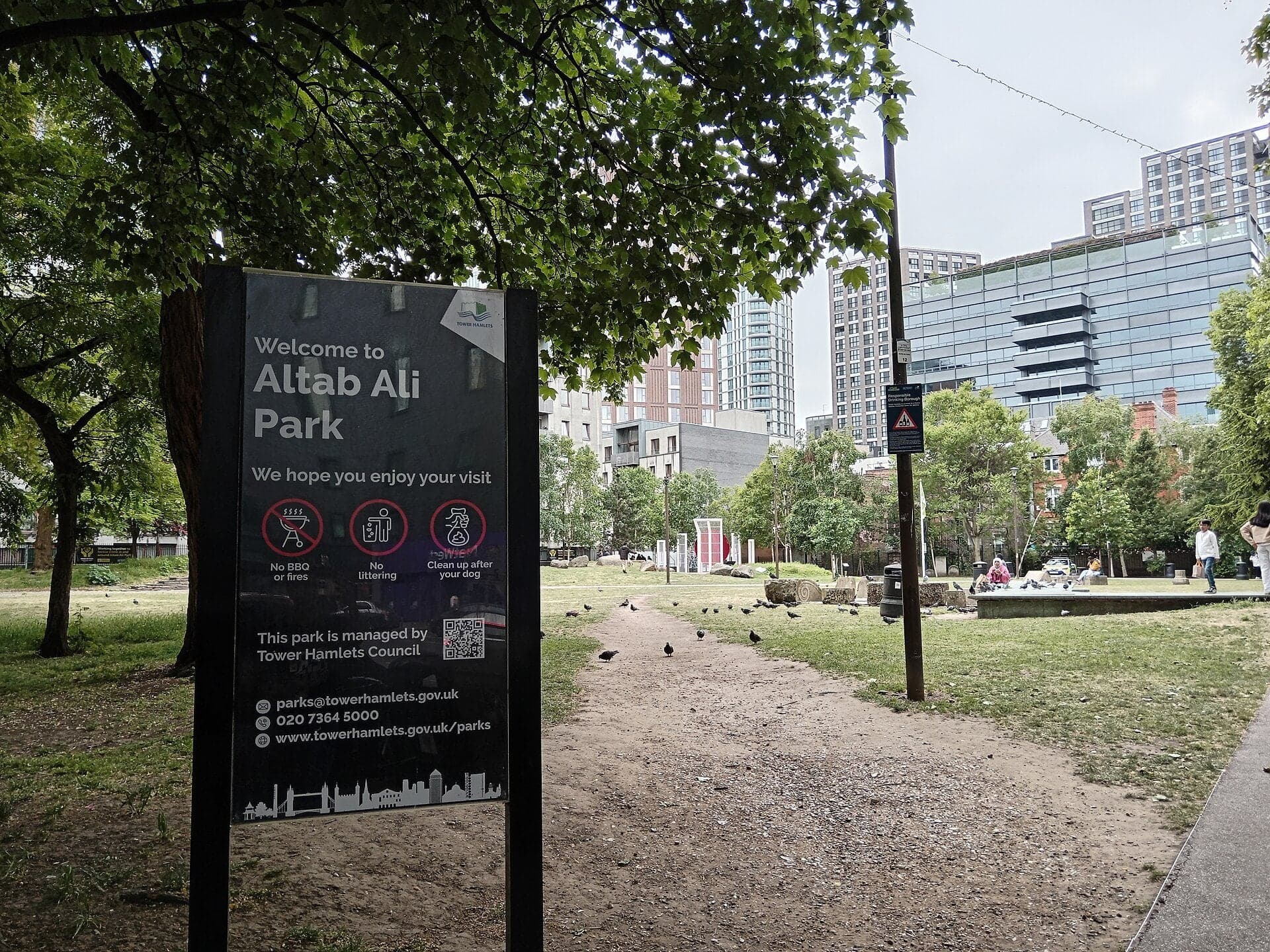
The churchyard that named Whitechapel. It is now a park named for Altab Ali, with a Shaheed Minar put up in 1999.
- 11
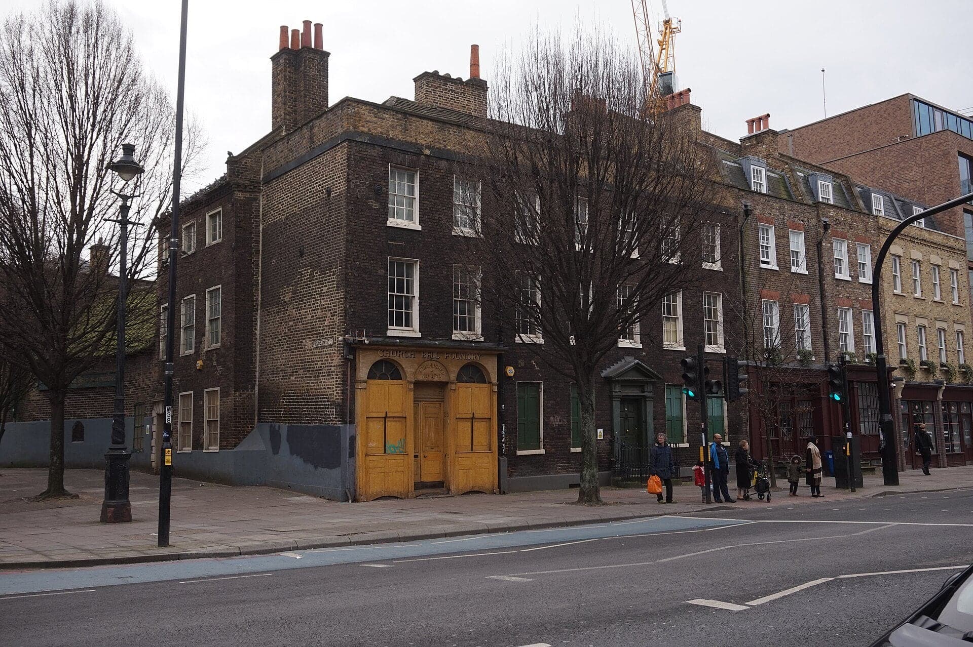
Whitechapel Bell Foundry: The Sign Above the Door
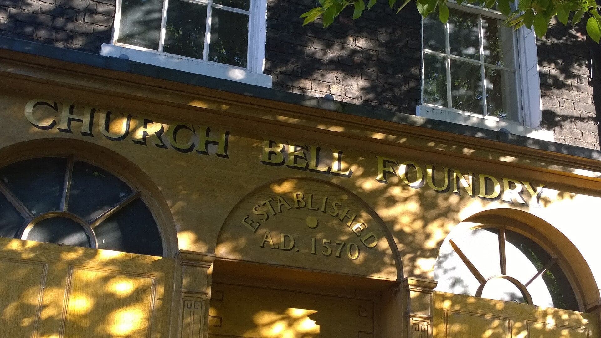
The foundry that cast Big Ben. Bells were made in Whitechapel for centuries; the foundry closed in 2017 and stands empty.
Details
Best Time to Visit
A weekday from Tuesday to Friday, starting between 10am and 2pm: the lanes are calm, the Whitechapel Gallery is open (it closes on Mondays) and you finish in daylight. Brick Lane is at its busiest on Sundays and on Friday and Saturday evenings, when stopping to listen on its narrow pavements is hard. Christ Church usually opens to visitors only on Sunday afternoons. Altab Ali Park is quieter after dark.
Pro Tips
- •Getting to the start: Liverpool Street station is served by the Elizabeth, Central, Circle, Hammersmith and City and Metropolitan lines and by trains to East Anglia; the walk begins on the Bishopsgate pavement outside it. For step-free routes, check TfL's journey planner before you travel. Checked 7 October 2026.
- •Getting home: the walk ends on Whitechapel Road, a few minutes from Whitechapel station (District, Hammersmith and City, Elizabeth line and Overground) and about ten minutes from Aldgate East (District, Hammersmith and City). Buses 25, 205 and 254 run along the road. Checked 7 October 2026.
- •Christ Church Spitalfields (stop 4) says it is open to the public on Sundays from 1pm to 4pm, with the vestibule open on Mondays and Tuesdays from 10am to 3pm; services are on Sundays at 11am and 5pm, and it asks visitors to check it is not closed for an event (spitalfields.church). Checked 7 October 2026.
- •Old Spitalfields Market (stop 3): Monday, Tuesday, Wednesday and Friday 10am to 8pm, Thursday 8am to 6pm, Saturday 10am to 6pm, Sunday 10am to 5pm; shops and restaurants keep their own hours (oldspitalfieldsmarket.com). Checked 7 October 2026.
- •Whitechapel Gallery (stop 9): displays free, one ticketed exhibition each season (8.25 to 18.15 pounds), closed Mondays, late opening on Thursdays to 9pm with Pay What You Can from 6pm (whitechapelgallery.org). Checked 7 October 2026.
- •The Whitechapel Bell Foundry (stop 11) has been closed since 2017 and is for sale: there is no visit or shop. Checked 7 October 2026.
Safety & Precautions
- •Artillery Lane, Gun Street and Adler Street are narrow streets with some traffic and narrow pavements: they are not traffic-free, so keep to the edge.
- •Cross Bishopsgate, Commercial Street and Whitechapel High Street only at the signals the route uses; Whitechapel High Street is crossed in two stages with a central island. Whitechapel Road is a busy trunk road with street stalls on its pavements on many days.
- •Brick Lane's pavements are narrow and very crowded on Sundays and on Friday and Saturday evenings; restaurant staff may approach you. Step to the side to listen.
- •Altab Ali Park has gates. If they are shut, stop 10 works from the pavement at the park's west gate on the main road, where the Shaheed Minar is still in view.
- •The Brick Lane mosque and the synagogue on Sandys Row are working places of worship, and the houses of Fournier Street and Wilkes Street are private homes: look from the street. The streets of 1888 are ordinary streets where people live and work today.
Travel advisory: Exercise Increased Caution (Level 2).
Gallery
Related Reading
Go deeper on what you'll see, hear, and walk through.
Overview
A Pub's Age Is a Claim: Three London Pubs and What the Records Say
4 min
Overview
London Travel Guide: How Many Days, Getting Around, When to Go (2026)
5 min
Overview
Reading London's Layers: How to See a City That Refuses to Erase Itself
8 min
Thematic
Best History Walking Tours in London (2026)
2 min
Thematic
What to Eat in London: A Food Guide (2026)
5 min
Companion
The Ten Bells: How a Spitalfields Pub Got Tied to the Ripper Story
4 min
Companion
What a City Does With Its Dead: London Below the Pavement
5 min
Read the walk
The full story of Spitalfields and Brick Lane: Outside the City Gate, in words. Prefer to listen? Play it narrated, from home or on location.
Introduction
London, the capital of England and the United Kingdom, grew up inside a Roman wall, entered through its gates. This walk starts just outside one of them, Bishopsgate, and heads east into Spitalfields and Whitechapel: the ground where London put what it did not want inside. A hospital, a burial ground, a market, some of the cheapest beds in the capital. It was also where newcomers could afford to land. Protestant refugees from France, Jewish families from Eastern Europe and families from Bangladesh came in turn, and each reused what the last had left. One building on Brick Lane has been a chapel, a synagogue and a mosque.
Three names come back along the way. Nicholas Hawksmoor designed the white stone church that towers over the weavers' streets. Annie Chapman was one of five women murdered in the East End and the City in the autumn of eighteen eighty-eight; here they are remembered by where they lived and who they were, not by how they died. And Altab Ali was a young clothing worker whose killing in nineteen seventy-eight gave a park its name.
The walk is eleven stops over about one point seven kilometres, a little over a mile, on level streets, and takes about an hour and a quarter. It runs from Liverpool Street station through the lanes and market streets of Spitalfields, down Brick Lane, and ends at an old bell foundry on Whitechapel Road.
1. Liverpool Street: The Edge of the City
Welcome to Bishopsgate, and to the start of the East End walk. The road beside you is older than anything you can see from it. Its line follows the Roman road north out of London, and when a bomb tore a crater in this road in nineteen ninety-three, archaeologists found Roman layers in the ground beneath it.
Bishopsgate was the name of a gate in the City wall, farther down this road towards the towers. The gate came down in the eighteenth century, but the idea stayed. Everything on this walk lies beyond it, and Londoners had a word for that: without. The medieval hospital you will meet at the next stops was the priory of Saint Mary without Bishopsgate. Outside the gate.
The edge of the City was where London put what it did not want inside. Behind the station lay a burial ground, opened after the plague of fifteen sixty-three and used from fifteen sixty-nine to seventeen thirty-nine. About twenty-five thousand people were buried in it, among them migrants and many of the city's poor. It was called Bedlam, after the hospital of Saint Mary of Bethlehem that stood next to it. When the railway that became the Elizabeth line was dug here, archaeologists excavated more than three thousand of those burials.
Nothing of the burial ground shows from this pavement. The station opened in the mid eighteen seventies, and the red brick and stone hotel beside it is Victorian. So read this place as a line on a map. The City lies back down the road. The walk goes the other way, out into the ground that took the City's dead, its sick and, later, its refugees.
Follow the route across Bishopsgate at the lights. Next, a narrow lane the silk trade knew.
2. Artillery Passage: A Lane of Silk Merchants
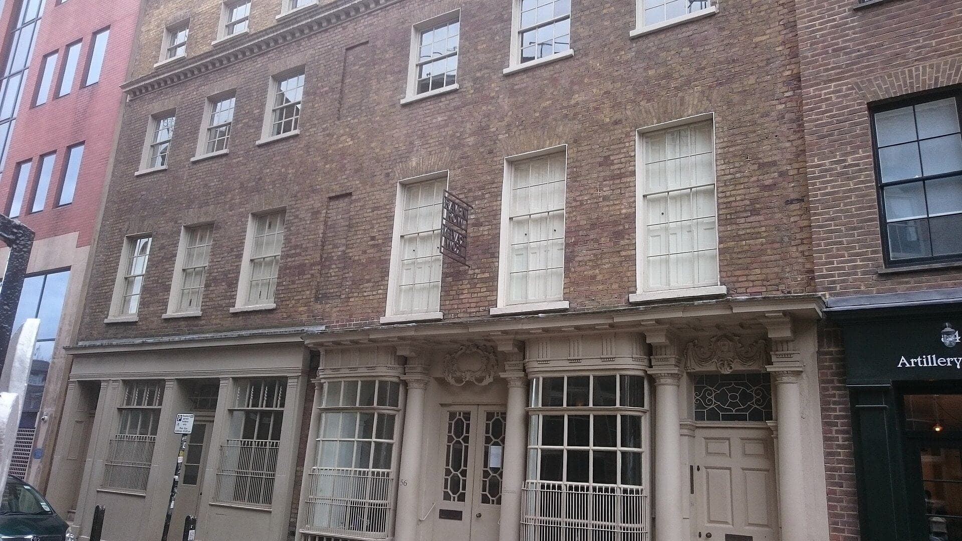
Walk on into Artillery Passage and stop partway along it. Look at how narrow it is: brick fronts a couple of steps apart, shopfronts at street level, two or three storeys above. In the sixteen hundreds and seventeen hundreds this lane was commonly known as Smock Alley, and at least one house here survives from a row described in seventeen oh seven as newly built.
The name you see now comes from the ground just beyond the lane. In the fifteen thirties the priory leased its southern grounds to a guild of archers and gunners, the guild of artillery of longbows, crossbows and handguns, and they drilled there.
Then came the refugees. Protestants from France, the Huguenots, settled in these streets in numbers, and many brought silk-weaving skills from Nantes, Lyon and other French cities. Round the corner on Artillery Lane, two houses were given new fronts in the seventeen fifties, one of them with a shopfront of that time. The families who lived there had French names, and in seventeen sixty-three they were described as mercers: silk merchants, the people who sold what the weavers made.
They worshipped in French, too. A few steps from here, on Sandys Row, a French Protestant church opened in seventeen sixty-six. About a century later it was leased to a congregation of Dutch Jews, and in eighteen seventy it was consecrated as a synagogue. It is a synagogue still. Its outside is plain, so there is nothing to see from the street, but keep it in mind: a building that changed faith along with its neighborhood. You will meet a bigger one on Brick Lane.
Follow the route out of the passage. The next lanes carry a little traffic, so keep to the edge. Next, the street of the old market.
3. Brushfield Street: The Hospital's Fields
Walk on along Brushfield Street and stop here, beside the market's buildings, with a white stone spire closing the far end of the street.
This ground gave Spitalfields its name. Spital means hospital. Around eleven ninety-seven two citizens of London, a husband and wife, founded the priory and hospital of Saint Mary here, outside Bishopsgate. It cared for the sick and the poor, and for women giving birth. When it was closed in fifteen thirty-nine, it had about a hundred and eighty beds. Archaeologists working on this ground between nineteen ninety-one and two thousand and seven recorded more than ten thousand five hundred medieval skeletons, among them mass graves that archaeologists link to a famine in the late twelve fifties, after a huge volcanic eruption far away. They also found a Roman woman of the fourth century, buried in a lead coffin inside a stone one, wearing silk damask from China with threads of gold. Silk was here long before the weavers.
The market came later. The right to hold one here was granted in sixteen eighty-two, and the market's Victorian buildings went up in the eighteen eighties and early nineties. Now look along the street at the Georgian-looking brick fronts. Some of them are not Georgian at all. They belong to the market's extension of the nineteen twenties, and the Survey of London calls them an attempt to recall the vanished house-fronts of a nearby square.
Behind the buildings across the street ran Dorset Street, a street of common lodging houses. It has gone, built over. Very early on Saturday the eighth of September, eighteen eighty-eight, a lodger named Annie Chapman left number thirty-five, because she did not have the money for her bed. The night watchman saw her go up a narrow passage towards this street. You will hear more about her at Hanbury Street.
Follow the route on towards the spire. Next, the church itself.
4. Christ Church Spitalfields: Stone in a Street of Brick
Walk on a little closer and stop, with the church's tower filling the end of the street. Look up. This is Christ Church, Spitalfields, designed by Nicholas Hawksmoor.
In seventeen eleven Parliament passed an act for fifty new churches in and around London, paid for with a tax on coal. The parish of Stepney, which then covered this district, was reckoned to hold eighty-six thousand five hundred people and nineteen meeting-houses of Nonconformists and French Protestants. Hawksmoor was a surveyor to the commissioners who ran the program, and he designed this church and five others. The foundations went in around seventeen fourteen, the upper tower and the spire rose in the late seventeen twenties, and the church was consecrated on the fifth of July, seventeen twenty-nine.
Now the material. The outside is Portland stone, pale and almost white, and the mason's work alone cost about half the price of the church. The houses on the streets around it are brick. The front is a portico of four giant columns, plain Tuscan ones, laid out like an enormous window with a tall arch in the middle, and above it the tower climbs in stages to a spire more than sixty metres high. The Survey of London speaks of its Roman immensity against the modest scale of the streets around it. You will see that from the side in a moment.
The church was restored in the early two thousands and reopened in two thousand and four. It usually opens to visitors on Sunday afternoons, outside services.
On the far corner beside the church stands a tall stucco pub, the Ten Bells. Many retellings put the women of eighteen eighty-eight inside it. The inquest reports of the time do not.
Follow the route across Commercial Street at the lights, into the narrow street beside the church. Next, the weavers' houses.
5. Fournier Street: The Weavers' Windows
Walk on along Fournier Street, with the church's long side wall across the narrow street, and stop where Wilkes Street opens off it. From here Christ Church shows its real size: a long wall of stone, with the spire rising above the roof, beside houses built to a domestic…
Full narration for this stop unlocks with the tour.
6. Hanbury Street: The House That Is Gone
Walk on to Hanbury Street and stop at the corner. On one side, more eighteenth-century brick houses, like the ones you just left. On the other, the long brick buildings of the old Truman brewery. There was a brewery on Brick Lane by the sixteen eighties, and in the nineteenth…
Full narration for this stop unlocks with the tour.
7. Brick Lane: One Building, Three Faiths
Walk on down Brick Lane and stop at the corner of Fournier Street, beside the big brick building on the corner. Brick Lane is named for what was made here. A survey of fifteen fifty records tile yards on its eastern side, and the lane already had its name. Now the building…
Full narration for this stop unlocks with the tour.
8. Wentworth Street: Five Women, Remembered by Name
Walk on to the bottom of Brick Lane and stop where you can see along Wentworth Street, with its shops and, on market days, its stalls. In the nineteenth century the streets around here were the center of Spitalfields' common lodging houses. The Survey of London puts it plainly:…
Full narration for this stop unlocks with the tour.
9. Whitechapel Gallery: Art for the East End
Cross at the lights to the far pavement, then stop and turn round to face back across the road, to the sandy colored front with the broad arch and two small towers. This is the Whitechapel Gallery. Its displays are free, there is one ticketed exhibition each season, and it is…
Full narration for this stop unlocks with the tour.
10. Altab Ali Park: The White Chapel's Churchyard
Walk on into the park and stop on the path. This green space is a churchyard. The church that stood here, Saint Mary Matfelon, was known as the white chapel, and it gave Whitechapel its name. The last church was destroyed by firebombs on the twenty-ninth of December, nineteen…
Full narration for this stop unlocks with the tour.
11. Whitechapel Bell Foundry: The Sign Above the Door
Walk on along Whitechapel Road and stop beside the long Georgian brick front with a shopfront at one end. This is the Whitechapel Bell Foundry, and it is the last stop. Read the front. Dark purple-red brick mixed with yellow stock brick, three storeys and an attic, seven…
Full narration for this stop unlocks with the tour.
- Entrance to Liverpool Street railway station on Bishopsgate — Sunil060902, CC BY-SA 3.0 · source
- Bishopsgate looking towards Liverpool Street station — Peter Whatley, CC BY-SA 2.0 · source
- Grapeshots, Spitalfields, E1. A little wine bar on a tiny street. Address: 2-3 Artillery Passage. Owner: Davy's (https://www.davy.co.uk/wine — Ewan Munro, CC BY-SA 2.0 · source
- Brushfield Street, Spitalfields — Des Blenkinsopp, CC BY-SA 2.0 · source
- Brushfield Street, Spitalfields — Chris Whippet, CC BY-SA 2.0 · source
- Nicholas Hawksmoor's beautiful 1729 church. In 1711, parliament passed an Act for the building of Fifty New Churches in the Cities of London — Amanda Slater from Coventry, West Midlands, UK, CC BY-SA 2.0 · source
- Nicholas Hawksmoor's famous and glamorous church on Commercial St. (Another photo of it.) Address: Commercial Street. Architect(s): Nicholas — Ewan-M, CC BY-SA 2.0 · source
- The listed buildings running from 25 to 41 Fournier Street in Spitalfields. — Doyle of London, CC BY-SA 4.0 · source
- The Grade II listed building at 15 Fournier Street, Spitalfields. This is a photo of listed building number 1065158. — Doyle of London, CC BY-SA 4.0 · source
- View of the Truman Brewery from Hanbury Street — Robert Lamb, CC BY-SA 2.0 · source
- Hanbury Street, Spitalfields — Chris Whippet, CC BY-SA 2.0 · source
- Detail on the south face of the Grade II* listed Brick Lane Mosque. — Doyle of London, CC BY-SA 4.0 · source
- View of the Brick Lane Jamme Masjid from Brick Lane #3 — Robert Lamb, CC BY-SA 2.0 · source
- View along Wentworth Street — Robert Lamb, CC BY-SA 2.0 · source
- Clothes rails in Wentworth Street — Steve Daniels, CC BY-SA 2.0 · source
- Whitechapel Gallery, Whitechapel High Street, London Borough of Tower Hamlets, London E1, England. — GrindtXX, CC BY-SA 4.0 · source
- Whitechapel Gallery — Matt Brown, CC BY 2.0 · source
- View of the Shaheed Minar in Altab Ali Park — Robert Lamb, CC BY-SA 2.0 · source
- Church Bell Foundry — Ian S, CC BY-SA 2.0 · source
Images may be cropped or resized. Other photos via Unsplash and Pexels.